Bachelor Hill Topo Map Texas
To zoom in, hover over the map of Bachelor Hill
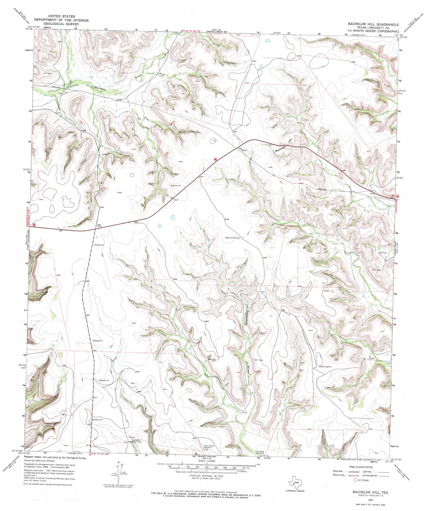
USGS Topo Quad 30101f5 - 1:24,000 scale
| Topo Map Name: | Bachelor Hill |
| USGS Topo Quad ID: | 30101f5 |
| Print Size: | ca. 21 1/4" wide x 27" high |
| Southeast Coordinates: | 30.625° N latitude / 101.5° W longitude |
| Map Center Coordinates: | 30.6875° N latitude / 101.5625° W longitude |
| U.S. State: | TX |
| Filename: | o30101f5.jpg |
| Download Map JPG Image: | Bachelor Hill topo map 1:24,000 scale |
| Map Type: | Topographic |
| Topo Series: | 7.5´ |
| Map Scale: | 1:24,000 |
| Source of Map Images: | United States Geological Survey (USGS) |
| Alternate Map Versions: |
Bachelor Hill TX 1967, updated 1970 Download PDF Buy paper map Bachelor Hill TX 2010 Download PDF Buy paper map Bachelor Hill TX 2012 Download PDF Buy paper map Bachelor Hill TX 2016 Download PDF Buy paper map |
1:24,000 Topo Quads surrounding Bachelor Hill
Twelvemile Camp |
Owens Creek Nw |
Owens Creek Ne |
Schneeman Draw Nw |
Schneeman Draw Ne |
Deer Canyon |
Owens Creek Sw |
Owens Creek Se |
Schneeman Draw Sw |
Schneeman Draw Se |
Sheffield |
Fort Lancaster |
Bachelor Hill |
Pikes Peak |
Mitchell Canyon Ne |
Sheffield Se |
Dead Man Canyon |
Burnt Canyon |
Mitchell Canyon |
Hunt Ranch |
Oasis Ranch |
Sixshooter Canyon |
Prince Albert Draw |
Howards Well |
Howards Well Ne |
> Back to 30101e1 at 1:100,000 scale
> Back to 30100a1 at 1:250,000 scale
> Back to U.S. Topo Maps home
Bachelor Hill topo map: Gazetteer
Bachelor Hill: Lakes
Escondido Water Hole elevation 767m 2516′Bachelor Hill: Populated Places
Four Corner Windmill elevation 781m 2562′Bachelor Hill: Summits
Bachelor Hill elevation 804m 2637′Bachelor Hill digital topo map on disk
Buy this Bachelor Hill topo map showing relief, roads, GPS coordinates and other geographical features, as a high-resolution digital map file on DVD: