Narrow Bow Draw Topo Map Texas
To zoom in, hover over the map of Narrow Bow Draw
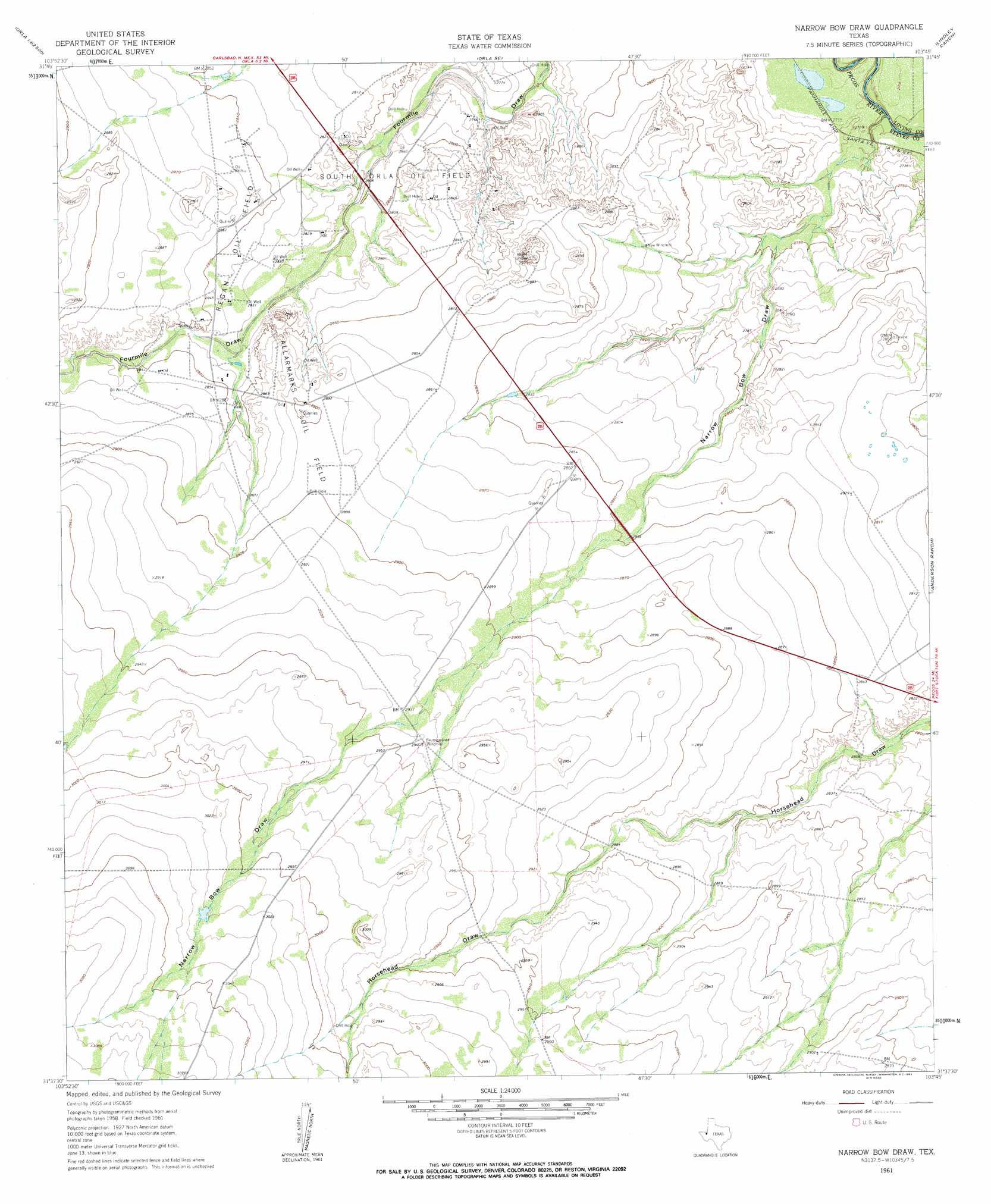
USGS Topo Quad 31103f7 - 1:24,000 scale
| Topo Map Name: | Narrow Bow Draw |
| USGS Topo Quad ID: | 31103f7 |
| Print Size: | ca. 21 1/4" wide x 27" high |
| Southeast Coordinates: | 31.625° N latitude / 103.75° W longitude |
| Map Center Coordinates: | 31.6875° N latitude / 103.8125° W longitude |
| U.S. State: | TX |
| Filename: | o31103f7.jpg |
| Download Map JPG Image: | Narrow Bow Draw topo map 1:24,000 scale |
| Map Type: | Topographic |
| Topo Series: | 7.5´ |
| Map Scale: | 1:24,000 |
| Source of Map Images: | United States Geological Survey (USGS) |
| Alternate Map Versions: |
Narrow Bow Draw TX 1961, updated 1963 Download PDF Buy paper map Narrow Bow Draw TX 1961, updated 1963 Download PDF Buy paper map Narrow Bow Draw TX 2010 Download PDF Buy paper map Narrow Bow Draw TX 2013 Download PDF Buy paper map Narrow Bow Draw TX 2016 Download PDF Buy paper map |
1:24,000 Topo Quads surrounding Narrow Bow Draw
Screw Bean Draw Ne |
Red Bluff |
Orla Ne |
Kyle Ranch |
Rudd Draw Ne |
Screw Bean Draw East |
Orla |
Orla Se |
Lindley Ranch |
Rudd Draw |
Derrick Draw |
Threemile Draw |
Narrow Bow Draw |
Anderson Ranch |
Mentone |
Dry Lake |
W T Ranch |
Halamicek Ranch |
Mentone Sw |
Sand Lake |
Burnt Spring Hills |
Toyah Nw |
Big Hill |
Hermosa |
Pecos West |
> Back to 31103e1 at 1:100,000 scale
> Back to 31102a1 at 1:250,000 scale
> Back to U.S. Topo Maps home
Narrow Bow Draw topo map: Gazetteer
Narrow Bow Draw: Oilfields
Allarmarks Oil Field elevation 882m 2893′Regan Oil Field elevation 866m 2841′
South Orla Oil Field elevation 851m 2791′
Narrow Bow Draw: Reservoirs
Hackberry Tank elevation 909m 2982′Narrow Bow Draw: Valleys
Narrow Bow Draw elevation 827m 2713′W T Draw elevation 927m 3041′
Narrow Bow Draw digital topo map on disk
Buy this Narrow Bow Draw topo map showing relief, roads, GPS coordinates and other geographical features, as a high-resolution digital map file on DVD: