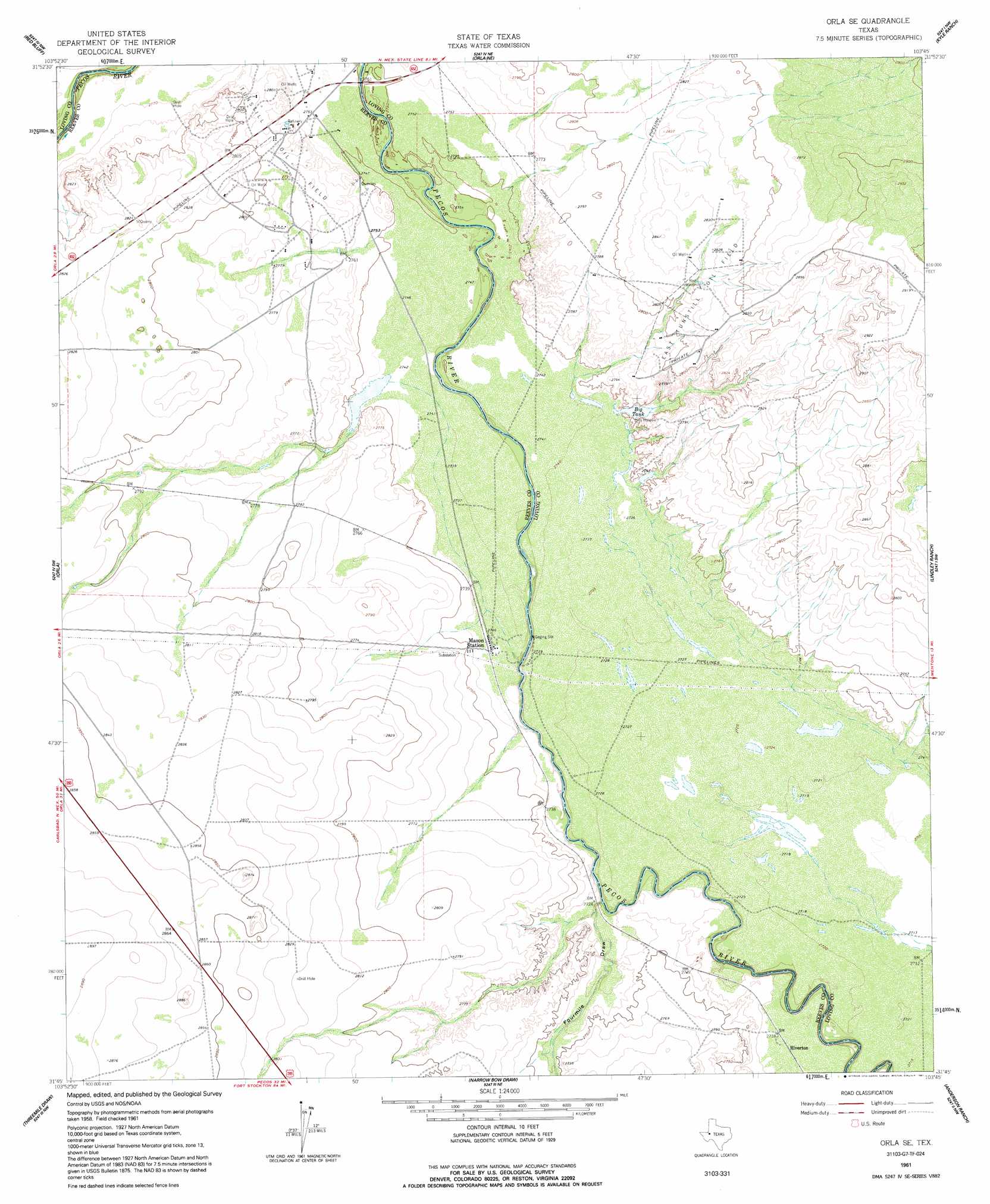
Orla Se Topo Map Texas
To zoom in, hover over the map of Orla Se
USGS Topo Quad 31103g7 - 1:24,000 scale
| Topo Map Name: | Orla Se |
| USGS Topo Quad ID: | 31103g7 |
| Print Size: | ca. 21 1/4" wide x 27" high |
| Southeast Coordinates: | 31.75° N latitude / 103.75° W longitude |
| Map Center Coordinates: | 31.8125° N latitude / 103.8125° W longitude |
| U.S. State: | TX |
| Filename: | o31103g7.jpg |
| Download Map JPG Image: | Orla Se topo map 1:24,000 scale |
| Map Type: | Topographic |
| Topo Series: | 7.5´ |
| Map Scale: | 1:24,000 |
| Source of Map Images: | United States Geological Survey (USGS) |
| Alternate Map Versions: |
Orla SE TX 1961, updated 1963 Download PDF Buy paper map Orla SE TX 1961, updated 1991 Download PDF Buy paper map Orla SE TX 2010 Download PDF Buy paper map Orla SE TX 2013 Download PDF Buy paper map Orla SE TX 2016 Download PDF Buy paper map |
1:24,000 Topo Quads surrounding Orla Se
Red Bluff |
Ross Ranch |
Phatom Banks |
Paduca Breaks West |
Paduca Breaks East |
Screw Bean Draw Ne |
Red Bluff |
Orla Ne |
Kyle Ranch |
Rudd Draw Ne |
Screw Bean Draw East |
Orla |
Orla Se |
Lindley Ranch |
Rudd Draw |
Derrick Draw |
Threemile Draw |
Narrow Bow Draw |
Anderson Ranch |
Mentone |
Dry Lake |
W T Ranch |
Halamicek Ranch |
Mentone Sw |
Sand Lake |
> Back to 31103e1 at 1:100,000 scale
> Back to 31102a1 at 1:250,000 scale
> Back to U.S. Topo Maps home
Orla Se topo map: Gazetteer
Orla Se: Lakes
Big Tank elevation 835m 2739′Orla Se: Oilfields
East Tunstill Oil Field elevation 854m 2801′Orla Se: Populated Places
Riverton elevation 829m 2719′Orla Se: Valleys
Fourmile Draw elevation 825m 2706′Sand Bend Draw elevation 835m 2739′
Orla Se digital topo map on disk
Buy this Orla Se topo map showing relief, roads, GPS coordinates and other geographical features, as a high-resolution digital map file on DVD: