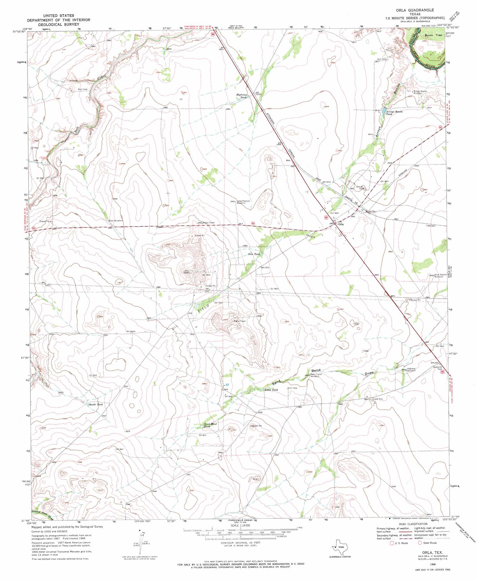
Orla Topo Map Texas
To zoom in, hover over the map of Orla
USGS Topo Quad 31103g8 - 1:24,000 scale
| Topo Map Name: | Orla |
| USGS Topo Quad ID: | 31103g8 |
| Print Size: | ca. 21 1/4" wide x 27" high |
| Southeast Coordinates: | 31.75° N latitude / 103.875° W longitude |
| Map Center Coordinates: | 31.8125° N latitude / 103.9375° W longitude |
| U.S. State: | TX |
| Filename: | o31103g8.jpg |
| Download Map JPG Image: | Orla topo map 1:24,000 scale |
| Map Type: | Topographic |
| Topo Series: | 7.5´ |
| Map Scale: | 1:24,000 |
| Source of Map Images: | United States Geological Survey (USGS) |
| Alternate Map Versions: |
Orla TX 1968, updated 1971 Download PDF Buy paper map Orla TX 2010 Download PDF Buy paper map Orla TX 2013 Download PDF Buy paper map Orla TX 2016 Download PDF Buy paper map |
1:24,000 Topo Quads surrounding Orla
Cottonwood Hills |
Red Bluff |
Ross Ranch |
Phatom Banks |
Paduca Breaks West |
Owl Hills |
Screw Bean Draw Ne |
Red Bluff |
Orla Ne |
Kyle Ranch |
Screw Bean Draw West |
Screw Bean Draw East |
Orla |
Orla Se |
Lindley Ranch |
Rustler Hills |
Derrick Draw |
Threemile Draw |
Narrow Bow Draw |
Anderson Ranch |
Two Mill Draw East |
Dry Lake |
W T Ranch |
Halamicek Ranch |
Mentone Sw |
> Back to 31103e1 at 1:100,000 scale
> Back to 31102a1 at 1:250,000 scale
> Back to U.S. Topo Maps home
Orla topo map: Gazetteer
Orla: Areas
Burro Trap elevation 845m 2772′Orla: Lakes
Highway Tank elevation 869m 2851′Little Tank elevation 888m 2913′
Orla Tank elevation 888m 2913′
Sand Bend Tank elevation 906m 2972′
South Tank elevation 912m 2992′
Orla: Populated Places
Orla elevation 874m 2867′Orla: Reservoirs
Arroyo Bonito Tank elevation 854m 2801′Orla: Valleys
Arroyo Bonito elevation 844m 2769′Sand Bend Draw elevation 863m 2831′
Orla digital topo map on disk
Buy this Orla topo map showing relief, roads, GPS coordinates and other geographical features, as a high-resolution digital map file on DVD: