Tenmile Topo Map Texas
To zoom in, hover over the map of Tenmile
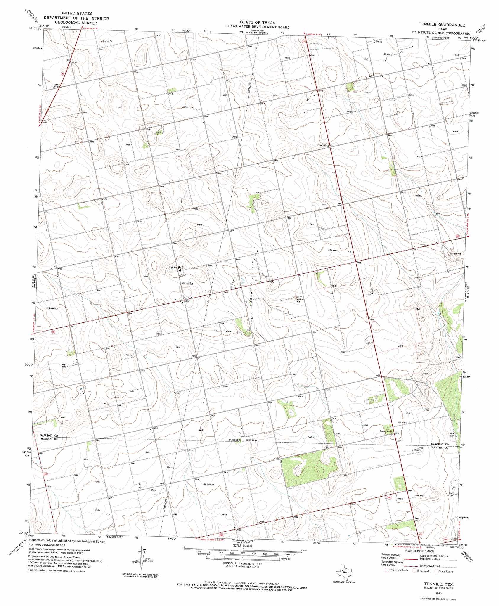
USGS Topo Quad 32101e8 - 1:24,000 scale
| Topo Map Name: | Tenmile |
| USGS Topo Quad ID: | 32101e8 |
| Print Size: | ca. 21 1/4" wide x 27" high |
| Southeast Coordinates: | 32.5° N latitude / 101.875° W longitude |
| Map Center Coordinates: | 32.5625° N latitude / 101.9375° W longitude |
| U.S. State: | TX |
| Filename: | o32101e8.jpg |
| Download Map JPG Image: | Tenmile topo map 1:24,000 scale |
| Map Type: | Topographic |
| Topo Series: | 7.5´ |
| Map Scale: | 1:24,000 |
| Source of Map Images: | United States Geological Survey (USGS) |
| Alternate Map Versions: |
Tenmile TX 1970, updated 1973 Download PDF Buy paper map Tenmile TX 2010 Download PDF Buy paper map Tenmile TX 2012 Download PDF Buy paper map Tenmile TX 2016 Download PDF Buy paper map |
1:24,000 Topo Quads surrounding Tenmile
Welch Sw |
Punkin Center |
Lamesa North |
Hancock |
Indian Canyon |
Sand |
Patricia Ne |
Lamesa South |
Key |
Sand Creek |
Patricia Sw |
Patricia |
Tenmile |
Sparenberg |
Ackerly |
Scharbauer Ranch |
Wolcott Ranch |
Flower Grove |
Merrick |
Knott |
Bird Ranch |
Flynt Ranch |
Lenorah West |
Lenorah East |
Knott Sw |
> Back to 32101e1 at 1:100,000 scale
> Back to 32100a1 at 1:250,000 scale
> Back to U.S. Topo Maps home
Tenmile topo map: Gazetteer
Tenmile: Airports
Thorp Airport elevation 870m 2854′Tenmile: Oilfields
Tex Hamon Oil Field elevation 872m 2860′Tenmile: Populated Places
Klondike elevation 879m 2883′Tenmile elevation 882m 2893′
Tenmile digital topo map on disk
Buy this Tenmile topo map showing relief, roads, GPS coordinates and other geographical features, as a high-resolution digital map file on DVD: