Bunker Hill Topo Map Texas
To zoom in, hover over the map of Bunker Hill
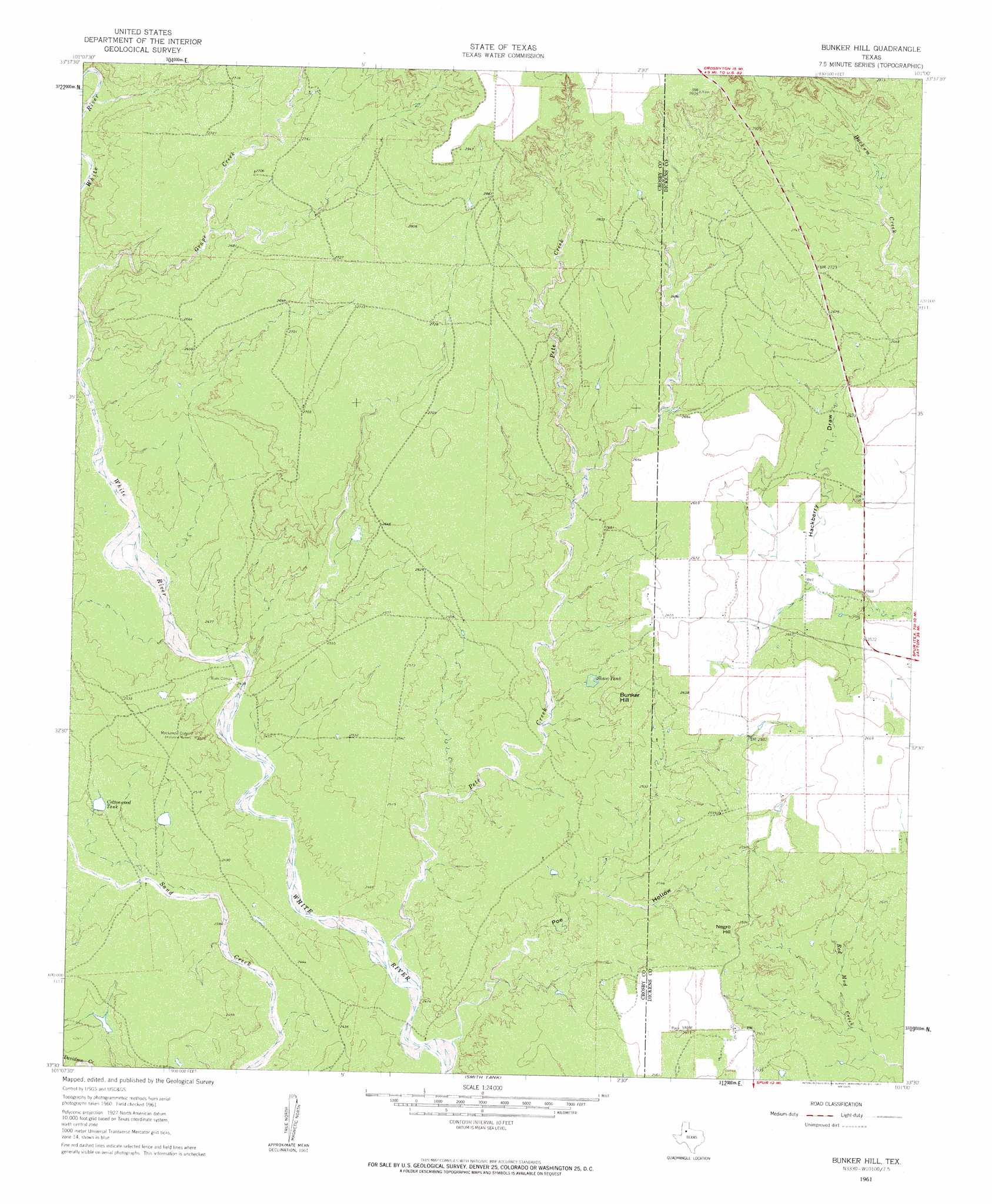
USGS Topo Quad 33101e1 - 1:24,000 scale
| Topo Map Name: | Bunker Hill |
| USGS Topo Quad ID: | 33101e1 |
| Print Size: | ca. 21 1/4" wide x 27" high |
| Southeast Coordinates: | 33.5° N latitude / 101° W longitude |
| Map Center Coordinates: | 33.5625° N latitude / 101.0625° W longitude |
| U.S. State: | TX |
| Filename: | o33101e1.jpg |
| Download Map JPG Image: | Bunker Hill topo map 1:24,000 scale |
| Map Type: | Topographic |
| Topo Series: | 7.5´ |
| Map Scale: | 1:24,000 |
| Source of Map Images: | United States Geological Survey (USGS) |
| Alternate Map Versions: |
Bunker Hill TX 1961, updated 1963 Download PDF Buy paper map Bunker Hill TX 2010 Download PDF Buy paper map Bunker Hill TX 2012 Download PDF Buy paper map Bunker Hill TX 2016 Download PDF Buy paper map |
1:24,000 Topo Quads surrounding Bunker Hill
Floydada Se |
Mount Blanco |
Wake |
Rustler Camp |
Afton |
Ralls Ne |
Crosbyton |
Mcadoo |
Haystack Mountain |
Dickens North |
Ralls Se |
Collett Springs |
Bunker Hill |
Foreman Chapel |
Dickens South |
Canyon Valley |
Kalgary |
Smith Tank |
Spur Nw |
Spur |
Cap Rock Se |
Verbena |
Twomile Creek |
Spur Sw |
White Camp |
> Back to 33101e1 at 1:100,000 scale
> Back to 33100a1 at 1:250,000 scale
> Back to U.S. Topo Maps home
Bunker Hill topo map: Gazetteer
Bunker Hill: Dams
Soil Conservation Service Site 6 Dam elevation 781m 2562′Bunker Hill: Reservoirs
Cottonwood Tank elevation 746m 2447′Shaw Tank elevation 772m 2532′
Soil Conservation Service Site 6 Reservoir elevation 781m 2562′
Bunker Hill: Streams
Pete Creek elevation 727m 2385′Bunker Hill: Summits
Bunker Hill elevation 811m 2660′Negro Hill elevation 798m 2618′
Bunker Hill: Valleys
Poe Hollow elevation 724m 2375′Bunker Hill digital topo map on disk
Buy this Bunker Hill topo map showing relief, roads, GPS coordinates and other geographical features, as a high-resolution digital map file on DVD: