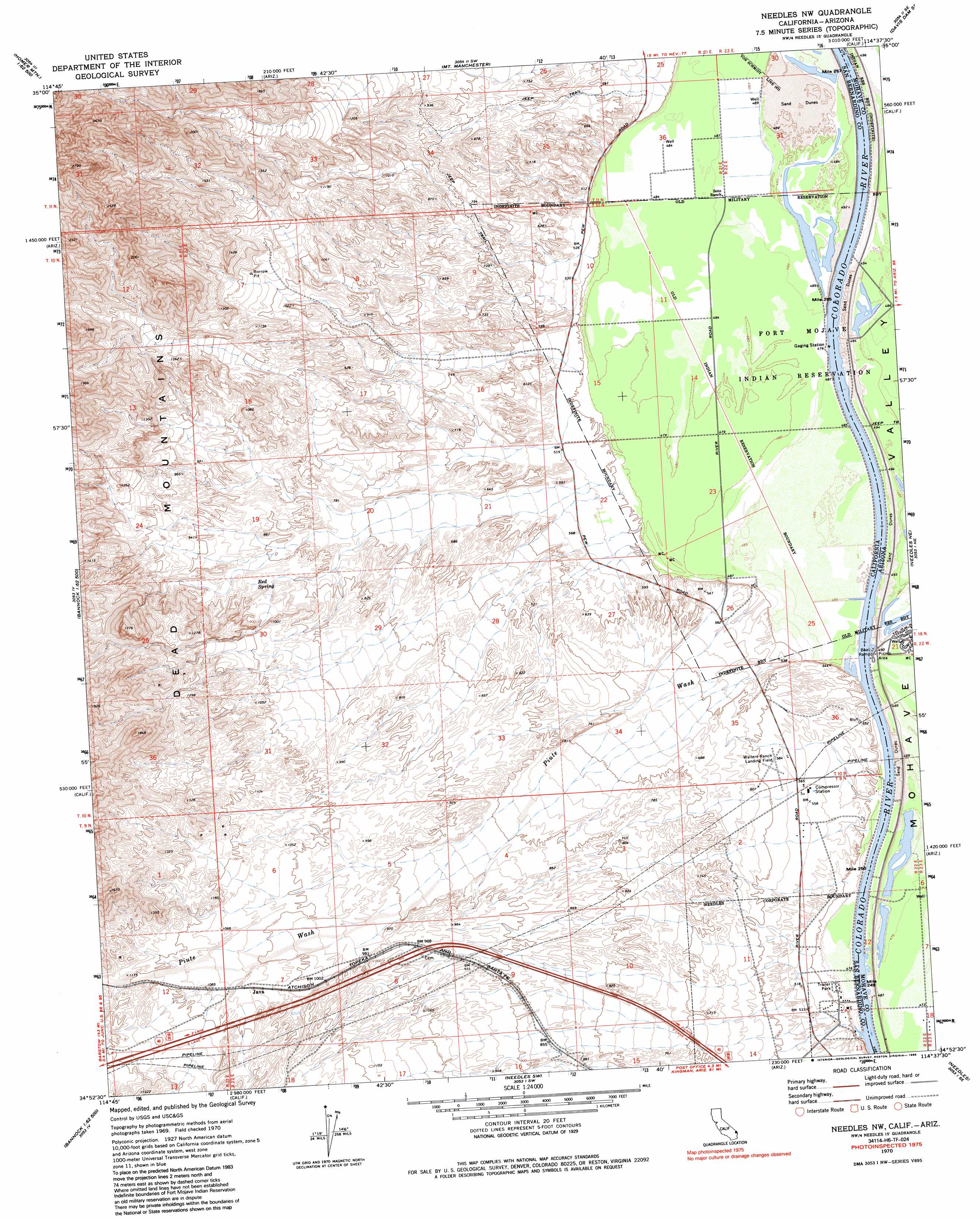
Needles Nw Topo Map California
To zoom in, hover over the map of Needles Nw
USGS Topo Quad 34114h6 - 1:24,000 scale
| Topo Map Name: | Needles Nw |
| USGS Topo Quad ID: | 34114h6 |
| Print Size: | ca. 21 1/4" wide x 27" high |
| Southeast Coordinates: | 34.875° N latitude / 114.625° W longitude |
| Map Center Coordinates: | 34.9375° N latitude / 114.6875° W longitude |
| U.S. States: | CA, AZ |
| Filename: | o34114h6.jpg |
| Download Map JPG Image: | Needles Nw topo map 1:24,000 scale |
| Map Type: | Topographic |
| Topo Series: | 7.5´ |
| Map Scale: | 1:24,000 |
| Source of Map Images: | United States Geological Survey (USGS) |
| Alternate Map Versions: |
Needles NW CA 1970, updated 1973 Download PDF Buy paper map Needles NW CA 1970, updated 1986 Download PDF Buy paper map Needles NW CA 2012 Download PDF Buy paper map Needles NW CA 2015 Download PDF Buy paper map |
1:24,000 Topo Quads surrounding Needles Nw
West Of Juniper Mine |
Juniper Mine |
Bridge Canyon |
Davis Dam |
Union Pass |
Homer Mountain |
East Of Homer Mountain |
Mount Manchester |
Davis Dam Se |
Oatman |
Homer |
Bannock |
Needles Nw |
Needles Ne |
Boundary Cone |
West Of Flattop Mountain |
Flattop Mountain |
Needles Sw |
Needles |
Warm Springs Sw |
Stepladder Mountains Nw |
Stepladder Mountains Ne |
Monumental Pass |
Whale Mountain |
Topock |
> Back to 34114e1 at 1:100,000 scale
> Back to 34114a1 at 1:250,000 scale
> Back to U.S. Topo Maps home
Needles Nw topo map: Gazetteer
Needles Nw: Airports
Walters Ranch Landing Field elevation 181m 593′Needles Nw: Populated Places
Java elevation 318m 1043′Needles Nw: Springs
Red Spring elevation 255m 836′Needles Nw: Streams
Hacienda Wash elevation 306m 1003′Piute Wash elevation 153m 501′
Piute Wash elevation 147m 482′
Needles Nw: Valleys
Piute Valley elevation 312m 1023′Needles Nw digital topo map on disk
Buy this Needles Nw topo map showing relief, roads, GPS coordinates and other geographical features, as a high-resolution digital map file on DVD: