Borger Topo Map Texas
To zoom in, hover over the map of Borger
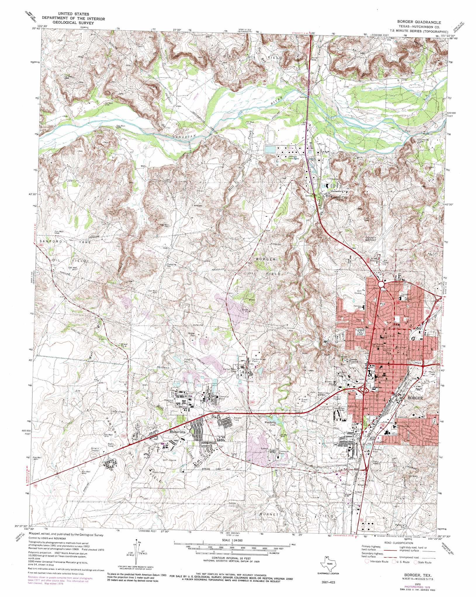
USGS Topo Quad 35101f4 - 1:24,000 scale
| Topo Map Name: | Borger |
| USGS Topo Quad ID: | 35101f4 |
| Print Size: | ca. 21 1/4" wide x 27" high |
| Southeast Coordinates: | 35.625° N latitude / 101.375° W longitude |
| Map Center Coordinates: | 35.6875° N latitude / 101.4375° W longitude |
| U.S. State: | TX |
| Filename: | o35101f4.jpg |
| Download Map JPG Image: | Borger topo map 1:24,000 scale |
| Map Type: | Topographic |
| Topo Series: | 7.5´ |
| Map Scale: | 1:24,000 |
| Source of Map Images: | United States Geological Survey (USGS) |
| Alternate Map Versions: |
Borger TX 1953, updated 1955 Download PDF Buy paper map Borger TX 1970, updated 1973 Download PDF Buy paper map Borger TX 1970, updated 1983 Download PDF Buy paper map Borger TX 2010 Download PDF Buy paper map Borger TX 2012 Download PDF Buy paper map Borger TX 2016 Download PDF Buy paper map |
1:24,000 Topo Quads surrounding Borger
Pollard Creek Nw |
Pollard Creek Ne |
Pringle |
Stinnett Station |
Adobe Creek |
Pollard Creek |
Camp Creek |
Stinnett |
Plemons |
Adobe Creek Sw |
Evans Canyon |
Sanford |
Borger |
Phillips |
Skellytown Nw |
Alibates Ranch |
Deal |
Mcbride |
Borger Se |
Skellytown |
Berry Sand Draw |
Pomeroy |
Abell |
Cuyler |
White Deer |
> Back to 35101e1 at 1:100,000 scale
> Back to 35100a1 at 1:250,000 scale
> Back to U.S. Topo Maps home
Borger topo map: Gazetteer
Borger: Airports
Hutchinson County Airport elevation 918m 3011′Borger: Oilfields
Pantex Oil Field elevation 973m 3192′Borger: Parks
Huber Park elevation 951m 3120′Johnson Park elevation 906m 2972′
Rock Creek Park elevation 922m 3024′
Borger: Populated Places
Borger elevation 938m 3077′Bunavista elevation 964m 3162′
Electric City elevation 851m 2791′
Philrich elevation 955m 3133′
Borger: Reservoirs
Weatherly Lake elevation 927m 3041′Borger: Streams
Antelope Creek elevation 850m 2788′Cottonwood Creek elevation 842m 2762′
Hill Creek elevation 845m 2772′
Patton Creek elevation 842m 2762′
Rock Creek elevation 839m 2752′
Tar Box Creek elevation 845m 2772′
West Hill Creek elevation 847m 2778′
Borger digital topo map on disk
Buy this Borger topo map showing relief, roads, GPS coordinates and other geographical features, as a high-resolution digital map file on DVD: