Separation Canyon Topo Map Arizona
To zoom in, hover over the map of Separation Canyon
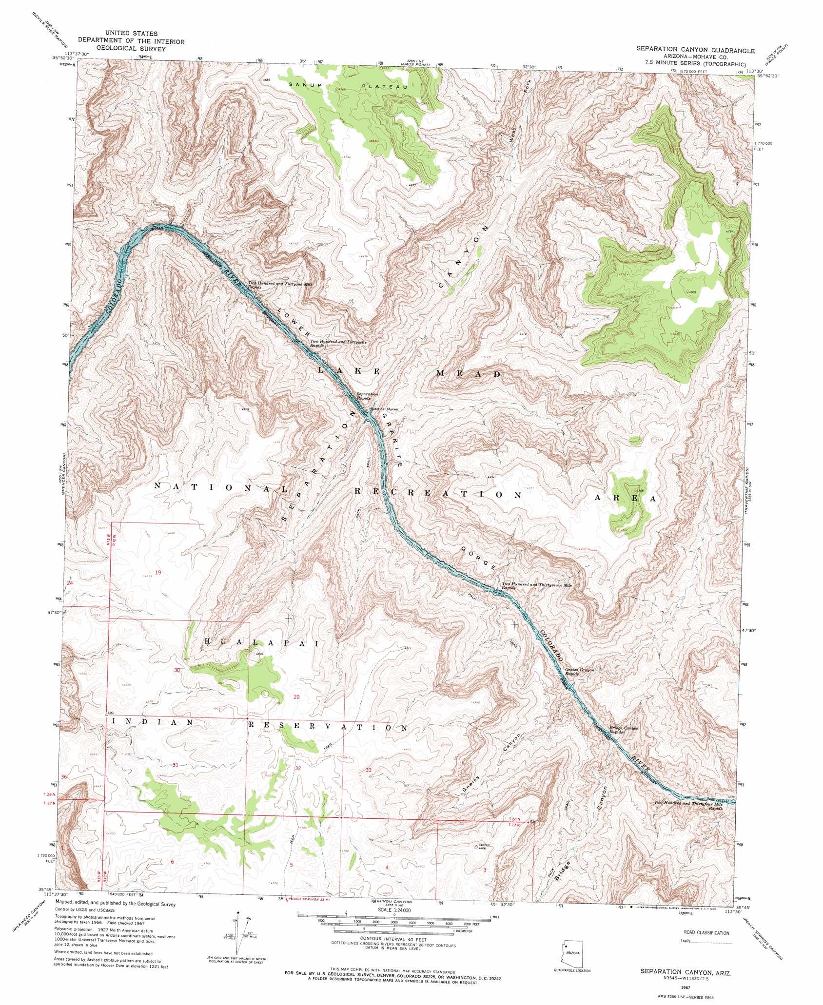
USGS Topo Quad 35113g5 - 1:24,000 scale
| Topo Map Name: | Separation Canyon |
| USGS Topo Quad ID: | 35113g5 |
| Print Size: | ca. 21 1/4" wide x 27" high |
| Southeast Coordinates: | 35.75° N latitude / 113.5° W longitude |
| Map Center Coordinates: | 35.8125° N latitude / 113.5625° W longitude |
| U.S. State: | AZ |
| Filename: | o35113g5.jpg |
| Download Map JPG Image: | Separation Canyon topo map 1:24,000 scale |
| Map Type: | Topographic |
| Topo Series: | 7.5´ |
| Map Scale: | 1:24,000 |
| Source of Map Images: | United States Geological Survey (USGS) |
| Alternate Map Versions: |
Separation Canyon AZ 1967, updated 1970 Download PDF Buy paper map Separation Canyon AZ 2011 Download PDF Buy paper map Separation Canyon AZ 2014 Download PDF Buy paper map |
1:24,000 Topo Quads surrounding Separation Canyon
Bat Cave |
Tincanebitts Point |
Mount Dellenbaugh |
Whitmore Point Sw |
Whitmore Point Se |
Quartermaster Canyon |
Devils Slide Rapids |
Amos Point |
Price Point |
Granite Park |
Horse Flat |
Spencer Canyon |
Separation Canyon |
Travertine Rapids |
Diamond Peak |
Music Mountains Ne |
Milkweed Canyon Nw |
Hindu Canyon |
Peach Springs Canyon |
Peach Springs Ne |
Music Mountains Se |
Milkweed Canyon Sw |
Milkweed Canyon Se |
Peach Springs |
Nelson |
> Back to 35113e1 at 1:100,000 scale
> Back to 35112a1 at 1:250,000 scale
> Back to U.S. Topo Maps home
Separation Canyon topo map: Gazetteer
Separation Canyon: Rapids
Bridge Canyon Rapids elevation 379m 1243′Gneiss Canyon Rapids elevation 379m 1243′
Separation Rapids elevation 0m 0′
Two Hundred and Fortymile Rapids elevation 368m 1207′
Two Hundred and Fortyone Mile Rapids elevation 368m 1207′
Two Hundred and Thirtyfour Mile Rapids elevation 379m 1243′
Two Hundred and Thirtyseven Mile Rapids elevation 368m 1207′
Separation Canyon: Valleys
Bridge Canyon elevation 379m 1243′Gneiss Canyon elevation 379m 1243′
Separation Canyon elevation 0m 0′
West Fork Separation Canyon elevation 561m 1840′
Separation Canyon digital topo map on disk
Buy this Separation Canyon topo map showing relief, roads, GPS coordinates and other geographical features, as a high-resolution digital map file on DVD: