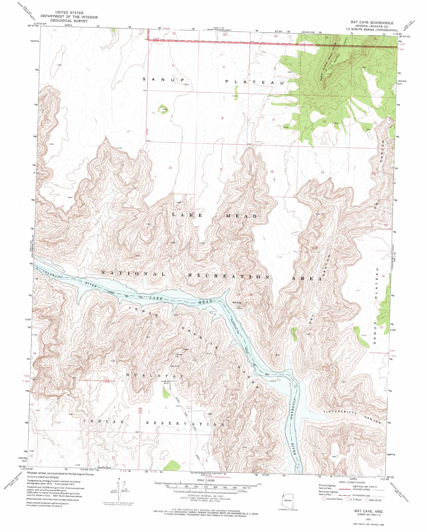
Bat Cave Topo Map Arizona
To zoom in, hover over the map of Bat Cave
USGS Topo Quad 36113a7 - 1:24,000 scale
| Topo Map Name: | Bat Cave |
| USGS Topo Quad ID: | 36113a7 |
| Print Size: | ca. 21 1/4" wide x 27" high |
| Southeast Coordinates: | 36° N latitude / 113.75° W longitude |
| Map Center Coordinates: | 36.0625° N latitude / 113.8125° W longitude |
| U.S. State: | AZ |
| Filename: | o36113a7.jpg |
| Download Map JPG Image: | Bat Cave topo map 1:24,000 scale |
| Map Type: | Topographic |
| Topo Series: | 7.5´ |
| Map Scale: | 1:24,000 |
| Source of Map Images: | United States Geological Survey (USGS) |
| Alternate Map Versions: |
Bat Cave AZ 1971, updated 1973 Download PDF Buy paper map Bat Cave AZ 2011 Download PDF Buy paper map Bat Cave AZ 2014 Download PDF Buy paper map |
1:24,000 Topo Quads surrounding Bat Cave
Azure Ridge |
Gyp Hills |
Grand Gulch Bench |
Mustang Point |
Wildcat Ranch |
Iceberg Canyon |
Snap Canyon West |
Snap Canyon East |
Snap Draw |
Castle Peak |
Meadview North |
Columbine Falls |
Bat Cave |
Tincanebitts Point |
Mount Dellenbaugh |
Meadview South |
Grapevine Canyon |
Quartermaster Canyon |
Devils Slide Rapids |
Amos Point |
Garnet Mountain |
Quartermaster Canyon Sw |
Horse Flat |
Spencer Canyon |
Separation Canyon |
> Back to 36113a1 at 1:100,000 scale
> Back to 36112a1 at 1:250,000 scale
> Back to U.S. Topo Maps home
Bat Cave topo map: Gazetteer
Bat Cave: Airports
Grand Canyon West-1 Heliport elevation 1461m 4793′Grand Canyon West-2 Heliport elevation 382m 1253′
Bat Cave: Cliffs
Fort Garrett Point elevation 1942m 6371′Bat Cave: Reservoirs
Granite Tank elevation 1371m 4498′Bat Cave: Valleys
Dry Canyon elevation 369m 1210′Tincanebitts Canyon elevation 373m 1223′
Bat Cave digital topo map on disk
Buy this Bat Cave topo map showing relief, roads, GPS coordinates and other geographical features, as a high-resolution digital map file on DVD: