Beaumont Topo Map Kansas
To zoom in, hover over the map of Beaumont
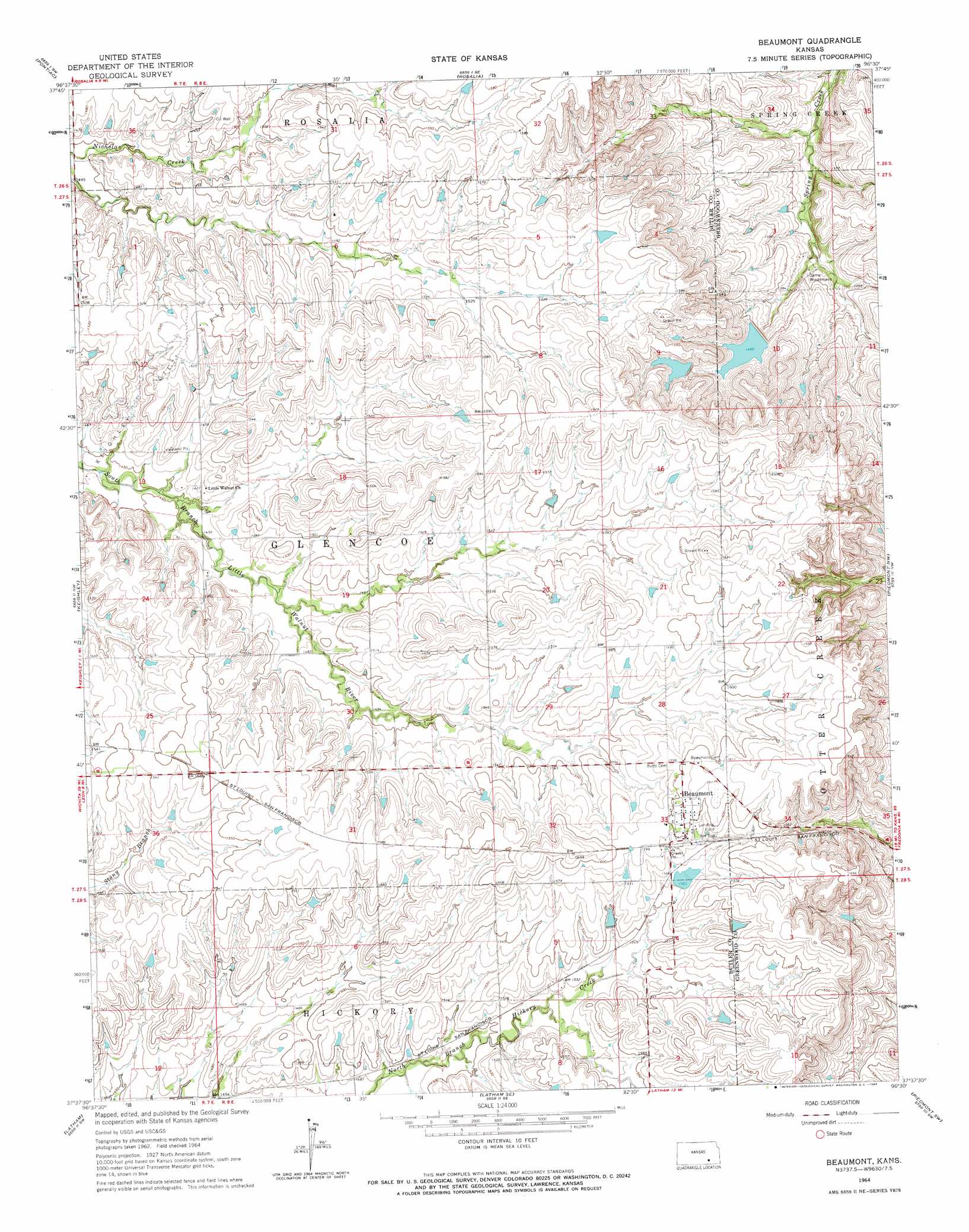
USGS Topo Quad 37096f5 - 1:24,000 scale
| Topo Map Name: | Beaumont |
| USGS Topo Quad ID: | 37096f5 |
| Print Size: | ca. 21 1/4" wide x 27" high |
| Southeast Coordinates: | 37.625° N latitude / 96.5° W longitude |
| Map Center Coordinates: | 37.6875° N latitude / 96.5625° W longitude |
| U.S. State: | KS |
| Filename: | o37096f5.jpg |
| Download Map JPG Image: | Beaumont topo map 1:24,000 scale |
| Map Type: | Topographic |
| Topo Series: | 7.5´ |
| Map Scale: | 1:24,000 |
| Source of Map Images: | United States Geological Survey (USGS) |
| Alternate Map Versions: |
Beaumont KS 1964, updated 1965 Download PDF Buy paper map Beaumont KS 2009 Download PDF Buy paper map Beaumont KS 2012 Download PDF Buy paper map Beaumont KS 2015 Download PDF Buy paper map |
1:24,000 Topo Quads surrounding Beaumont
De Graff |
Rosalia Nw |
Rosalia Ne |
Lapland |
Eureka Ne |
El Dorado |
Pontiac |
Rosalia |
Reece |
Eureka |
Leon |
Keighley |
Beaumont |
Piedmont Nw |
Piedmont Ne |
Augusta Se |
Latham |
Latham Se |
Piedmont Sw |
Piedmont |
Atlanta |
Cambridge Nw |
Cambridge Ne |
Howard Nw |
Howard |
> Back to 37096e1 at 1:100,000 scale
> Back to 37096a1 at 1:250,000 scale
> Back to U.S. Topo Maps home
Beaumont topo map: Gazetteer
Beaumont: Airports
Beaumont Hotel Airport elevation 490m 1607′Beaumont: Dams
Lower Wiedemann Dam elevation 443m 1453′Upper Wiedemann Dam elevation 462m 1515′
Beaumont: Populated Places
Beaumont elevation 489m 1604′Beaumont digital topo map on disk
Buy this Beaumont topo map showing relief, roads, GPS coordinates and other geographical features, as a high-resolution digital map file on DVD: