Wright Topo Map Kansas
To zoom in, hover over the map of Wright
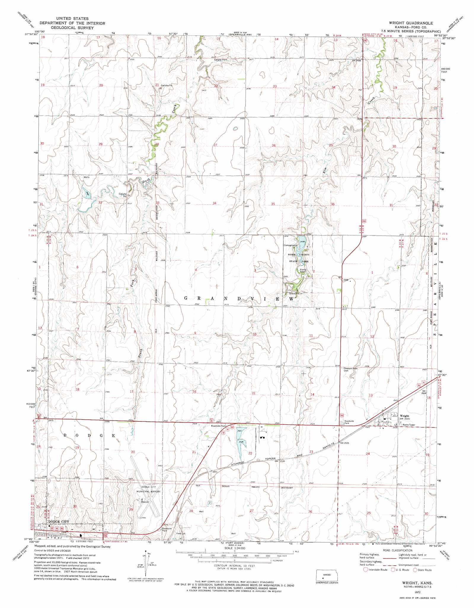
USGS Topo Quad 37099g8 - 1:24,000 scale
| Topo Map Name: | Wright |
| USGS Topo Quad ID: | 37099g8 |
| Print Size: | ca. 21 1/4" wide x 27" high |
| Southeast Coordinates: | 37.75° N latitude / 99.875° W longitude |
| Map Center Coordinates: | 37.8125° N latitude / 99.9375° W longitude |
| U.S. State: | KS |
| Filename: | o37099g8.jpg |
| Download Map JPG Image: | Wright topo map 1:24,000 scale |
| Map Type: | Topographic |
| Topo Series: | 7.5´ |
| Map Scale: | 1:24,000 |
| Source of Map Images: | United States Geological Survey (USGS) |
| Alternate Map Versions: |
Wright KS 1972, updated 1974 Download PDF Buy paper map Wright KS 2010 Download PDF Buy paper map Wright KS 2012 Download PDF Buy paper map Wright KS 2016 Download PDF Buy paper map |
1:24,000 Topo Quads surrounding Wright
Horse Thief Canyon Sw |
Horse Thief Canyon |
Jetmore |
Jetmore Se |
Hanston |
Dodge City Nw |
Dodge City Ne |
Spearville Nw |
Spearville Ne |
Offerle Nw |
Dodge City Sw |
Dodge City |
Wright |
Spearville |
Bellefont |
Ensign |
South Dodge |
Fort Dodge |
Ford |
Bucklin Nw |
Ensign Sw |
Ensign Se |
Fort Dodge Sw |
Kingsdown |
Bucklin |
> Back to 37099e1 at 1:100,000 scale
> Back to 37098a1 at 1:250,000 scale
> Back to U.S. Topo Maps home
Wright topo map: Gazetteer
Wright: Airports
Dodge City Municipal Airport elevation 791m 2595′Wright: Dams
Ford County Dam elevation 741m 2431′Wright: Parks
Ford County State Park elevation 750m 2460′Wright: Populated Places
Wright elevation 772m 2532′Wright: Reservoirs
Ford County Lake elevation 750m 2460′Wright: Streams
South Fork Duck Creek elevation 746m 2447′Wright digital topo map on disk
Buy this Wright topo map showing relief, roads, GPS coordinates and other geographical features, as a high-resolution digital map file on DVD: