Liberal Topo Map Kansas
To zoom in, hover over the map of Liberal
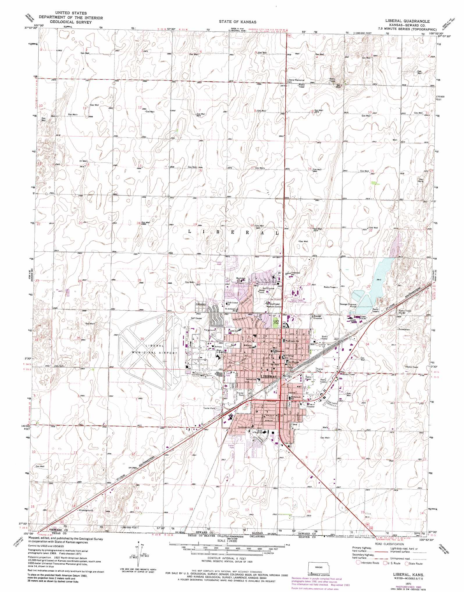
USGS Topo Quad 37100a8 - 1:24,000 scale
| Topo Map Name: | Liberal |
| USGS Topo Quad ID: | 37100a8 |
| Print Size: | ca. 21 1/4" wide x 27" high |
| Southeast Coordinates: | 37° N latitude / 100.875° W longitude |
| Map Center Coordinates: | 37.0625° N latitude / 100.9375° W longitude |
| U.S. State: | KS |
| Filename: | o37100a8.jpg |
| Download Map JPG Image: | Liberal topo map 1:24,000 scale |
| Map Type: | Topographic |
| Topo Series: | 7.5´ |
| Map Scale: | 1:24,000 |
| Source of Map Images: | United States Geological Survey (USGS) |
| Alternate Map Versions: |
Liberal KS 1971 Download PDF Buy paper map Liberal KS 1971, updated 1973 Download PDF Buy paper map Liberal KS 1971, updated 1983 Download PDF Buy paper map Liberal KS 2010 Download PDF Buy paper map Liberal KS 2012 Download PDF Buy paper map Liberal KS 2016 Download PDF Buy paper map |
1:24,000 Topo Quads surrounding Liberal
Moscow |
Moscow Se |
Sublette Sw |
Sublette Se |
Plains Sw |
Woods Nw |
Woods |
Liberal Nw |
Liberal Ne |
Kismet |
Woods Sw |
Woods Se |
Liberal |
Hayne |
Kismet Sw |
Hooker Nw |
Tyrone |
Little Ponderosa |
Turpin Ne |
Beaver Nw |
Hooker |
Adams |
Turpin West |
Turpin East |
Floris |
> Back to 37100a1 at 1:100,000 scale
> Back to 37100a1 at 1:250,000 scale
> Back to U.S. Topo Maps home
Liberal topo map: Gazetteer
Liberal: Airports
Liberal Municipal Airport elevation 879m 2883′Liberal: Parks
Bellaire Park elevation 873m 2864′Blue Bonnet Park elevation 869m 2851′
Cooper Park elevation 864m 2834′
Country Club Acres Park elevation 872m 2860′
Harrison Circle Park elevation 867m 2844′
Light Park elevation 864m 2834′
Mahuron Park elevation 861m 2824′
Mary Frame Park elevation 866m 2841′
McCray Park elevation 869m 2851′
Redskin Field elevation 871m 2857′
Southlawn Park elevation 868m 2847′
Tower Park elevation 863m 2831′
Liberal: Populated Places
Liberal elevation 864m 2834′Liberal digital topo map on disk
Buy this Liberal topo map showing relief, roads, GPS coordinates and other geographical features, as a high-resolution digital map file on DVD: