Hall Mesa Topo Map Utah
To zoom in, hover over the map of Hall Mesa
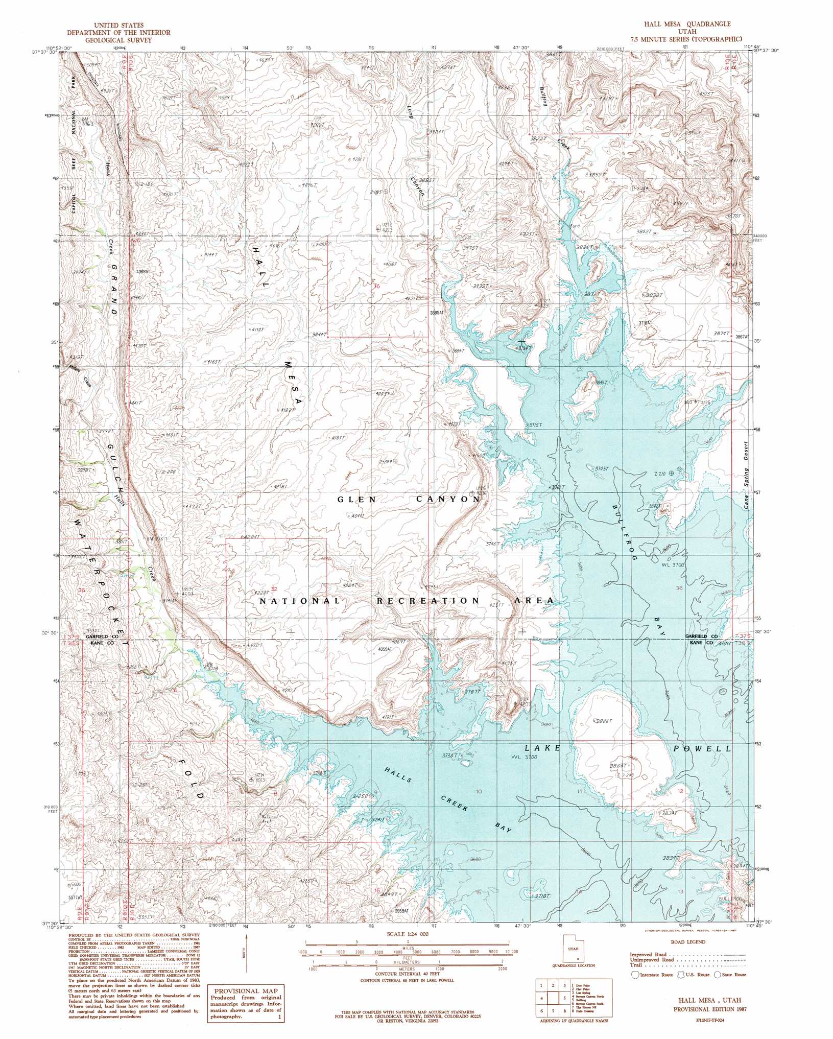
USGS Topo Quad 37110e7 - 1:24,000 scale
| Topo Map Name: | Hall Mesa |
| USGS Topo Quad ID: | 37110e7 |
| Print Size: | ca. 21 1/4" wide x 27" high |
| Southeast Coordinates: | 37.5° N latitude / 110.75° W longitude |
| Map Center Coordinates: | 37.5625° N latitude / 110.8125° W longitude |
| U.S. State: | UT |
| Filename: | o37110e7.jpg |
| Download Map JPG Image: | Hall Mesa topo map 1:24,000 scale |
| Map Type: | Topographic |
| Topo Series: | 7.5´ |
| Map Scale: | 1:24,000 |
| Source of Map Images: | United States Geological Survey (USGS) |
| Alternate Map Versions: |
Hall Mesa UT 1987, updated 1987 Download PDF Buy paper map Hall Mesa UT 2011 Download PDF Buy paper map Hall Mesa UT 2014 Download PDF Buy paper map |
1:24,000 Topo Quads surrounding Hall Mesa
Wagon Box Mesa |
The Post |
Ant Knoll |
Copper Creek Benches |
Mount Holmes |
Horse Pasture Mesa |
Deer Point |
Clay Point |
Lost Spring |
Ticaboo Mesa |
Scorpion Gulch |
Stevens Canyon North |
Hall Mesa |
Bullfrog |
Knowles Canyon |
King Mesa |
Stevens Canyon South |
The Rincon Ne |
Halls Crossing |
Halls Crossing Ne |
Sooner Bench |
Davis Gulch |
The Rincon |
Alcove Canyon |
Nokai Dome |
> Back to 37110e1 at 1:100,000 scale
> Back to 37110a1 at 1:250,000 scale
> Back to U.S. Topo Maps home
Hall Mesa topo map: Gazetteer
Hall Mesa: Bays
Halls Creek Bay elevation 1210m 3969′Hall Mesa: Streams
Bullfrog Creek elevation 1129m 3704′Halls Creek elevation 1129m 3704′
Millers Creek elevation 1171m 3841′
Hall Mesa: Valleys
Grand Gulch elevation 1129m 3704′Long Canyon elevation 1129m 3704′
Hall Mesa digital topo map on disk
Buy this Hall Mesa topo map showing relief, roads, GPS coordinates and other geographical features, as a high-resolution digital map file on DVD: