Panguitch Nw Topo Map Utah
To zoom in, hover over the map of Panguitch Nw
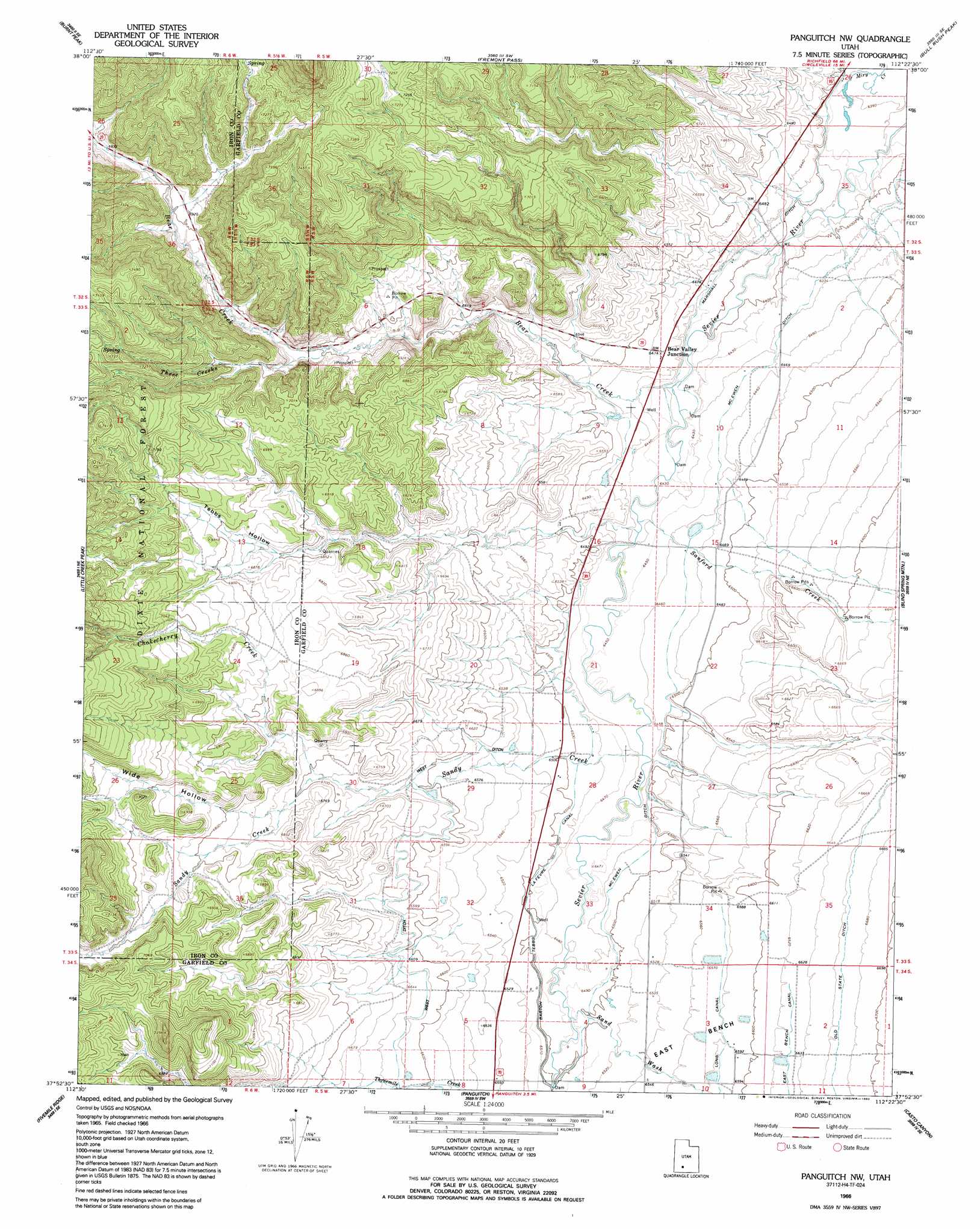
USGS Topo Quad 37112h4 - 1:24,000 scale
| Topo Map Name: | Panguitch Nw |
| USGS Topo Quad ID: | 37112h4 |
| Print Size: | ca. 21 1/4" wide x 27" high |
| Southeast Coordinates: | 37.875° N latitude / 112.375° W longitude |
| Map Center Coordinates: | 37.9375° N latitude / 112.4375° W longitude |
| U.S. State: | UT |
| Filename: | o37112h4.jpg |
| Download Map JPG Image: | Panguitch Nw topo map 1:24,000 scale |
| Map Type: | Topographic |
| Topo Series: | 7.5´ |
| Map Scale: | 1:24,000 |
| Source of Map Images: | United States Geological Survey (USGS) |
| Alternate Map Versions: |
Panguitch NW UT 1966, updated 1969 Download PDF Buy paper map Panguitch NW UT 1966, updated 1992 Download PDF Buy paper map Panguitch NW UT 2002, updated 2005 Download PDF Buy paper map Panguitch NW UT 2011 Download PDF Buy paper map Panguitch NW UT 2014 Download PDF Buy paper map |
| FStopo: | US Forest Service topo Panguitch NW is available: Download FStopo PDF Download FStopo TIF |
1:24,000 Topo Quads surrounding Panguitch Nw
Greenville Bench |
Kane Canyon |
Circleville Mountain |
Circleville |
Junction |
Buckhorn Flat |
Burnt Peak |
Fremont Pass |
Bull Rush Peak |
Mount Dutton |
Cottonwood Mountain |
Little Creek Peak |
Panguitch Nw |
Blind Spring Mountain |
Adams Head |
Red Creek Reservoir |
Fivemile Ridge |
Panguitch |
Casto Canyon |
Flake Mountain West |
Panguitch Lake |
Haycock Mountain |
Hatch |
Wilson Peak |
Bryce Canyon |
> Back to 37112e1 at 1:100,000 scale
> Back to 37112a1 at 1:250,000 scale
> Back to U.S. Topo Maps home
Panguitch Nw topo map: Gazetteer
Panguitch Nw: Canals
Barton Tebbs LaFevre Canal elevation 1982m 6502′Marshall Ditch elevation 1955m 6414′
McEwen Ditch elevation 1975m 6479′
Old State Ditch elevation 2033m 6669′
Panguitch Canal elevation 2020m 6627′
Panguitch Nw: Populated Places
Bear Valley Junction elevation 1973m 6473′Panguitch Nw: Streams
Bear Creek elevation 1956m 6417′Chokecherry Creek elevation 2037m 6683′
Sandy Creek elevation 1968m 6456′
Sanford Creek elevation 1964m 6443′
Three Creeks elevation 2040m 6692′
Panguitch Nw: Valleys
Sand Wash elevation 1978m 6489′Tebbs Hollow elevation 2045m 6709′
Wide Hollow elevation 2071m 6794′
Panguitch Nw digital topo map on disk
Buy this Panguitch Nw topo map showing relief, roads, GPS coordinates and other geographical features, as a high-resolution digital map file on DVD: