Bunceton Topo Map Missouri
To zoom in, hover over the map of Bunceton
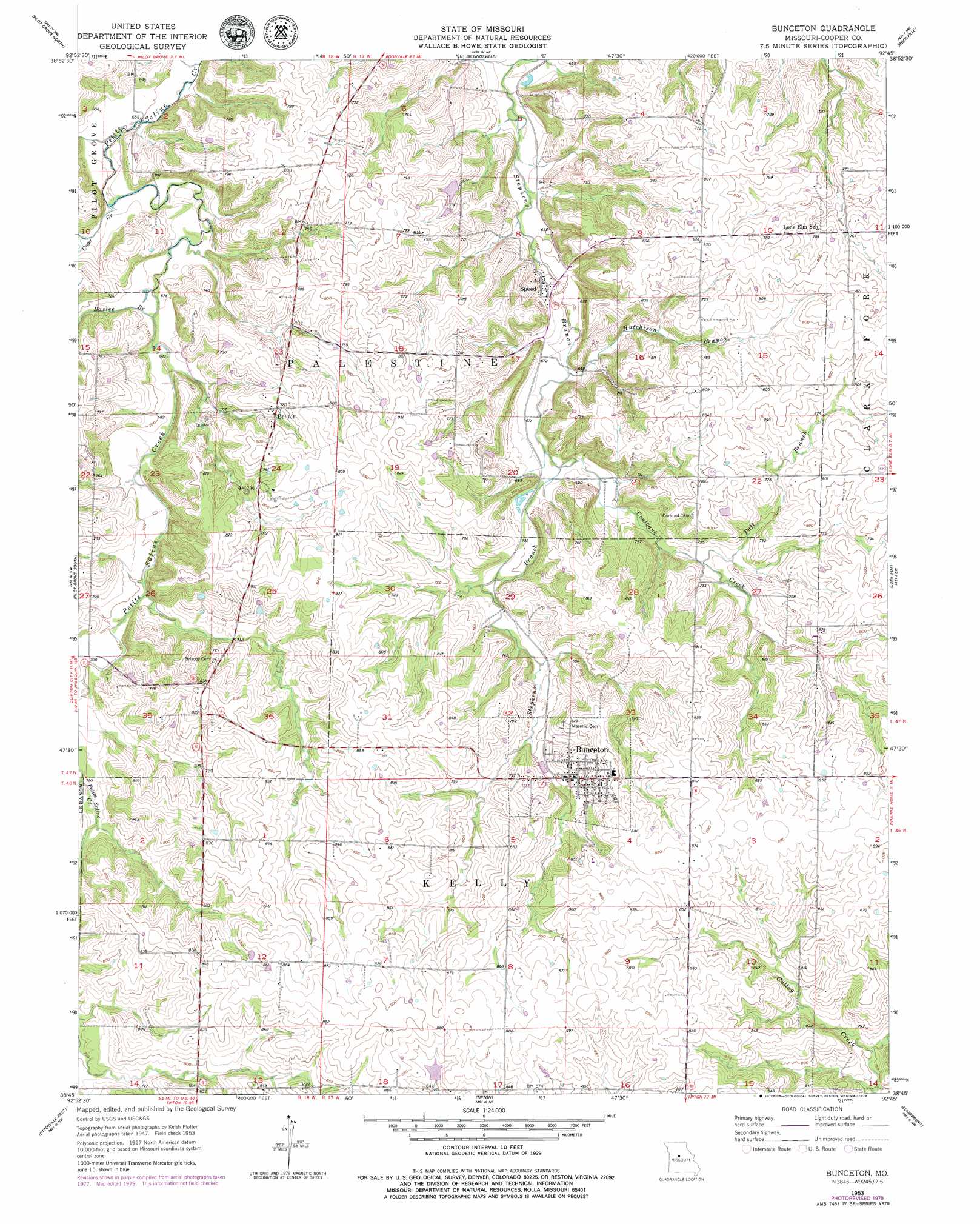
USGS Topo Quad 38092g7 - 1:24,000 scale
| Topo Map Name: | Bunceton |
| USGS Topo Quad ID: | 38092g7 |
| Print Size: | ca. 21 1/4" wide x 27" high |
| Southeast Coordinates: | 38.75° N latitude / 92.75° W longitude |
| Map Center Coordinates: | 38.8125° N latitude / 92.8125° W longitude |
| U.S. State: | MO |
| Filename: | o38092g7.jpg |
| Download Map JPG Image: | Bunceton topo map 1:24,000 scale |
| Map Type: | Topographic |
| Topo Series: | 7.5´ |
| Map Scale: | 1:24,000 |
| Source of Map Images: | United States Geological Survey (USGS) |
| Alternate Map Versions: |
Bunceton MO 1953, updated 1954 Download PDF Buy paper map Bunceton MO 1953, updated 1979 Download PDF Buy paper map Bunceton MO 2011 Download PDF Buy paper map Bunceton MO 2015 Download PDF Buy paper map |
1:24,000 Topo Quads surrounding Bunceton
Napton |
Arrow Rock |
Franklin |
New Franklin |
Hilldale |
Nelson |
Pilot Grove North |
Billingsville |
Boonville |
Rocheport |
Clifton City |
Pilot Grove South |
Bunceton |
Lone Elm |
Prairie Home |
Otterville West |
Otterville East |
Tipton |
Clarksburg |
California North |
Pyrmont |
Florence |
Fortuna |
Latham |
California South |
> Back to 38092e1 at 1:100,000 scale
> Back to 38092a1 at 1:250,000 scale
> Back to U.S. Topo Maps home
Bunceton topo map: Gazetteer
Bunceton: Areas
West Central Loess Hills elevation 235m 770′Bunceton: Populated Places
Bellair elevation 240m 787′Bunceton elevation 239m 784′
Petersburg (historical) elevation 225m 738′
Speed elevation 204m 669′
Bunceton: Streams
Baslee Branch elevation 204m 669′Coalbank Creek elevation 204m 669′
Coon Creek elevation 199m 652′
Hutchison Branch elevation 200m 656′
Tutt Branch elevation 216m 708′
Bunceton digital topo map on disk
Buy this Bunceton topo map showing relief, roads, GPS coordinates and other geographical features, as a high-resolution digital map file on DVD: