Lyndon Topo Map Kansas
To zoom in, hover over the map of Lyndon
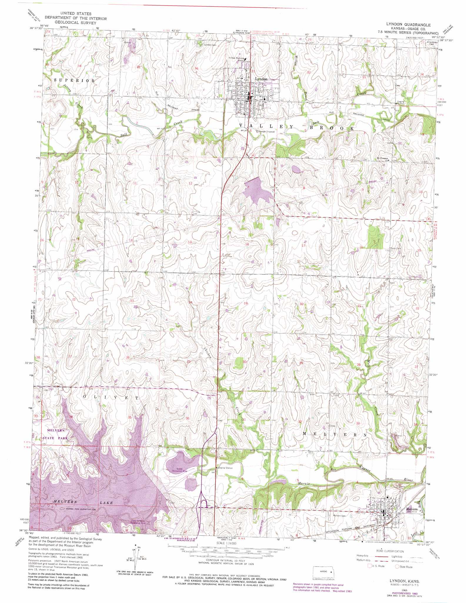
USGS Topo Quad 38095e6 - 1:24,000 scale
| Topo Map Name: | Lyndon |
| USGS Topo Quad ID: | 38095e6 |
| Print Size: | ca. 21 1/4" wide x 27" high |
| Southeast Coordinates: | 38.5° N latitude / 95.625° W longitude |
| Map Center Coordinates: | 38.5625° N latitude / 95.6875° W longitude |
| U.S. State: | KS |
| Filename: | o38095e6.jpg |
| Download Map JPG Image: | Lyndon topo map 1:24,000 scale |
| Map Type: | Topographic |
| Topo Series: | 7.5´ |
| Map Scale: | 1:24,000 |
| Source of Map Images: | United States Geological Survey (USGS) |
| Alternate Map Versions: |
Lyndon KS 1965, updated 1966 Download PDF Buy paper map Lyndon KS 1965, updated 1976 Download PDF Buy paper map Lyndon KS 1965, updated 1983 Download PDF Buy paper map Lyndon KS 2009 Download PDF Buy paper map Lyndon KS 2012 Download PDF Buy paper map Lyndon KS 2015 Download PDF Buy paper map |
1:24,000 Topo Quads surrounding Lyndon
Harveyville |
Burlingame |
Carbondale |
Overbrook |
Globe |
Miller |
Osage City |
Lyndon Nw |
Vassar |
Ottawa Nw |
Reading |
Osage City Se |
Lyndon |
Quenemo |
Pomona |
Lebo Nw |
Lebo |
Waverly Nw |
Waverly |
Williamsburg |
Hartford |
Ottumwa |
New Strawn |
Waverly Se |
Harris |
> Back to 38095e1 at 1:100,000 scale
> Back to 38094a1 at 1:250,000 scale
> Back to U.S. Topo Maps home
Lyndon topo map: Gazetteer
Lyndon: Dams
Lyndon City Dam elevation 309m 1013′Melvern Dam elevation 301m 987′
Lyndon: Parks
Melvena Wildlife Area elevation 328m 1076′Melvern State Park elevation 328m 1076′
Lyndon: Populated Places
Lyndon elevation 315m 1033′Melvern elevation 309m 1013′
Lyndon: Reservoirs
Melvern Lake elevation 301m 987′Lyndon: Streams
Chicken Creek elevation 293m 961′Jersey Creek elevation 305m 1000′
Willow Brook elevation 298m 977′
Lyndon digital topo map on disk
Buy this Lyndon topo map showing relief, roads, GPS coordinates and other geographical features, as a high-resolution digital map file on DVD: