Allen Sw Topo Map Kansas
To zoom in, hover over the map of Allen Sw
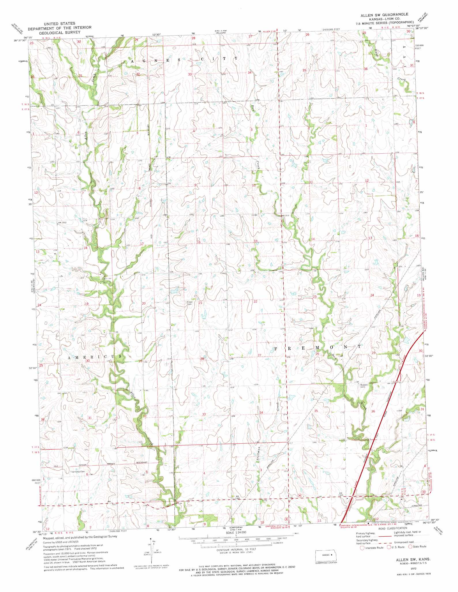
USGS Topo Quad 38096e2 - 1:24,000 scale
| Topo Map Name: | Allen Sw |
| USGS Topo Quad ID: | 38096e2 |
| Print Size: | ca. 21 1/4" wide x 27" high |
| Southeast Coordinates: | 38.5° N latitude / 96.125° W longitude |
| Map Center Coordinates: | 38.5625° N latitude / 96.1875° W longitude |
| U.S. State: | KS |
| Filename: | o38096e2.jpg |
| Download Map JPG Image: | Allen Sw topo map 1:24,000 scale |
| Map Type: | Topographic |
| Topo Series: | 7.5´ |
| Map Scale: | 1:24,000 |
| Source of Map Images: | United States Geological Survey (USGS) |
| Alternate Map Versions: |
Allen SW KS 1972, updated 1974 Download PDF Buy paper map Allen SW KS 2009 Download PDF Buy paper map Allen SW KS 2012 Download PDF Buy paper map Allen SW KS 2015 Download PDF Buy paper map |
1:24,000 Topo Quads surrounding Allen Sw
Alta Vista |
Alta Vista Se |
Lake Wabaunsee |
Eskridge |
Harveyville |
Council Grove |
Bushong |
Allen |
Admire |
Miller |
Lake Kahola |
Americus |
Allen Sw |
Allen Se |
Reading |
Saffordville |
Plymouth |
Emporia |
Lang |
Lebo Nw |
Gladstone |
Phenis Creek |
Olpe |
Emporia Se |
Hartford |
> Back to 38096e1 at 1:100,000 scale
> Back to 38096a1 at 1:250,000 scale
> Back to U.S. Topo Maps home
No gazetteer data is available for the Allen Sw topo map sheet.
Allen Sw digital topo map on disk
Buy this Allen Sw topo map showing relief, roads, GPS coordinates and other geographical features, as a high-resolution digital map file on DVD: