Admire Topo Map Kansas
To zoom in, hover over the map of Admire
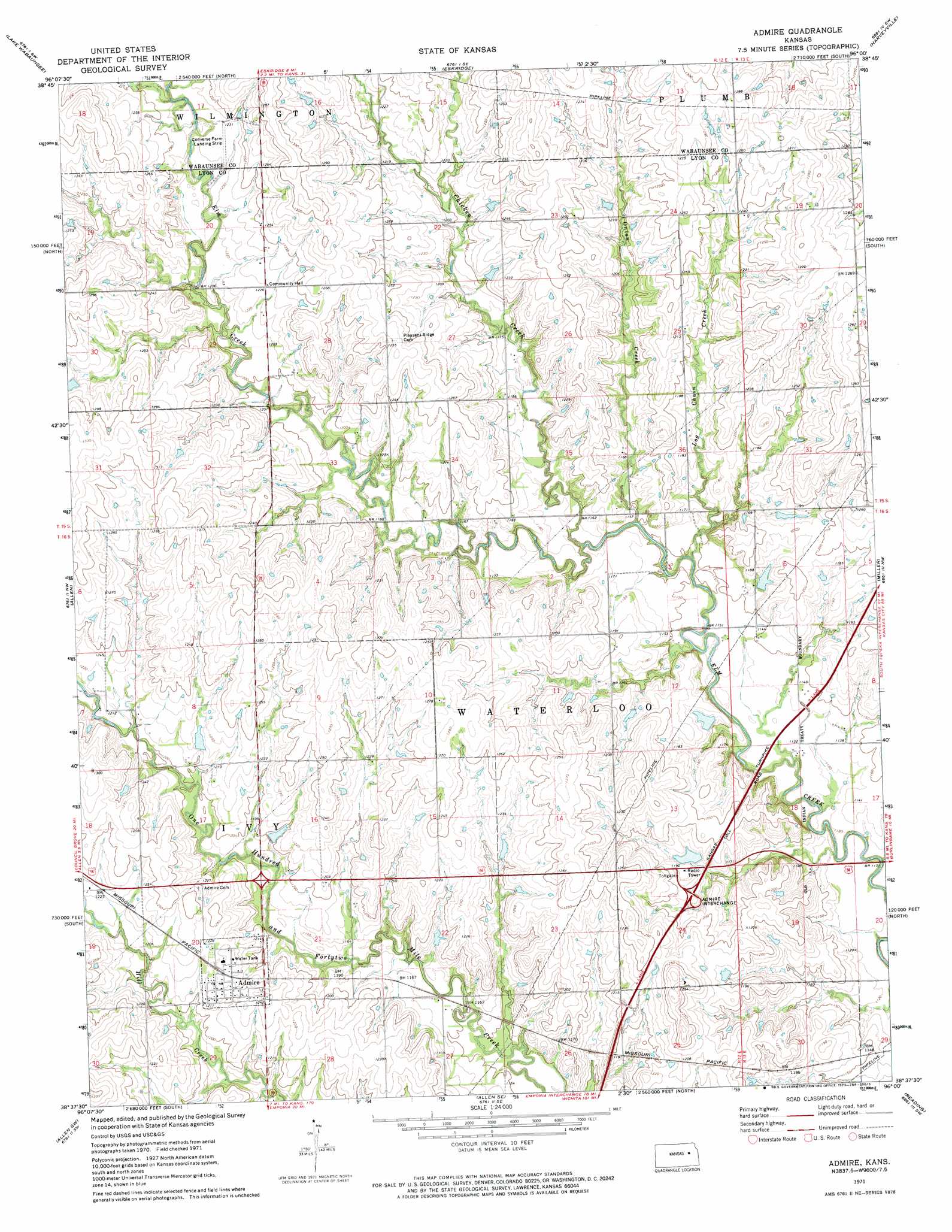
USGS Topo Quad 38096f1 - 1:24,000 scale
| Topo Map Name: | Admire |
| USGS Topo Quad ID: | 38096f1 |
| Print Size: | ca. 21 1/4" wide x 27" high |
| Southeast Coordinates: | 38.625° N latitude / 96° W longitude |
| Map Center Coordinates: | 38.6875° N latitude / 96.0625° W longitude |
| U.S. State: | KS |
| Filename: | o38096f1.jpg |
| Download Map JPG Image: | Admire topo map 1:24,000 scale |
| Map Type: | Topographic |
| Topo Series: | 7.5´ |
| Map Scale: | 1:24,000 |
| Source of Map Images: | United States Geological Survey (USGS) |
| Alternate Map Versions: |
Admire KS 1971, updated 1973 Download PDF Buy paper map Admire KS 2009 Download PDF Buy paper map Admire KS 2012 Download PDF Buy paper map Admire KS 2015 Download PDF Buy paper map |
1:24,000 Topo Quads surrounding Admire
Allendorph |
Hessdale |
Keene |
Dover |
Auburn |
Alta Vista Se |
Lake Wabaunsee |
Eskridge |
Harveyville |
Burlingame |
Bushong |
Allen |
Admire |
Miller |
Osage City |
Americus |
Allen Sw |
Allen Se |
Reading |
Osage City Se |
Plymouth |
Emporia |
Lang |
Lebo Nw |
Lebo |
> Back to 38096e1 at 1:100,000 scale
> Back to 38096a1 at 1:250,000 scale
> Back to U.S. Topo Maps home
Admire topo map: Gazetteer
Admire: Airports
Converse Farm Landing Strip elevation 378m 1240′Admire: Populated Places
Admire elevation 377m 1236′Admire: Streams
Chicken Creek elevation 347m 1138′Log Chain Creek elevation 344m 1128′
Onion Creek elevation 350m 1148′
Admire digital topo map on disk
Buy this Admire topo map showing relief, roads, GPS coordinates and other geographical features, as a high-resolution digital map file on DVD: