Lorraine Topo Map Kansas
To zoom in, hover over the map of Lorraine
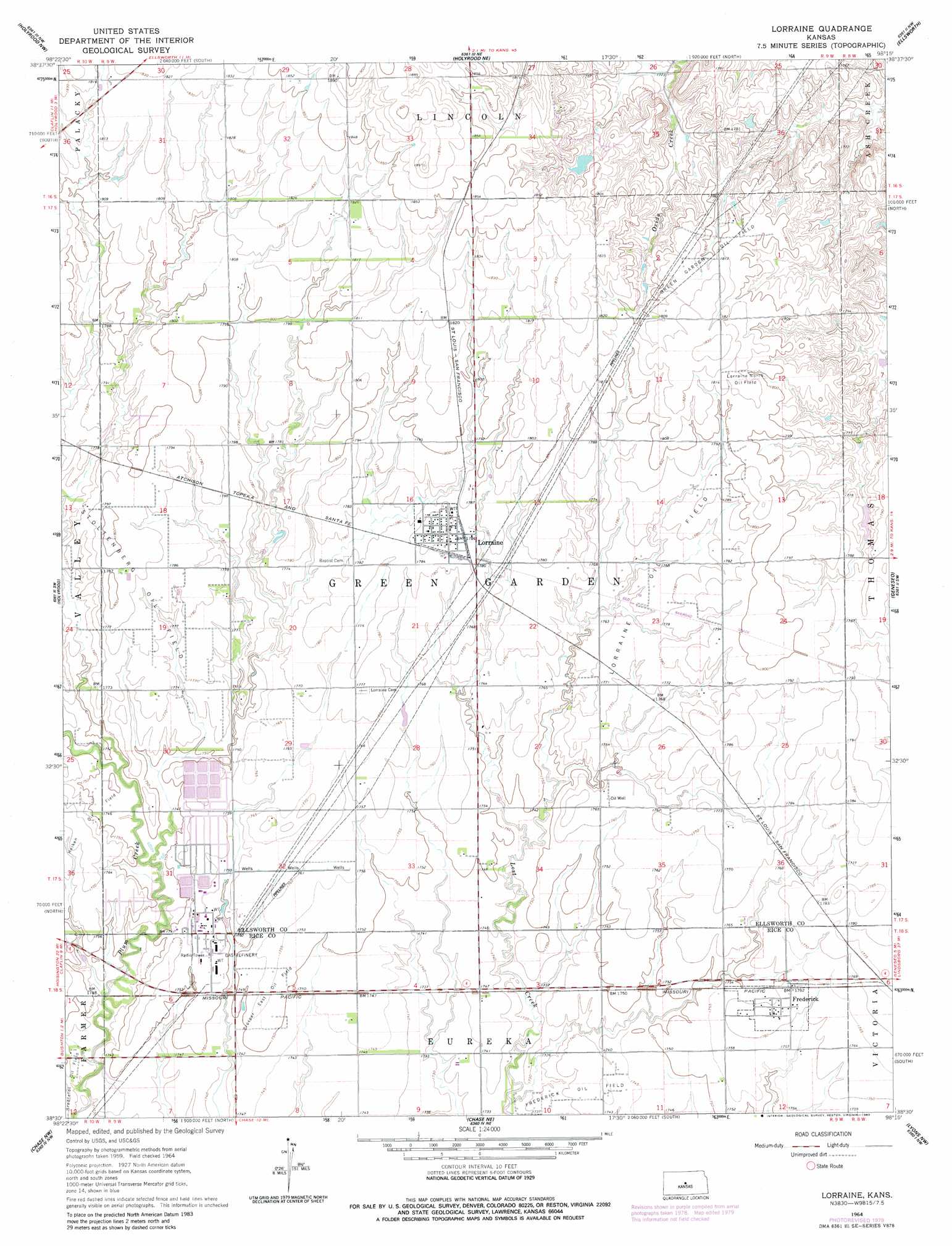
USGS Topo Quad 38098e3 - 1:24,000 scale
| Topo Map Name: | Lorraine |
| USGS Topo Quad ID: | 38098e3 |
| Print Size: | ca. 21 1/4" wide x 27" high |
| Southeast Coordinates: | 38.5° N latitude / 98.25° W longitude |
| Map Center Coordinates: | 38.5625° N latitude / 98.3125° W longitude |
| U.S. State: | KS |
| Filename: | o38098e3.jpg |
| Download Map JPG Image: | Lorraine topo map 1:24,000 scale |
| Map Type: | Topographic |
| Topo Series: | 7.5´ |
| Map Scale: | 1:24,000 |
| Source of Map Images: | United States Geological Survey (USGS) |
| Alternate Map Versions: |
Lorraine KS 1964, updated 1965 Download PDF Buy paper map Lorraine KS 1964, updated 1980 Download PDF Buy paper map Lorraine KS 2009 Download PDF Buy paper map Lorraine KS 2012 Download PDF Buy paper map Lorraine KS 2015 Download PDF Buy paper map |
1:24,000 Topo Quads surrounding Lorraine
Dorrance |
Wilson |
Black Wolf |
Westfall Sw |
Westfall Se |
Dubuque |
Holyrood Nw |
Holyrood Ne |
Ellsworth |
Carneiro |
Claflin |
Holyrood |
Lorraine |
Geneseo |
Crawford |
Ellinwood Ne |
Chase Nw |
Chase Ne |
Lyons Nw |
Little River |
Ellinwood |
Raymond |
Chase |
Lyons |
Lyons Se |
> Back to 38098e1 at 1:100,000 scale
> Back to 38098a1 at 1:250,000 scale
> Back to U.S. Topo Maps home
Lorraine topo map: Gazetteer
Lorraine: Oilfields
Bredfeldt Oil Field elevation 530m 1738′Green Garden Oil Field elevation 551m 1807′
Lorraine North Oil Field elevation 552m 1811′
Lorraine Oil Field elevation 540m 1771′
Prosper East Oil Field elevation 535m 1755′
Lorraine: Populated Places
Frederick elevation 536m 1758′Lorraine elevation 545m 1788′
Lorraine digital topo map on disk
Buy this Lorraine topo map showing relief, roads, GPS coordinates and other geographical features, as a high-resolution digital map file on DVD: