Bellmore Topo Map Indiana
To zoom in, hover over the map of Bellmore
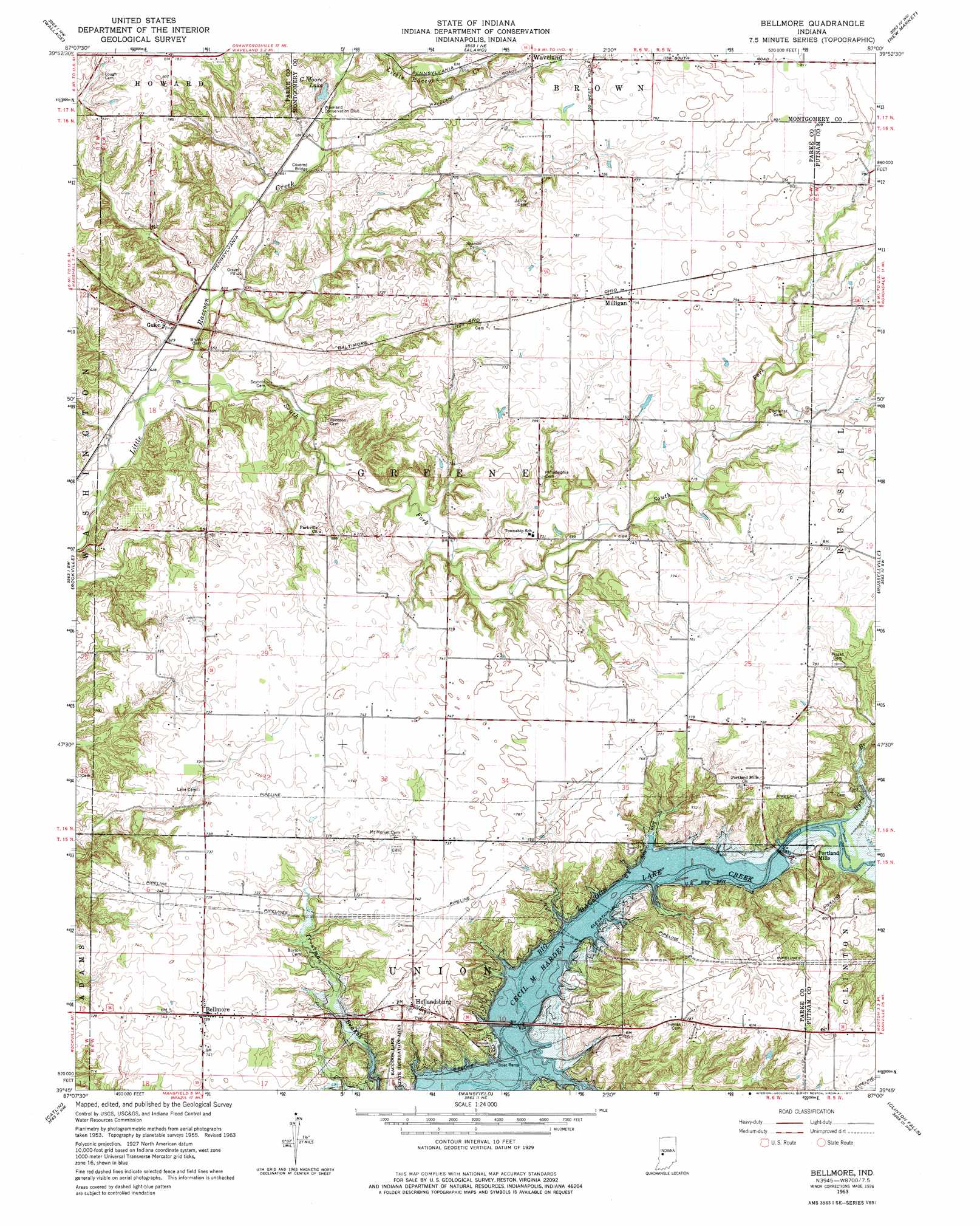
USGS Topo Quad 39087g1 - 1:24,000 scale
| Topo Map Name: | Bellmore |
| USGS Topo Quad ID: | 39087g1 |
| Print Size: | ca. 21 1/4" wide x 27" high |
| Southeast Coordinates: | 39.75° N latitude / 87° W longitude |
| Map Center Coordinates: | 39.8125° N latitude / 87.0625° W longitude |
| U.S. State: | IN |
| Filename: | o39087g1.jpg |
| Download Map JPG Image: | Bellmore topo map 1:24,000 scale |
| Map Type: | Topographic |
| Topo Series: | 7.5´ |
| Map Scale: | 1:24,000 |
| Source of Map Images: | United States Geological Survey (USGS) |
| Alternate Map Versions: |
Bellmore IN 1963, updated 1964 Download PDF Buy paper map Bellmore IN 1963, updated 1975 Download PDF Buy paper map Bellmore IN 1963, updated 1977 Download PDF Buy paper map Bellmore IN 2010 Download PDF Buy paper map Bellmore IN 2013 Download PDF Buy paper map Bellmore IN 2016 Download PDF Buy paper map |
1:24,000 Topo Quads surrounding Bellmore
Veedersburg |
Hillsboro |
Waynetown |
Crawfordsville |
Darlington |
Kingman |
Wallace |
Alamo |
New Market |
Ladoga |
Montezuma |
Rockville |
Bellmore |
Russellville |
Roachdale |
Mecca |
Catlin |
Mansfield |
Clinton Falls |
Greencastle |
Rosedale |
Brazil West |
Brazil East |
Reelsville |
Cloverdale |
> Back to 39087e1 at 1:100,000 scale
> Back to 39086a1 at 1:250,000 scale
> Back to U.S. Topo Maps home
Bellmore topo map: Gazetteer
Bellmore: Bridges
Portland Mills Bridge elevation 205m 672′Bellmore: Dams
Little Raccoon Structure Number 11 elevation 204m 669′Bellmore: Lakes
C Moore Lake elevation 200m 656′Bellmore: Populated Places
Bellmore elevation 226m 741′Guion elevation 200m 656′
Hollandsburg elevation 226m 741′
Milligan elevation 242m 793′
Parkeville elevation 211m 692′
Portland Mills elevation 223m 731′
Bellmore: Streams
Bains Branch elevation 200m 656′Byrd Branch elevation 203m 666′
Demeree Creek elevation 201m 659′
South Fork Little Raccoon Creek elevation 189m 620′
Bellmore digital topo map on disk
Buy this Bellmore topo map showing relief, roads, GPS coordinates and other geographical features, as a high-resolution digital map file on DVD:
Northern Illinois, Northern Indiana & Southwestern Michigan
Buy digital topo maps: Northern Illinois, Northern Indiana & Southwestern Michigan