Quinter Nw Topo Map Kansas
To zoom in, hover over the map of Quinter Nw
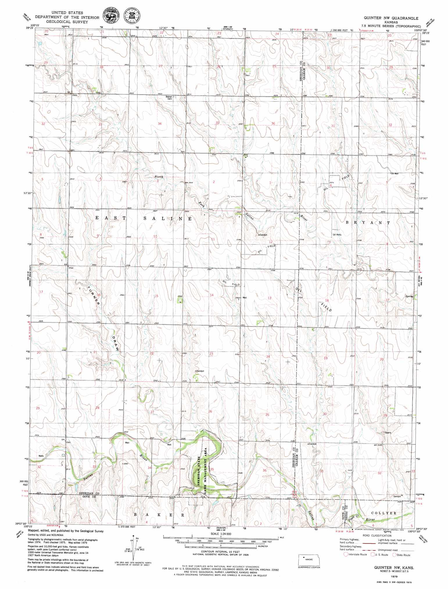
USGS Topo Quad 39100b2 - 1:24,000 scale
| Topo Map Name: | Quinter Nw |
| USGS Topo Quad ID: | 39100b2 |
| Print Size: | ca. 21 1/4" wide x 27" high |
| Southeast Coordinates: | 39.125° N latitude / 100.125° W longitude |
| Map Center Coordinates: | 39.1875° N latitude / 100.1875° W longitude |
| U.S. State: | KS |
| Filename: | o39100b2.jpg |
| Download Map JPG Image: | Quinter Nw topo map 1:24,000 scale |
| Map Type: | Topographic |
| Topo Series: | 7.5´ |
| Map Scale: | 1:24,000 |
| Source of Map Images: | United States Geological Survey (USGS) |
| Alternate Map Versions: |
Quinter NW KS 1979, updated 1979 Download PDF Buy paper map Quinter NW KS 2009 Download PDF Buy paper map Quinter NW KS 2012 Download PDF Buy paper map Quinter NW KS 2015 Download PDF Buy paper map |
1:24,000 Topo Quads surrounding Quinter Nw
Hoxie Nw |
Hoxie Ne |
Lucerne |
Morland Ne |
Hill City Nw |
Hoxie |
Tasco |
Studley |
Morland |
Penokee |
Midway Draw West |
Midway Draw East |
Quinter Nw |
Saint Peter |
Hay Hollow |
Grainfield |
Park |
Quinter |
Collyer |
Wa Keeney West |
Gove |
Gove Ne |
Castle Rock Nw |
Castle Rock Ne |
Trego Center |
> Back to 39100a1 at 1:100,000 scale
> Back to 39100a1 at 1:250,000 scale
> Back to U.S. Topo Maps home
Quinter Nw topo map: Gazetteer
Quinter Nw: Parks
Sheridan Wildlife Area elevation 751m 2463′Sheridan Wildlife Area elevation 750m 2460′
Quinter Nw: Streams
Plum Creek elevation 735m 2411′Quinter Nw: Valleys
Turner Draw elevation 751m 2463′Quinter Nw digital topo map on disk
Buy this Quinter Nw topo map showing relief, roads, GPS coordinates and other geographical features, as a high-resolution digital map file on DVD: