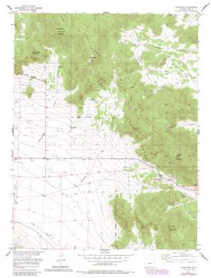
Glentivar Topo Map Colorado
To zoom in, hover over the map of Glentivar
USGS Topo Quad 39105a5 - 1:24,000 scale
| Topo Map Name: | Glentivar |
| USGS Topo Quad ID: | 39105a5 |
| Print Size: | ca. 21 1/4" wide x 27" high |
| Southeast Coordinates: | 39° N latitude / 105.5° W longitude |
| Map Center Coordinates: | 39.0625° N latitude / 105.5625° W longitude |
| U.S. State: | CO |
| Filename: | o39105a5.jpg |
| Download Map JPG Image: | Glentivar topo map 1:24,000 scale |
| Map Type: | Topographic |
| Topo Series: | 7.5´ |
| Map Scale: | 1:24,000 |
| Source of Map Images: | United States Geological Survey (USGS) |
| Alternate Map Versions: |
Glentivar CO 1956, updated 1957 Download PDF Buy paper map Glentivar CO 1956, updated 1960 Download PDF Buy paper map Glentivar CO 1956, updated 1960 Download PDF Buy paper map Glentivar CO 1956, updated 1976 Download PDF Buy paper map Glentivar CO 1956, updated 1985 Download PDF Buy paper map Glentivar CO 1994, updated 1998 Download PDF Buy paper map Glentivar CO 1994, updated 1998 Download PDF Buy paper map Glentivar CO 2011 Download PDF Buy paper map Glentivar CO 2013 Download PDF Buy paper map Glentivar CO 2016 Download PDF Buy paper map |
| FStopo: | US Forest Service topo Glentivar is available: Download FStopo PDF Download FStopo TIF |
1:24,000 Topo Quads surrounding Glentivar
> Back to 39105a1 at 1:100,000 scale
> Back to 39104a1 at 1:250,000 scale
> Back to U.S. Topo Maps home
Glentivar topo map: Gazetteer
Glentivar: Airports
Badger Mountain Heliport elevation 3413m 11197′Glentivar: Gaps
La Salle Pass elevation 2968m 9737′Wilkerson Pass elevation 2897m 9504′
Glentivar: Mines
Big Sheep Horn Claim Mine elevation 2838m 9311′Blue-green Lode Number One Mine elevation 3101m 10173′
Blue-green Lode Number Two Mine elevation 3101m 10173′
Christie-Ward-Lucky Thirteen Number One Mine elevation 3101m 10173′
Great Western Mine elevation 2904m 9527′
Meteor Mine elevation 2682m 8799′
Roger Publishing Company Mine elevation 2826m 9271′
Glentivar: Populated Places
Glentivar elevation 2703m 8868′Glentivar: Ranges
Puma Hills elevation 2781m 9124′Glentivar: Springs
Rishaberger Spring elevation 2898m 9507′Glentivar: Summits
Badger Mountain elevation 3434m 11266′Martlnad Peak elevation 3438m 11279′
Pulver Mountain elevation 3206m 10518′
Rishaberger Mountain elevation 3121m 10239′
Schoolmarm Mountain elevation 3442m 11292′
Glentivar: Valleys
Martland Gulch elevation 2647m 8684′Glentivar digital topo map on disk
Buy this Glentivar topo map showing relief, roads, GPS coordinates and other geographical features, as a high-resolution digital map file on DVD:


