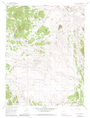
Eagle Rock Topo Map Colorado
To zoom in, hover over the map of Eagle Rock
USGS Topo Quad 39105b6 - 1:24,000 scale
| Topo Map Name: | Eagle Rock |
| USGS Topo Quad ID: | 39105b6 |
| Print Size: | ca. 21 1/4" wide x 27" high |
| Southeast Coordinates: | 39.125° N latitude / 105.625° W longitude |
| Map Center Coordinates: | 39.1875° N latitude / 105.6875° W longitude |
| U.S. State: | CO |
| Filename: | o39105b6.jpg |
| Download Map JPG Image: | Eagle Rock topo map 1:24,000 scale |
| Map Type: | Topographic |
| Topo Series: | 7.5´ |
| Map Scale: | 1:24,000 |
| Source of Map Images: | United States Geological Survey (USGS) |
| Alternate Map Versions: |
Eagle Rock CO 1956, updated 1957 Download PDF Buy paper map Eagle Rock CO 1956, updated 1957 Download PDF Buy paper map Eagle Rock CO 1956, updated 1971 Download PDF Buy paper map Eagle Rock CO 1956, updated 1971 Download PDF Buy paper map Eagle Rock CO 1956, updated 1981 Download PDF Buy paper map Eagle Rock CO 1994, updated 1998 Download PDF Buy paper map Eagle Rock CO 1994, updated 1998 Download PDF Buy paper map Eagle Rock CO 2011 Download PDF Buy paper map Eagle Rock CO 2013 Download PDF Buy paper map Eagle Rock CO 2016 Download PDF Buy paper map |
| FStopo: | US Forest Service topo Eagle Rock is available: Download FStopo PDF Download FStopo TIF |
1:24,000 Topo Quads surrounding Eagle Rock
> Back to 39105a1 at 1:100,000 scale
> Back to 39104a1 at 1:250,000 scale
> Back to U.S. Topo Maps home
Eagle Rock topo map: Gazetteer
Eagle Rock: Gaps
Windy Saddle elevation 2961m 9714′Eagle Rock: Mines
Lucky Jim One Mine elevation 2860m 9383′Lucky Jim Three Mine elevation 2860m 9383′
Lucky Jim Two Mine elevation 2860m 9383′
Eagle Rock: Pillars
Rock Point elevation 2738m 8982′Eagle Rock: Springs
Baker Spring elevation 2859m 9379′Berkey Spring elevation 2791m 9156′
Harriman Spring elevation 2795m 9169′
Inbetween Spring elevation 2799m 9183′
Willow Spring elevation 2884m 9461′
Eagle Rock: Summits
A L Hill elevation 2814m 9232′Baker Mountain elevation 2899m 9511′
Eagle Rock elevation 2939m 9642′
Eagle Rock: Valleys
A L Gulch elevation 2719m 8920′Baker Gulch elevation 2754m 9035′
Berkey Gulch elevation 2752m 9028′
Cabin Gulch elevation 2709m 8887′
Copenhaver Gulch elevation 2765m 9071′
Early Gulch elevation 2773m 9097′
Inbetween Gulch elevation 2754m 9035′
Little Baker Gulch elevation 2719m 8920′
Ruby Gulch elevation 2720m 8923′
Turner Gulch elevation 2709m 8887′
West Fork Early Gulch elevation 2806m 9206′
Eagle Rock digital topo map on disk
Buy this Eagle Rock topo map showing relief, roads, GPS coordinates and other geographical features, as a high-resolution digital map file on DVD:


