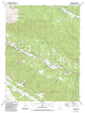
Shawnee Topo Map Colorado
To zoom in, hover over the map of Shawnee
USGS Topo Quad 39105d5 - 1:24,000 scale
| Topo Map Name: | Shawnee |
| USGS Topo Quad ID: | 39105d5 |
| Print Size: | ca. 21 1/4" wide x 27" high |
| Southeast Coordinates: | 39.375° N latitude / 105.5° W longitude |
| Map Center Coordinates: | 39.4375° N latitude / 105.5625° W longitude |
| U.S. State: | CO |
| Filename: | o39105d5.jpg |
| Download Map JPG Image: | Shawnee topo map 1:24,000 scale |
| Map Type: | Topographic |
| Topo Series: | 7.5´ |
| Map Scale: | 1:24,000 |
| Source of Map Images: | United States Geological Survey (USGS) |
| Alternate Map Versions: |
Shawnee CO 1945, updated 1957 Download PDF Buy paper map Shawnee CO 1945, updated 1972 Download PDF Buy paper map Shawnee CO 1948 Download PDF Buy paper map Shawnee CO 1987, updated 1987 Download PDF Buy paper map Shawnee CO 1987, updated 1987 Download PDF Buy paper map Shawnee CO 1994, updated 1998 Download PDF Buy paper map Shawnee CO 2011 Download PDF Buy paper map Shawnee CO 2013 Download PDF Buy paper map Shawnee CO 2016 Download PDF Buy paper map |
| FStopo: | US Forest Service topo Shawnee is available: Download FStopo PDF Download FStopo TIF |
1:24,000 Topo Quads surrounding Shawnee
> Back to 39105a1 at 1:100,000 scale
> Back to 39104a1 at 1:250,000 scale
> Back to U.S. Topo Maps home
Shawnee topo map: Gazetteer
Shawnee: Dams
Whiteford Lake Dam elevation 2454m 8051′Shawnee: Flats
Craig Park elevation 3367m 11046′Shawnee: Mines
Redskin Mines elevation 2635m 8645′Shawnee: Populated Places
Glenisle elevation 2455m 8054′Highland Park elevation 2730m 8956′
Shawnee elevation 2475m 8120′
Singleton elevation 2530m 8300′
Weller elevation 2579m 8461′
Shawnee: Ranges
Platte River Mountains elevation 3630m 11909′Shawnee: Reservoirs
Whiteford Reservoir elevation 2454m 8051′Shawnee: Streams
Payne Creek elevation 2393m 7851′Smith Creek elevation 2514m 8248′
Willow Creek elevation 2485m 8152′
Shawnee: Summits
Crooked Top Mountain elevation 3179m 10429′Derringer Peak elevation 2828m 9278′
Grouse Mountain elevation 3014m 9888′
Shawnee Peak elevation 3624m 11889′
Split Rock elevation 3006m 9862′
Shawnee: Trails
Craig Creek Trail elevation 3351m 10994′Payne Creek Trail elevation 2780m 9120′
Shawnee: Valleys
Ben Tyler Gulch elevation 2501m 8205′Bill Tyler Gulch elevation 2520m 8267′
Boxwood Gulch elevation 2498m 8195′
Brookside Gulch elevation 2413m 7916′
Foster Gulch elevation 2572m 8438′
Gibbs Gulch elevation 2479m 8133′
McArthur Gulch elevation 2429m 7969′
Payne Gulch elevation 2392m 7847′
Slaughterhouse Gulch elevation 2464m 8083′
Snaking Road Gulch elevation 2441m 8008′
Shawnee digital topo map on disk
Buy this Shawnee topo map showing relief, roads, GPS coordinates and other geographical features, as a high-resolution digital map file on DVD:


