Texas Creek Topo Map Colorado
To zoom in, hover over the map of Texas Creek
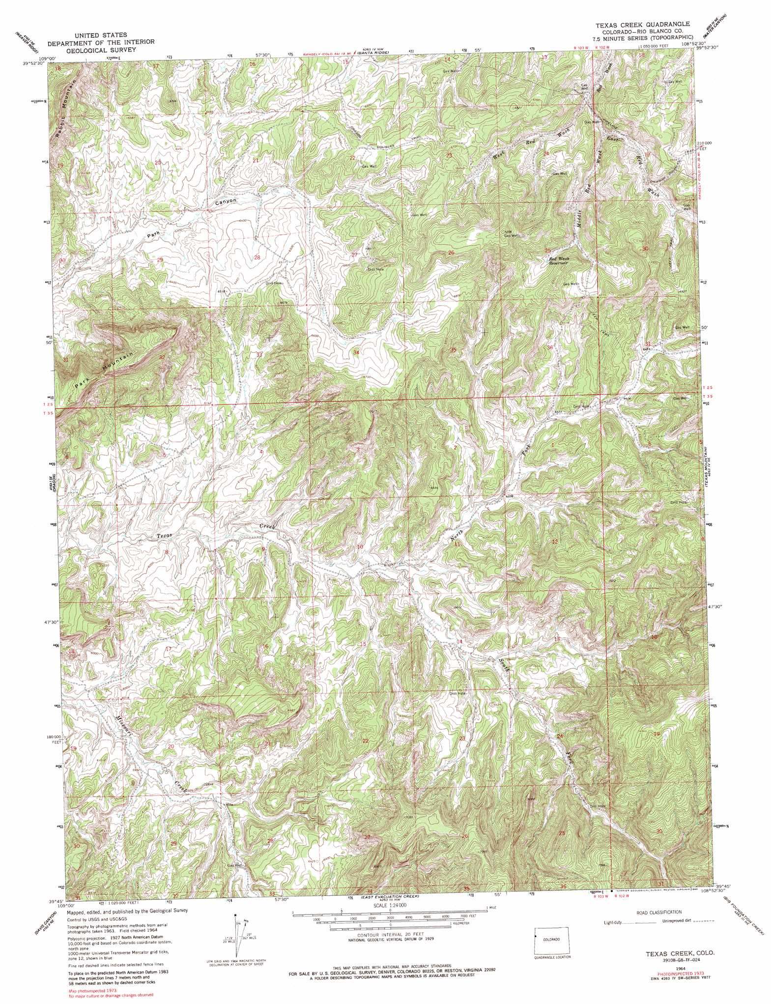
USGS Topo Quad 39108g8 - 1:24,000 scale
| Topo Map Name: | Texas Creek |
| USGS Topo Quad ID: | 39108g8 |
| Print Size: | ca. 21 1/4" wide x 27" high |
| Southeast Coordinates: | 39.75° N latitude / 108.875° W longitude |
| Map Center Coordinates: | 39.8125° N latitude / 108.9375° W longitude |
| U.S. State: | CO |
| Filename: | o39108g8.jpg |
| Download Map JPG Image: | Texas Creek topo map 1:24,000 scale |
| Map Type: | Topographic |
| Topo Series: | 7.5´ |
| Map Scale: | 1:24,000 |
| Source of Map Images: | United States Geological Survey (USGS) |
| Alternate Map Versions: |
Texas Creek CO 1964, updated 1968 Download PDF Buy paper map Texas Creek CO 1964, updated 1968 Download PDF Buy paper map Texas Creek CO 1964, updated 1986 Download PDF Buy paper map Texas Creek CO 2010 Download PDF Buy paper map Texas Creek CO 2013 Download PDF Buy paper map Texas Creek CO 2016 Download PDF Buy paper map |
1:24,000 Topo Quads surrounding Texas Creek
Bonanza |
Walsh Knolls |
Banty Point |
Rangely |
Gillam Draw |
Southam Canyon |
Weaver Ridge |
Banta Ridge |
Water Canyon |
Philadelphia Creek |
Rainbow |
Dragon |
Texas Creek |
Texas Mountain |
White Coyote Draw |
Burnt Timber Canyon |
Davis Canyon |
East Evacuation Creek |
Big Foundation Creek |
Brushy Point |
Tom Patterson Canyon |
Rat Hole Ridge |
Baxter Pass |
Douglas Pass |
Calf Canyon |
> Back to 39108e1 at 1:100,000 scale
> Back to 39108a1 at 1:250,000 scale
> Back to U.S. Topo Maps home
Texas Creek topo map: Gazetteer
Texas Creek: Reservoirs
Red Wash Reservoir elevation 2038m 6686′Texas Creek: Streams
East Red Wash elevation 1928m 6325′Middle Red Wash elevation 1948m 6391′
North Fork Texas Creek elevation 1855m 6085′
South Fork Texas Creek elevation 1855m 6085′
West Red Wash elevation 1928m 6325′
Texas Creek: Summits
Park Mountain elevation 2196m 7204′Texas Creek digital topo map on disk
Buy this Texas Creek topo map showing relief, roads, GPS coordinates and other geographical features, as a high-resolution digital map file on DVD: