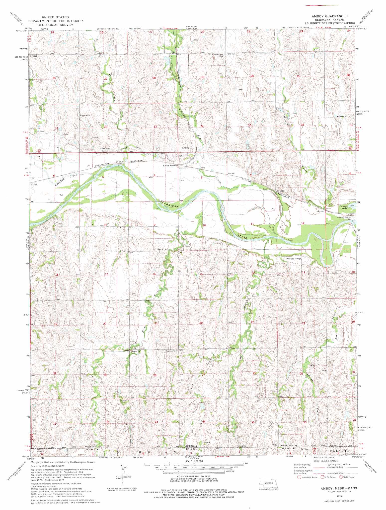
Amboy Topo Map Nebraska
To zoom in, hover over the map of Amboy
USGS Topo Quad 40098a4 - 1:24,000 scale
| Topo Map Name: | Amboy |
| USGS Topo Quad ID: | 40098a4 |
| Print Size: | ca. 21 1/4" wide x 27" high |
| Southeast Coordinates: | 40° N latitude / 98.375° W longitude |
| Map Center Coordinates: | 40.0625° N latitude / 98.4375° W longitude |
| U.S. States: | NE, KS |
| Filename: | O40098a4.jpg |
| Download Map JPG Image: | Amboy topo map 1:24,000 scale |
| Map Type: | Topographic |
| Topo Series: | 7.5´ |
| Map Scale: | 1:24,000 |
| Source of Map Images: | United States Geological Survey (USGS) |
| Alternate Map Versions: |
Amboy NE 1974, updated 1977 Download PDF Buy paper map Amboy NE 2011 Download PDF Buy paper map Amboy NE 2014 Download PDF Buy paper map |
1:24,000 Topo Quads surrounding Amboy
Campbell |
Bladen |
Blue Hill |
Lawrence |
Deweese |
Red Cloud Nw |
Red Cloud Ne |
Cowles |
Guide Rock Ne |
Mount Clare |
Inavale |
Red Cloud |
Amboy |
Guide Rock |
Bostwick |
Cora |
Mccracken Branch |
Burr Oak Nw |
Northbranch |
Mankato Nw |
Bellaire |
Lebanon |
Esbon |
Burr Oak |
Mankato |
> Back to 40098a1 at 1:100,000 scale
> Back to 40098a1 at 1:250,000 scale
> Back to U.S. Topo Maps home
Amboy topo map: Gazetteer
Amboy: Dams
Superior-Courtland Dam elevation 500m 1640′Amboy: Parks
Benjamin Wagoner Memorial Cemetery Historical Marker elevation 562m 1843′Elm Creek State Wildlife Management Area elevation 522m 1712′
Amboy: Populated Places
Amboy elevation 524m 1719′Lester Junction elevation 515m 1689′
Pawnee Village elevation 509m 1669′
Amboy: Post Offices
Amboy Post Office (historical) elevation 524m 1719′Amboy: Streams
Advent Creek elevation 529m 1735′Crooked Creek elevation 509m 1669′
Dry Creek elevation 507m 1663′
Elm Creek elevation 503m 1650′
Hicks Creek elevation 504m 1653′
Hicks Creek elevation 504m 1653′
Lost Creek elevation 503m 1650′
Lost Creek elevation 503m 1650′
Oak Creek elevation 521m 1709′
Oak Creek elevation 519m 1702′
Amboy: Summits
The Island elevation 537m 1761′Amboy digital topo map on disk
Buy this Amboy topo map showing relief, roads, GPS coordinates and other geographical features, as a high-resolution digital map file on DVD: