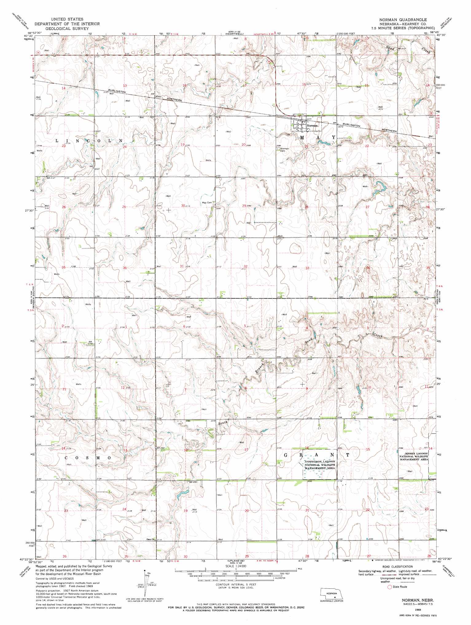
Norman Topo Map Nebraska
To zoom in, hover over the map of Norman
USGS Topo Quad 40098d7 - 1:24,000 scale
| Topo Map Name: | Norman |
| USGS Topo Quad ID: | 40098d7 |
| Print Size: | ca. 21 1/4" wide x 27" high |
| Southeast Coordinates: | 40.375° N latitude / 98.75° W longitude |
| Map Center Coordinates: | 40.4375° N latitude / 98.8125° W longitude |
| U.S. State: | NE |
| Filename: | O40098d7.jpg |
| Download Map JPG Image: | Norman topo map 1:24,000 scale |
| Map Type: | Topographic |
| Topo Series: | 7.5´ |
| Map Scale: | 1:24,000 |
| Source of Map Images: | United States Geological Survey (USGS) |
| Alternate Map Versions: |
Norman NE 1969, updated 1971 Download PDF Buy paper map Norman NE 2011 Download PDF Buy paper map Norman NE 2014 Download PDF Buy paper map |
1:24,000 Topo Quads surrounding Norman
Kearney |
Newark |
Gibbon South |
Denman |
Prosser |
Kearney Se |
Minden North |
Heartwell |
Kenesaw |
Juniata |
Axtell East |
Minden South |
Norman |
Holstein |
Roseland |
Hildreth |
Upland |
Upland Se |
Campbell |
Bladen |
Republican City Ne |
Macon |
Franklin Ne |
Red Cloud Nw |
Red Cloud Ne |
> Back to 40098a1 at 1:100,000 scale
> Back to 40098a1 at 1:250,000 scale
> Back to U.S. Topo Maps home
Norman topo map: Gazetteer
Norman: Dams
Christensen Dam elevation 639m 2096′Hieb Dam elevation 650m 2132′
Petersen Dam elevation 620m 2034′
Reiss Dam Number 1 elevation 631m 2070′
Reiss Dam Number 2 elevation 634m 2080′
Norman: Parks
Youngson Lagoon Nat Wildlife Mgt Area elevation 638m 2093′Norman: Populated Places
Norman elevation 635m 2083′Norman: Post Offices
Norman Post Office elevation 635m 2083′Osco Post Office (historical) elevation 643m 2109′
Norman: Reservoirs
Christensen Reservoir elevation 639m 2096′Hieb Reservoir elevation 650m 2132′
Petersen Reservoir elevation 620m 2034′
Reiss Reservoir Number 1 elevation 631m 2070′
Reiss Reservoir Number 2 elevation 634m 2080′
Norman: Streams
South Branch Sand Creek elevation 625m 2050′Norman digital topo map on disk
Buy this Norman topo map showing relief, roads, GPS coordinates and other geographical features, as a high-resolution digital map file on DVD: