Sedgwick Topo Map Colorado
To zoom in, hover over the map of Sedgwick
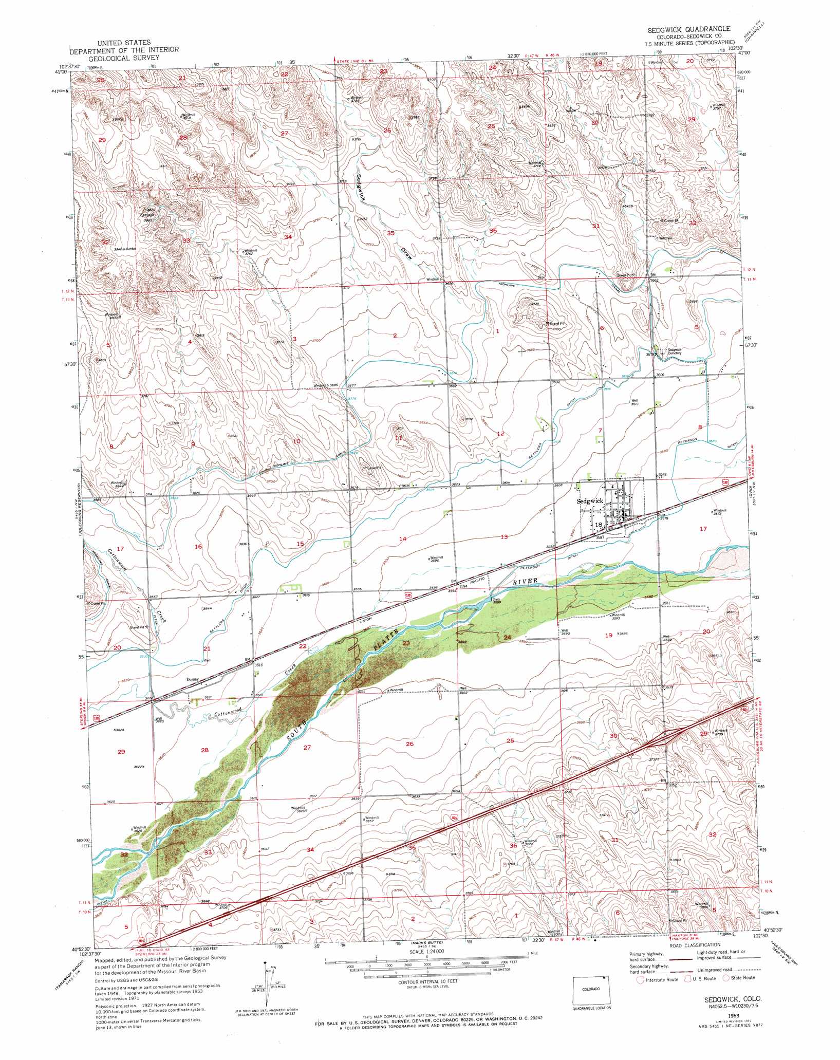
USGS Topo Quad 40102h5 - 1:24,000 scale
| Topo Map Name: | Sedgwick |
| USGS Topo Quad ID: | 40102h5 |
| Print Size: | ca. 21 1/4" wide x 27" high |
| Southeast Coordinates: | 40.875° N latitude / 102.5° W longitude |
| Map Center Coordinates: | 40.9375° N latitude / 102.5625° W longitude |
| U.S. State: | CO |
| Filename: | o40102h5.jpg |
| Download Map JPG Image: | Sedgwick topo map 1:24,000 scale |
| Map Type: | Topographic |
| Topo Series: | 7.5´ |
| Map Scale: | 1:24,000 |
| Source of Map Images: | United States Geological Survey (USGS) |
| Alternate Map Versions: |
Sedgwick CO 1953, updated 1954 Download PDF Buy paper map Sedgwick CO 1953, updated 1954 Download PDF Buy paper map Sedgwick CO 1953, updated 1972 Download PDF Buy paper map Sedgwick CO 2010 Download PDF Buy paper map Sedgwick CO 2013 Download PDF Buy paper map Sedgwick CO 2016 Download PDF Buy paper map |
1:24,000 Topo Quads surrounding Sedgwick
Sunol |
Lodgepole |
Mount Vernon |
Chappell Nw |
Chappell Ne |
Sidney Se |
Lodgepole Sw |
Lodgepole Se |
Chappell |
Chappell Se |
Twin Buttes |
Julesburg Reservoir |
Sedgwick |
Ovid |
Julesburg |
Crook |
Tamarack Ranch |
Marks Butte |
Julesburg Sw |
Julesburg Se |
Fleming |
Haxtun West |
Haxtun East |
Holyoke Nw |
Holyoke Ne |
> Back to 40102e1 at 1:100,000 scale
> Back to 40102a1 at 1:250,000 scale
> Back to U.S. Topo Maps home
Sedgwick topo map: Gazetteer
Sedgwick: Canals
Highline Canal elevation 1118m 3667′Settlers Ditch elevation 1106m 3628′
Sedgwick: Dams
Floodwater Retention Dam SS-2 elevation 1149m 3769′Sedgwick: Populated Places
Sedgwick elevation 1093m 3585′Sedgwick: Streams
Cottonwood Creek elevation 1096m 3595′Sedgwick: Valleys
Sedgwick Draw elevation 1113m 3651′Sedgwick digital topo map on disk
Buy this Sedgwick topo map showing relief, roads, GPS coordinates and other geographical features, as a high-resolution digital map file on DVD: