Limestone Hill Topo Map Colorado
To zoom in, hover over the map of Limestone Hill
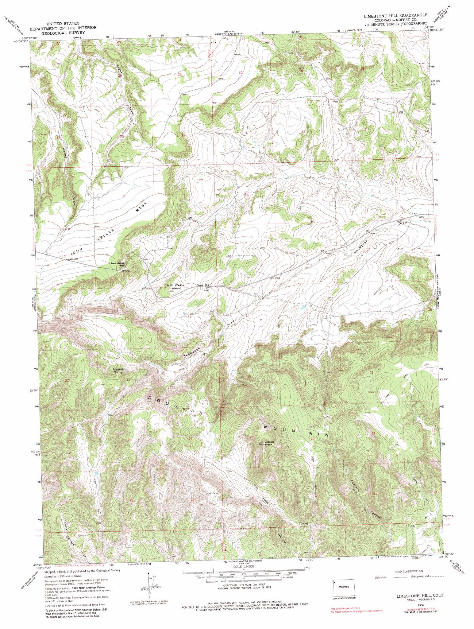
USGS Topo Quad 40108e5 - 1:24,000 scale
| Topo Map Name: | Limestone Hill |
| USGS Topo Quad ID: | 40108e5 |
| Print Size: | ca. 21 1/4" wide x 27" high |
| Southeast Coordinates: | 40.5° N latitude / 108.5° W longitude |
| Map Center Coordinates: | 40.5625° N latitude / 108.5625° W longitude |
| U.S. State: | CO |
| Filename: | o40108e5.jpg |
| Download Map JPG Image: | Limestone Hill topo map 1:24,000 scale |
| Map Type: | Topographic |
| Topo Series: | 7.5´ |
| Map Scale: | 1:24,000 |
| Source of Map Images: | United States Geological Survey (USGS) |
| Alternate Map Versions: |
Limestone Hill CO 1966, updated 1969 Download PDF Buy paper map Limestone Hill CO 1966, updated 1969 Download PDF Buy paper map Limestone Hill CO 1966, updated 1983 Download PDF Buy paper map Limestone Hill CO 2010 Download PDF Buy paper map Limestone Hill CO 2013 Download PDF Buy paper map Limestone Hill CO 2016 Download PDF Buy paper map |
1:24,000 Topo Quads surrounding Limestone Hill
Big Joe Basin |
Irish Canyon |
G Spring |
Sheepherder Springs |
Lang Spring |
Jack Springs |
Vermillion Mesa |
Sheephead Basin |
Clay Buttes |
Sevenmile Draw |
Zenobia Peak |
Greystone |
Limestone Hill |
Lone Mountain |
Peck Mesa |
Tanks Peak |
Haystack Rock |
Indian Water Canyon |
Twelvemile Mesa |
Cross Mountain Canyon |
Lazy Y Point |
Skull Creek |
M F Mountain |
Elk Springs |
Wapiti Peak |
> Back to 40108e1 at 1:100,000 scale
> Back to 40108a1 at 1:250,000 scale
> Back to U.S. Topo Maps home
Limestone Hill topo map: Gazetteer
Limestone Hill: Springs
Logging Spring elevation 2196m 7204′Limestone Hill: Summits
Allred Peak elevation 2429m 7969′Bill Weller Mesa elevation 2032m 6666′
Chase Hill elevation 1999m 6558′
John Weller Mesa elevation 2106m 6909′
Limestone Hill elevation 2085m 6840′
Limestone Hill digital topo map on disk
Buy this Limestone Hill topo map showing relief, roads, GPS coordinates and other geographical features, as a high-resolution digital map file on DVD: