Sheephead Basin Topo Map Colorado
To zoom in, hover over the map of Sheephead Basin
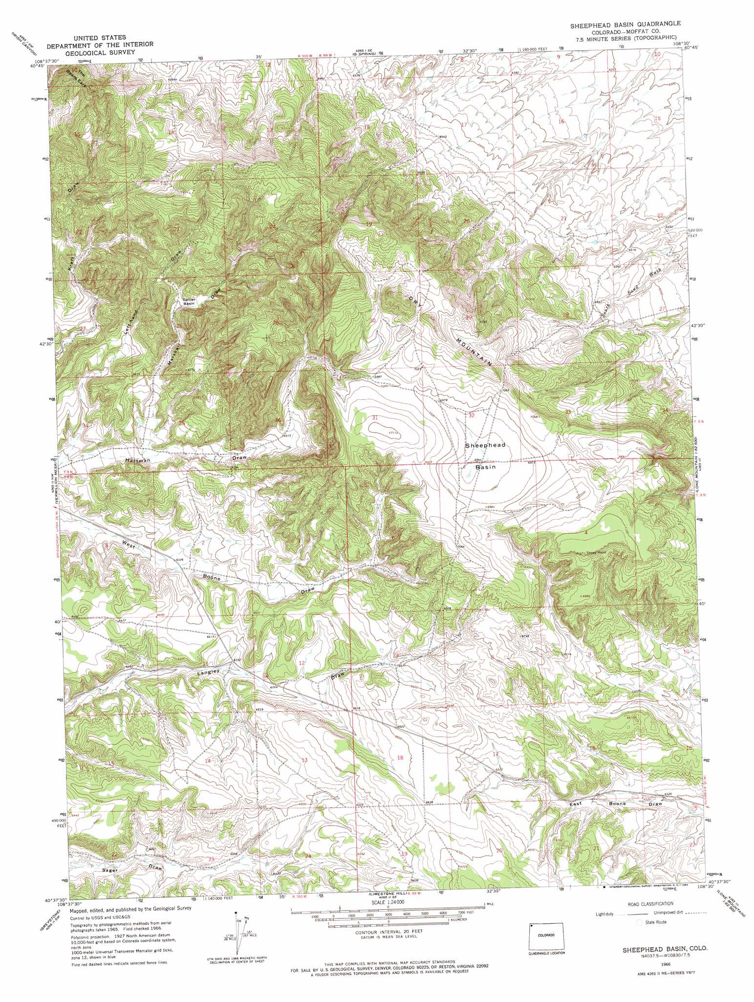
USGS Topo Quad 40108f5 - 1:24,000 scale
| Topo Map Name: | Sheephead Basin |
| USGS Topo Quad ID: | 40108f5 |
| Print Size: | ca. 21 1/4" wide x 27" high |
| Southeast Coordinates: | 40.625° N latitude / 108.5° W longitude |
| Map Center Coordinates: | 40.6875° N latitude / 108.5625° W longitude |
| U.S. State: | CO |
| Filename: | o40108f5.jpg |
| Download Map JPG Image: | Sheephead Basin topo map 1:24,000 scale |
| Map Type: | Topographic |
| Topo Series: | 7.5´ |
| Map Scale: | 1:24,000 |
| Source of Map Images: | United States Geological Survey (USGS) |
| Alternate Map Versions: |
Sheephead Basin CO 1966, updated 1969 Download PDF Buy paper map Sheephead Basin CO 2010 Download PDF Buy paper map Sheephead Basin CO 2013 Download PDF Buy paper map Sheephead Basin CO 2016 Download PDF Buy paper map |
1:24,000 Topo Quads surrounding Sheephead Basin
Sparks |
Sugarloaf Butte |
Hiawatha |
Coffee Pot Spring |
Powder Wash |
Big Joe Basin |
Irish Canyon |
G Spring |
Sheepherder Springs |
Lang Spring |
Jack Springs |
Vermillion Mesa |
Sheephead Basin |
Clay Buttes |
Sevenmile Draw |
Zenobia Peak |
Greystone |
Limestone Hill |
Lone Mountain |
Peck Mesa |
Tanks Peak |
Haystack Rock |
Indian Water Canyon |
Twelvemile Mesa |
Cross Mountain Canyon |
> Back to 40108e1 at 1:100,000 scale
> Back to 40108a1 at 1:250,000 scale
> Back to U.S. Topo Maps home
Sheephead Basin topo map: Gazetteer
Sheephead Basin: Basins
Sheephead Basin elevation 2117m 6945′Spicer Basin elevation 2054m 6738′
Sheephead Basin: Summits
Dry Mountain elevation 2238m 7342′The Bears Ears elevation 2239m 7345′
Sheephead Basin: Valleys
Hammond Draw elevation 1937m 6354′Marshall Draw elevation 1957m 6420′
Sheephead Basin digital topo map on disk
Buy this Sheephead Basin topo map showing relief, roads, GPS coordinates and other geographical features, as a high-resolution digital map file on DVD: