Wildcat Mountain Topo Map Utah
To zoom in, hover over the map of Wildcat Mountain
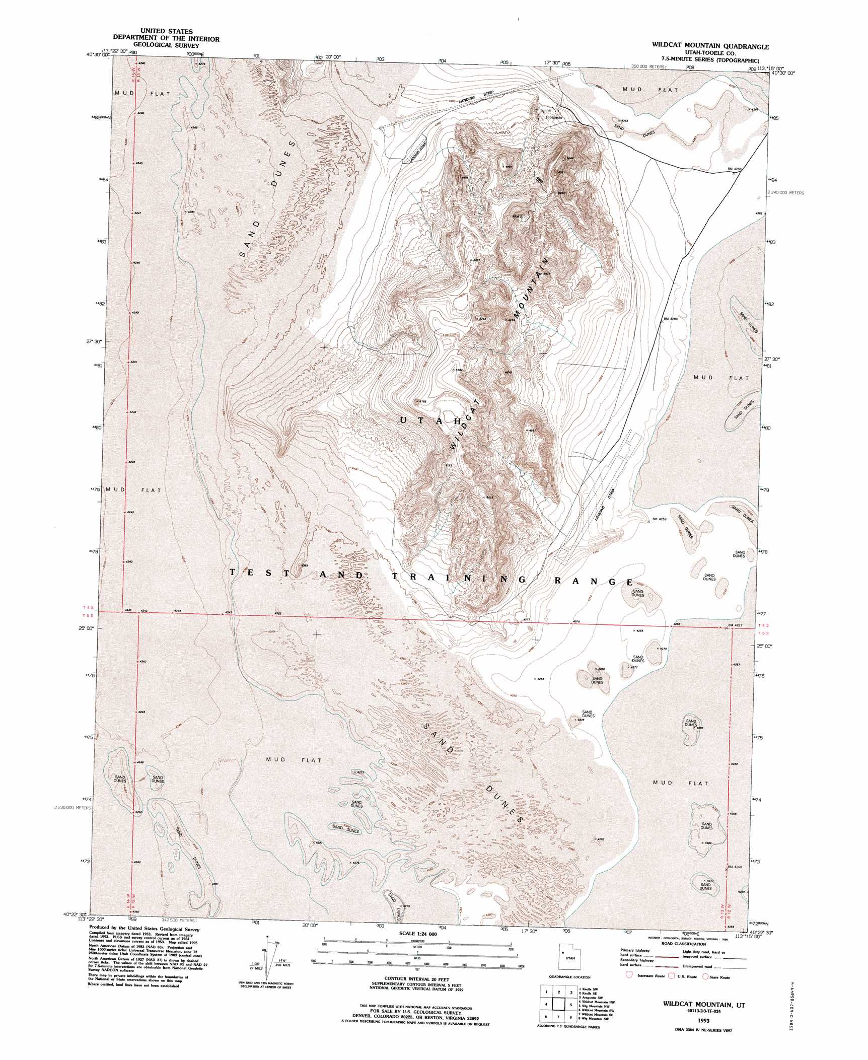
USGS Topo Quad 40113d3 - 1:24,000 scale
| Topo Map Name: | Wildcat Mountain |
| USGS Topo Quad ID: | 40113d3 |
| Print Size: | ca. 21 1/4" wide x 27" high |
| Southeast Coordinates: | 40.375° N latitude / 113.25° W longitude |
| Map Center Coordinates: | 40.4375° N latitude / 113.3125° W longitude |
| U.S. State: | UT |
| Filename: | o40113d3.jpg |
| Download Map JPG Image: | Wildcat Mountain topo map 1:24,000 scale |
| Map Type: | Topographic |
| Topo Series: | 7.5´ |
| Map Scale: | 1:24,000 |
| Source of Map Images: | United States Geological Survey (USGS) |
| Alternate Map Versions: |
Wildcat Mtn UT 1954, updated 1956 Download PDF Buy paper map Wildcat Mtn UT 1954, updated 1979 Download PDF Buy paper map Wildcat Mtn UT 1954, updated 1984 Download PDF Buy paper map Wildcat Mountain UT 1954, updated 1994 Download PDF Buy paper map Wildcat Mountain UT 1993, updated 1996 Download PDF Buy paper map Wildcat Mountain UT 2010 Download PDF Buy paper map Wildcat Mountain UT 2014 Download PDF Buy paper map |
1:24,000 Topo Quads surrounding Wildcat Mountain
Arinosa Ne |
Barro |
Knolls |
Aragonite Nw |
Aragonite |
Arinosa Se |
Knolls Sw |
Knolls Se |
Aragonite Sw |
Aragonite Se |
Gold Hill 1 Ne |
Wildcat Mountain Nw |
Wildcat Mountain |
Wig Mountain Nw |
Wig Mountain Ne |
Gold Hill 1 Se |
Wildcat Mountain Sw |
Wildcat Mountain Se |
Wig Mountain Sw |
Wig Mountain |
Gold Hill 4 Ne |
Granite Peak Nw |
Granite Peak |
Dugway Proving Ground Nw |
Dugway Proving Ground Ne |
> Back to 40113a1 at 1:100,000 scale
> Back to 40112a1 at 1:250,000 scale
> Back to U.S. Topo Maps home
Wildcat Mountain topo map: Gazetteer
Wildcat Mountain: Areas
Wildcat Dunes elevation 1327m 4353′Wildcat Mountain: Summits
Wildcat Mountain elevation 1594m 5229′Wildcat Mountain digital topo map on disk
Buy this Wildcat Mountain topo map showing relief, roads, GPS coordinates and other geographical features, as a high-resolution digital map file on DVD: