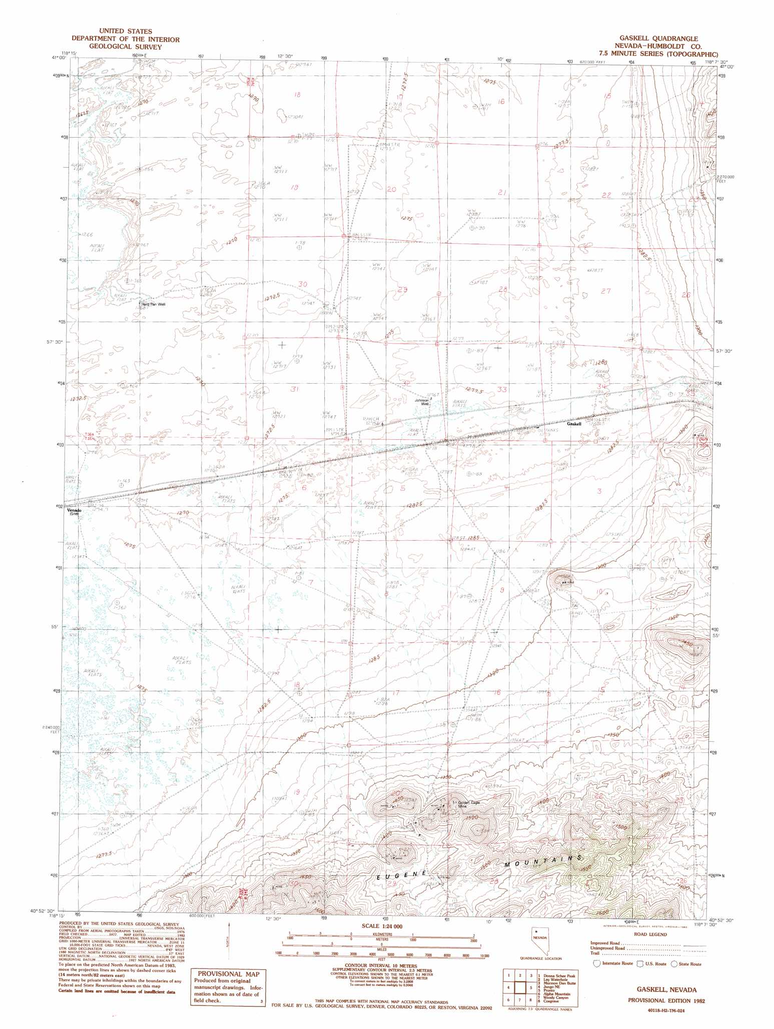
Gaskell Topo Map Nevada
To zoom in, hover over the map of Gaskell
USGS Topo Quad 40118h2 - 1:24,000 scale
| Topo Map Name: | Gaskell |
| USGS Topo Quad ID: | 40118h2 |
| Print Size: | ca. 21 1/4" wide x 27" high |
| Southeast Coordinates: | 40.875° N latitude / 118.125° W longitude |
| Map Center Coordinates: | 40.9375° N latitude / 118.1875° W longitude |
| U.S. State: | NV |
| Filename: | o40118h2.jpg |
| Download Map JPG Image: | Gaskell topo map 1:24,000 scale |
| Map Type: | Topographic |
| Topo Series: | 7.5´ |
| Map Scale: | 1:24,000 |
| Source of Map Images: | United States Geological Survey (USGS) |
| Alternate Map Versions: |
Gaskell NV 1982, updated 1982 Download PDF Buy paper map Gaskell NV 2011 Download PDF Buy paper map Gaskell NV 2014 Download PDF Buy paper map |
1:24,000 Topo Quads surrounding Gaskell
Schoolhouse Butte |
Dry Hills |
Presnel Well |
Sombrero Peak |
Silver State Draw |
Donna Schee Spring |
Donna Schee Peak |
Lay Waterhole |
Mormon Dan Butte |
Barrett Springs |
Jungo |
Jungo Ne |
Gaskell |
Pronto |
Rose Creek |
Long Canyon |
Alpha Mountain |
Woody Canyon |
Cosgrave |
Dun Glen Peak |
Majuba Mountain |
Rye Patch Res North |
Imlay |
Mill City |
Dun Glen |
> Back to 40118e1 at 1:100,000 scale
> Back to 40118a1 at 1:250,000 scale
> Back to U.S. Topo Maps home
Gaskell topo map: Gazetteer
Gaskell: Mines
Golden Eagle Mine elevation 1450m 4757′King Midas Mine elevation 1442m 4730′
Monitor Mine elevation 1453m 4767′
Yellow Jacket Mine elevation 1449m 4753′
Gaskell: Wells
Hard Pan Well elevation 1269m 4163′Johnson Well elevation 1277m 4189′
Gaskell digital topo map on disk
Buy this Gaskell topo map showing relief, roads, GPS coordinates and other geographical features, as a high-resolution digital map file on DVD: