Ravenna Nw Topo Map Nebraska
To zoom in, hover over the map of Ravenna Nw
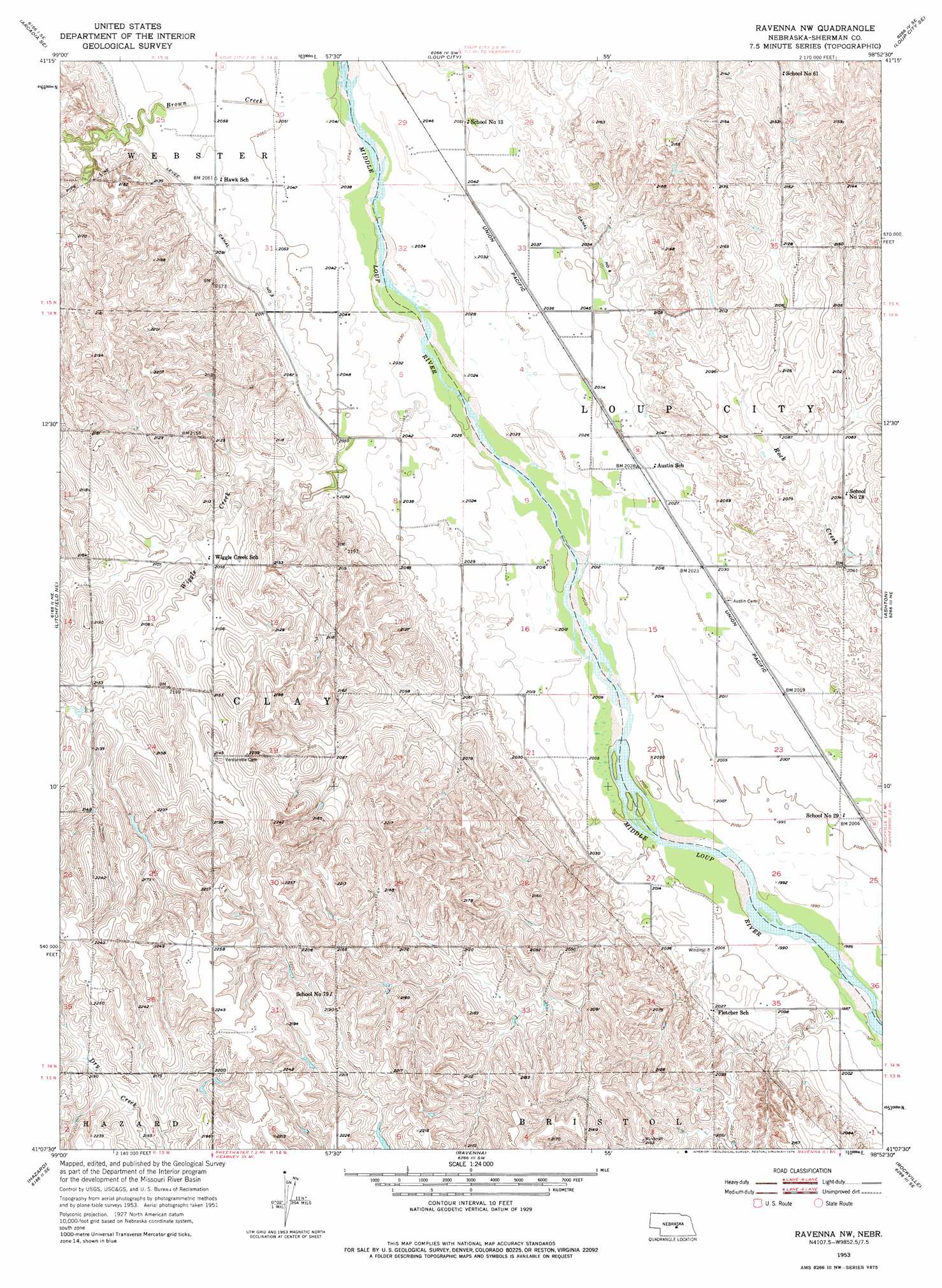
USGS Topo Quad 41098b8 - 1:24,000 scale
| Topo Map Name: | Ravenna Nw |
| USGS Topo Quad ID: | 41098b8 |
| Print Size: | ca. 21 1/4" wide x 27" high |
| Southeast Coordinates: | 41.125° N latitude / 98.875° W longitude |
| Map Center Coordinates: | 41.1875° N latitude / 98.9375° W longitude |
| U.S. State: | NE |
| Filename: | O41098B8.jpg |
| Download Map JPG Image: | Ravenna Nw topo map 1:24,000 scale |
| Map Type: | Topographic |
| Topo Series: | 7.5´ |
| Map Scale: | 1:24,000 |
| Source of Map Images: | United States Geological Survey (USGS) |
| Alternate Map Versions: |
Ravenna NW NE 1953, updated 1955 Download PDF Buy paper map Ravenna NW NE 1953, updated 1976 Download PDF Buy paper map Ravenna NW NE 2011 Download PDF Buy paper map Ravenna NW NE 2014 Download PDF Buy paper map |
1:24,000 Topo Quads surrounding Ravenna Nw
Arcadia West |
Arcadia East |
Loup City Nw |
North Loup |
Scotia |
Arcadia Sw |
Arcadia Se |
Loup City |
Loup City Se |
Cotesfield |
Litchfield |
Litchfield Ne |
Ravenna Nw |
Ashton |
Farwell |
Litchfield Sw |
Hazard |
Ravenna |
Rockville |
Boelus |
Pleasanton Nw |
Pleasanton |
Poole |
Poole Ne |
Cameron |
> Back to 41098a1 at 1:100,000 scale
> Back to 41098a1 at 1:250,000 scale
> Back to U.S. Topo Maps home
Ravenna Nw topo map: Gazetteer
Ravenna Nw: Post Offices
Austin Post Office (historical) elevation 618m 2027′Ravenna Nw: Streams
Brown Creek elevation 622m 2040′Wiggle Creek elevation 616m 2020′
Ravenna Nw digital topo map on disk
Buy this Ravenna Nw topo map showing relief, roads, GPS coordinates and other geographical features, as a high-resolution digital map file on DVD: