P O Ranch Topo Map Wyoming
To zoom in, hover over the map of P O Ranch
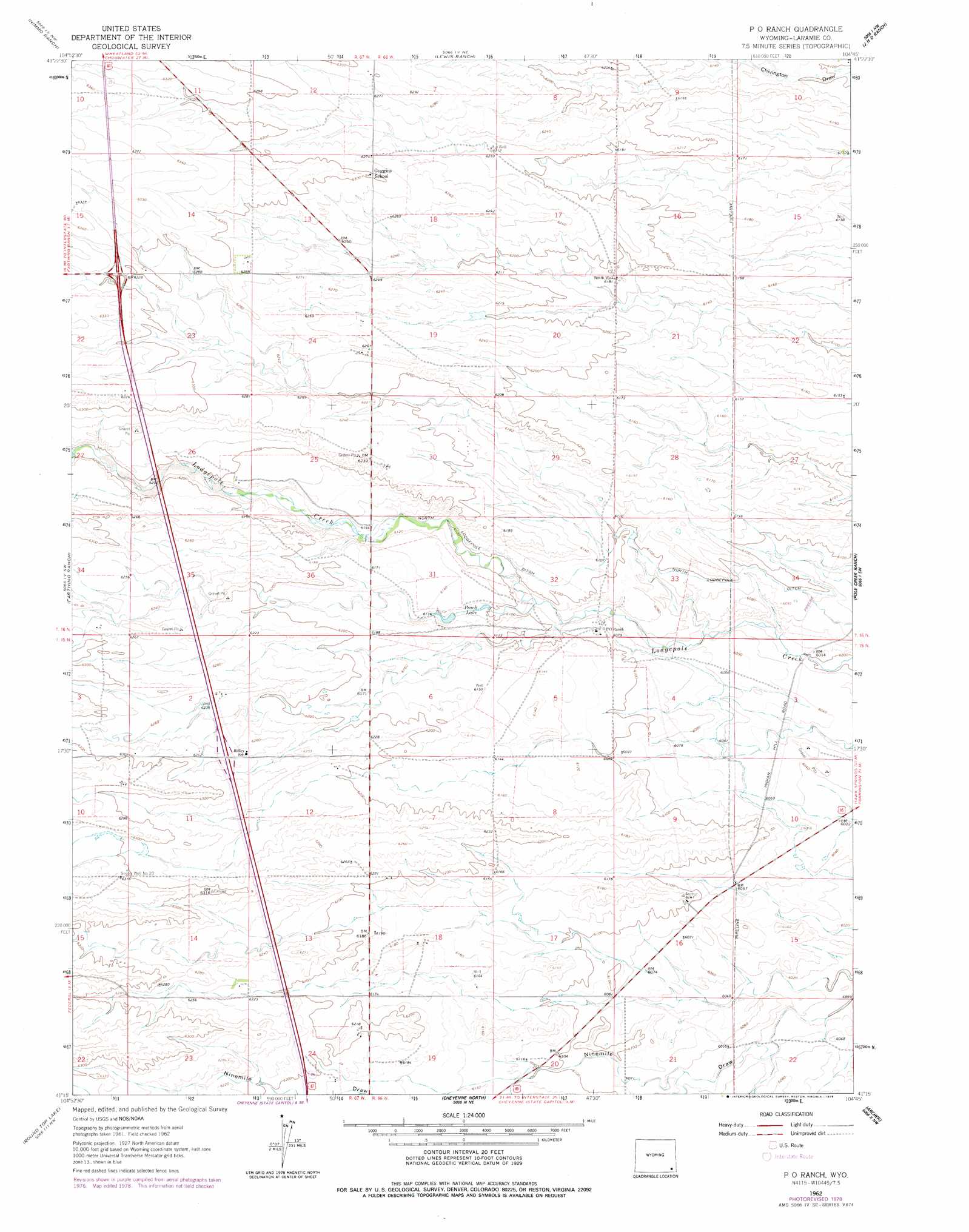
USGS Topo Quad 41104c7 - 1:24,000 scale
| Topo Map Name: | P O Ranch |
| USGS Topo Quad ID: | 41104c7 |
| Print Size: | ca. 21 1/4" wide x 27" high |
| Southeast Coordinates: | 41.25° N latitude / 104.75° W longitude |
| Map Center Coordinates: | 41.3125° N latitude / 104.8125° W longitude |
| U.S. State: | WY |
| Filename: | o41104c7.jpg |
| Download Map JPG Image: | P O Ranch topo map 1:24,000 scale |
| Map Type: | Topographic |
| Topo Series: | 7.5´ |
| Map Scale: | 1:24,000 |
| Source of Map Images: | United States Geological Survey (USGS) |
| Alternate Map Versions: |
P O Ranch WY 1962, updated 1964 Download PDF Buy paper map P O Ranch WY 1962, updated 1978 Download PDF Buy paper map P O Ranch WY 2012 Download PDF Buy paper map P O Ranch WY 2015 Download PDF Buy paper map |
1:24,000 Topo Quads surrounding P O Ranch
Hirsig Ranch |
Bristol Ridge |
Moffett Ranch |
Indian Hill |
Cattail Ranch |
Dereemer Ranch |
Nimmo Ranch |
Lewis Ranch |
J H D Ranch |
Little Indian Draw |
Federal |
Farthing Ranch |
P O Ranch |
Pole Creek Ranch |
Pole Creek Ranch Se |
Silver Crown |
Round Top Lake |
Cheyenne North |
Archer |
Durham |
Emkay |
Borie |
Cheyenne South |
Altvan |
Campstool |
> Back to 41104a1 at 1:100,000 scale
> Back to 41104a1 at 1:250,000 scale
> Back to U.S. Topo Maps home
P O Ranch topo map: Gazetteer
P O Ranch: Canals
North Lodgepole Ditch elevation 1860m 6102′P O Ranch: Reservoirs
Peach Lake elevation 1864m 6115′P O Ranch: Wells
North Well elevation 1886m 6187′Snyder Well Number 20 elevation 1926m 6318′
P O Ranch digital topo map on disk
Buy this P O Ranch topo map showing relief, roads, GPS coordinates and other geographical features, as a high-resolution digital map file on DVD:
Eastern Wyoming & Western South Dakota
Buy digital topo maps: Eastern Wyoming & Western South Dakota