Red Creek Ranch Topo Map Wyoming
To zoom in, hover over the map of Red Creek Ranch
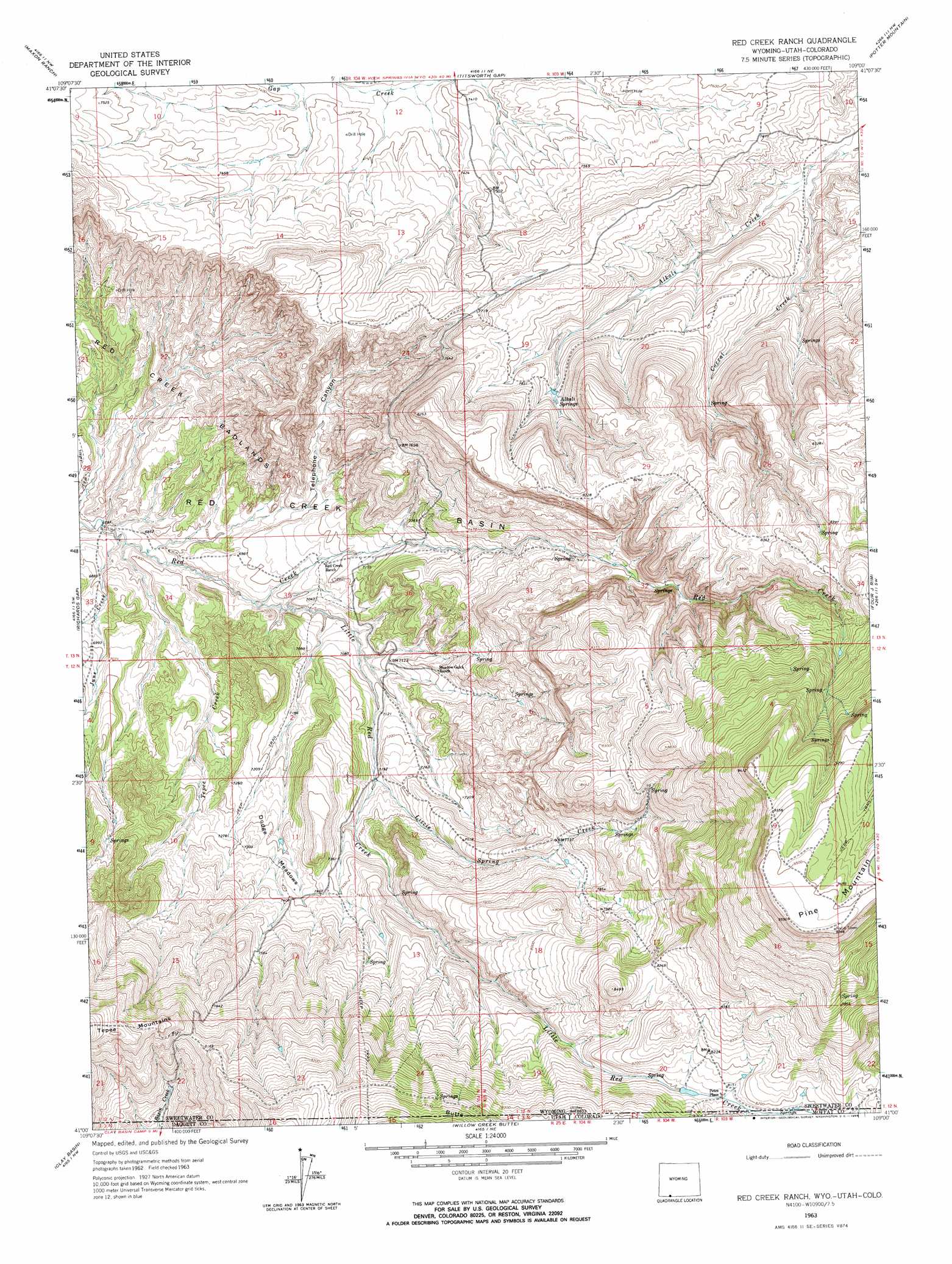
USGS Topo Quad 41109a1 - 1:24,000 scale
| Topo Map Name: | Red Creek Ranch |
| USGS Topo Quad ID: | 41109a1 |
| Print Size: | ca. 21 1/4" wide x 27" high |
| Southeast Coordinates: | 41° N latitude / 109° W longitude |
| Map Center Coordinates: | 41.0625° N latitude / 109.0625° W longitude |
| U.S. States: | WY, CO, UT |
| Filename: | o41109a1.jpg |
| Download Map JPG Image: | Red Creek Ranch topo map 1:24,000 scale |
| Map Type: | Topographic |
| Topo Series: | 7.5´ |
| Map Scale: | 1:24,000 |
| Source of Map Images: | United States Geological Survey (USGS) |
| Alternate Map Versions: |
Red Creek Ranch WY 1963, updated 1966 Download PDF Buy paper map Red Creek Ranch WY 1963, updated 1966 Download PDF Buy paper map Red Creek Ranch WY 2011 Download PDF Buy paper map Red Creek Ranch WY 2012 Download PDF Buy paper map Red Creek Ranch WY 2015 Download PDF Buy paper map |
1:24,000 Topo Quads surrounding Red Creek Ranch
Firehole Basin |
Earnest Butte |
South Baxter |
Mud Springs Ranch |
Burley Draw |
Big Ridge |
Maxon Ranch |
Titsworth Gap |
Potter Mountain |
Erickson-Kent Ranch |
Hawks Nest |
Richards Gap |
Red Creek Ranch |
Four J Rim |
Scrivner Butte |
Goslin Mountain |
Clay Basin |
Willow Creek Butte |
Beaver Basin |
Sparks |
Jackson Draw |
Warren Draw |
Swallow Canyon |
Lodore School |
Big Joe Basin |
> Back to 41109a1 at 1:100,000 scale
> Back to 41108a1 at 1:250,000 scale
> Back to U.S. Topo Maps home
Red Creek Ranch topo map: Gazetteer
Red Creek Ranch: Dams
John Erickson Dam elevation 2502m 8208′Red Creek Ranch: Flats
Dodge Meadows elevation 2228m 7309′Red Creek Ranch: Mines
Star Numbers Five and Six Mine elevation 2197m 7208′Red Creek Ranch: Populated Places
Petes Place elevation 2480m 8136′Red Creek Ranch: Reservoirs
John Erickson Reservoir elevation 2502m 8208′Red Creek Ranch: Springs
Alkali Springs elevation 2368m 7769′Red Creek Ranch: Streams
Basin Creek elevation 2325m 7627′Basin Creek elevation 2325m 7627′
Corral Creek elevation 2259m 7411′
June Creek elevation 2073m 6801′
Little Red Creek elevation 2109m 6919′
Lizzie Spring Creek elevation 2192m 7191′
Tepee Creek elevation 2077m 6814′
Red Creek Ranch: Valleys
Telephone Canyon elevation 2137m 7011′Red Creek Ranch digital topo map on disk
Buy this Red Creek Ranch topo map showing relief, roads, GPS coordinates and other geographical features, as a high-resolution digital map file on DVD: