Grant City Topo Map Iowa
To zoom in, hover over the map of Grant City
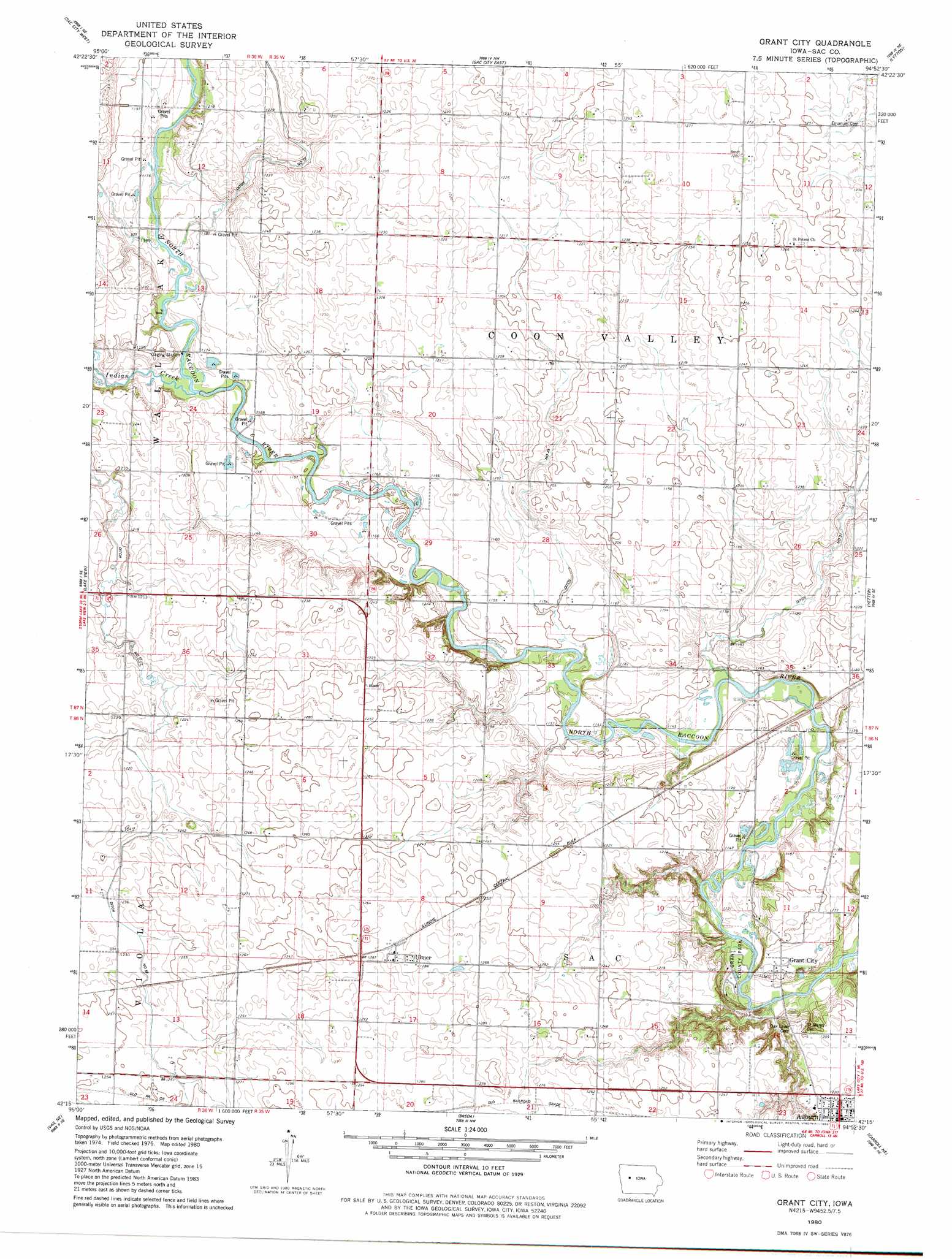
USGS Topo Quad 42094c8 - 1:24,000 scale
| Topo Map Name: | Grant City |
| USGS Topo Quad ID: | 42094c8 |
| Print Size: | ca. 21 1/4" wide x 27" high |
| Southeast Coordinates: | 42.25° N latitude / 94.875° W longitude |
| Map Center Coordinates: | 42.3125° N latitude / 94.9375° W longitude |
| U.S. State: | IA |
| Filename: | o42094c8.jpg |
| Download Map JPG Image: | Grant City topo map 1:24,000 scale |
| Map Type: | Topographic |
| Topo Series: | 7.5´ |
| Map Scale: | 1:24,000 |
| Source of Map Images: | United States Geological Survey (USGS) |
| Alternate Map Versions: |
Grant City IA 1980, updated 1980 Download PDF Buy paper map Grant City IA 2010 Download PDF Buy paper map Grant City IA 2013 Download PDF Buy paper map Grant City IA 2015 Download PDF Buy paper map |
1:24,000 Topo Quads surrounding Grant City
Lakeside |
Newell West |
Newell East |
Fonda |
Pomeroy |
Early |
Sac City West |
Sac City East |
Lytton |
Rockwell City |
Odebolt East |
Lake View |
Grant City |
Yetter |
Lake City |
Boyer |
Vail Ne |
Breda |
Carroll Ne |
Lanesboro |
Vail |
Arcadia |
Carroll West |
Carroll East |
Glidden |
> Back to 42094a1 at 1:100,000 scale
> Back to 42094a1 at 1:250,000 scale
> Back to U.S. Topo Maps home
Grant City topo map: Gazetteer
Grant City: Areas
Whitehorse Access Public Hunting Area elevation 359m 1177′Grant City: Canals
Drainage Ditch 25 elevation 361m 1184′Drainage Ditch 31 elevation 358m 1174′
Drainage Ditch 57 elevation 372m 1220′
Drainage Ditch 73 elevation 367m 1204′
Grant City: Parks
Almer Noyd Wildlife Area elevation 345m 1131′Grant County Park elevation 341m 1118′
Jana Recreation Area elevation 353m 1158′
Grant City: Populated Places
Auburn elevation 373m 1223′Grant City elevation 353m 1158′
Hart elevation 381m 1250′
Pettis elevation 376m 1233′
Ulmer elevation 390m 1279′
Grant City: Post Offices
Auburn Post Office elevation 374m 1227′Coon Valley Post Office (historical) elevation 367m 1204′
Grant City Post Office (historical) elevation 353m 1158′
Pettis Post Office (historical) elevation 373m 1223′
Ulmer Post Office (historical) elevation 390m 1279′
Grant City: Streams
Indian Creek elevation 351m 1151′Grant City digital topo map on disk
Buy this Grant City topo map showing relief, roads, GPS coordinates and other geographical features, as a high-resolution digital map file on DVD: