Vail Ne Topo Map Iowa
To zoom in, hover over the map of Vail Ne
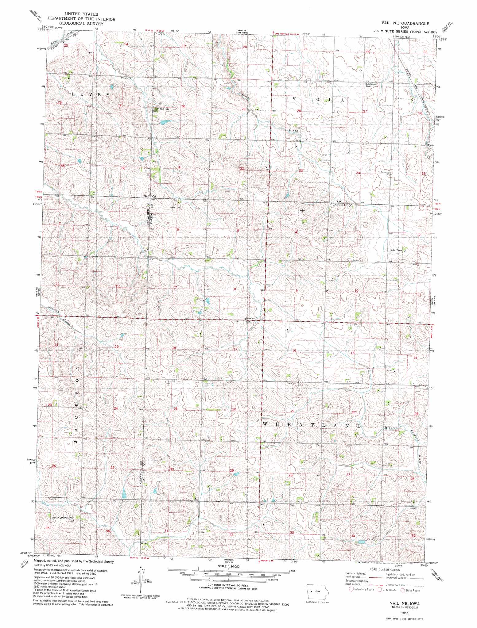
USGS Topo Quad 42095b1 - 1:24,000 scale
| Topo Map Name: | Vail Ne |
| USGS Topo Quad ID: | 42095b1 |
| Print Size: | ca. 21 1/4" wide x 27" high |
| Southeast Coordinates: | 42.125° N latitude / 95° W longitude |
| Map Center Coordinates: | 42.1875° N latitude / 95.0625° W longitude |
| U.S. State: | IA |
| Filename: | o42095b1.jpg |
| Download Map JPG Image: | Vail Ne topo map 1:24,000 scale |
| Map Type: | Topographic |
| Topo Series: | 7.5´ |
| Map Scale: | 1:24,000 |
| Source of Map Images: | United States Geological Survey (USGS) |
| Alternate Map Versions: |
Vail NE IA 1980, updated 1980 Download PDF Buy paper map Vail NE IA 2010 Download PDF Buy paper map Vail NE IA 2013 Download PDF Buy paper map Vail NE IA 2015 Download PDF Buy paper map |
1:24,000 Topo Quads surrounding Vail Ne
Schaller South |
Early |
Sac City West |
Sac City East |
Lytton |
Odebolt West |
Odebolt East |
Lake View |
Grant City |
Yetter |
Kiron |
Boyer |
Vail Ne |
Breda |
Carroll Ne |
Denison |
Vail |
Arcadia |
Carroll West |
Carroll East |
Earling Ne |
Manilla |
Manning |
Templeton |
Dedham |
> Back to 42095a1 at 1:100,000 scale
> Back to 42094a1 at 1:250,000 scale
> Back to U.S. Topo Maps home
Vail Ne topo map: Gazetteer
Vail Ne: Airports
Lawler Landing Strip elevation 429m 1407′Wall Lake Municipal Airport elevation 391m 1282′
Vail Ne: Canals
Wall Lake Inlet elevation 388m 1272′Vail Ne digital topo map on disk
Buy this Vail Ne topo map showing relief, roads, GPS coordinates and other geographical features, as a high-resolution digital map file on DVD: