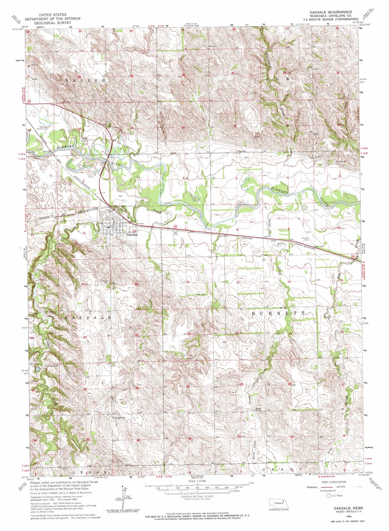
Oakdale Topo Map Nebraska
To zoom in, hover over the map of Oakdale
USGS Topo Quad 42097a8 - 1:24,000 scale
| Topo Map Name: | Oakdale |
| USGS Topo Quad ID: | 42097a8 |
| Print Size: | ca. 21 1/4" wide x 27" high |
| Southeast Coordinates: | 42° N latitude / 97.875° W longitude |
| Map Center Coordinates: | 42.0625° N latitude / 97.9375° W longitude |
| U.S. State: | NE |
| Filename: | O42097A8.jpg |
| Download Map JPG Image: | Oakdale topo map 1:24,000 scale |
| Map Type: | Topographic |
| Topo Series: | 7.5´ |
| Map Scale: | 1:24,000 |
| Source of Map Images: | United States Geological Survey (USGS) |
| Alternate Map Versions: |
Oakdale NE 1963, updated 1964 Download PDF Buy paper map Oakdale NE 2011 Download PDF Buy paper map Oakdale NE 2014 Download PDF Buy paper map |
1:24,000 Topo Quads surrounding Oakdale
Orchard |
Royal |
Brunswick |
Plainview |
Foster |
Clearwater |
Neligh |
Tilden Nw |
Tilden Ne |
Pierce Nw |
Neligh Sw |
Neligh Se |
Oakdale |
Tilden |
Meadow Grove |
Elgin Nw |
Elgin |
Closter |
Closter Ne |
Emerick |
Elgin Sw |
Petersburg |
Closter Sw |
Closter Se |
Battle Creek Sw |
> Back to 42097a1 at 1:100,000 scale
> Back to 42096a1 at 1:250,000 scale
> Back to U.S. Topo Maps home
Oakdale topo map: Gazetteer
Oakdale: Dams
Mitchell-Brandt Dam elevation 542m 1778′Oakdale: Parks
Oakdale City Park elevation 522m 1712′Oakdale: Populated Places
Oakdale elevation 523m 1715′Oakdale: Post Offices
Oakdale Post Office elevation 523m 1715′Oakdale: Reservoirs
Mitchell-Brandt Reservoir elevation 542m 1778′Oakdale: Streams
Cedar Creek elevation 515m 1689′Saint Clair Creek elevation 509m 1669′
Trueblood Creek elevation 509m 1669′
Oakdale digital topo map on disk
Buy this Oakdale topo map showing relief, roads, GPS coordinates and other geographical features, as a high-resolution digital map file on DVD: