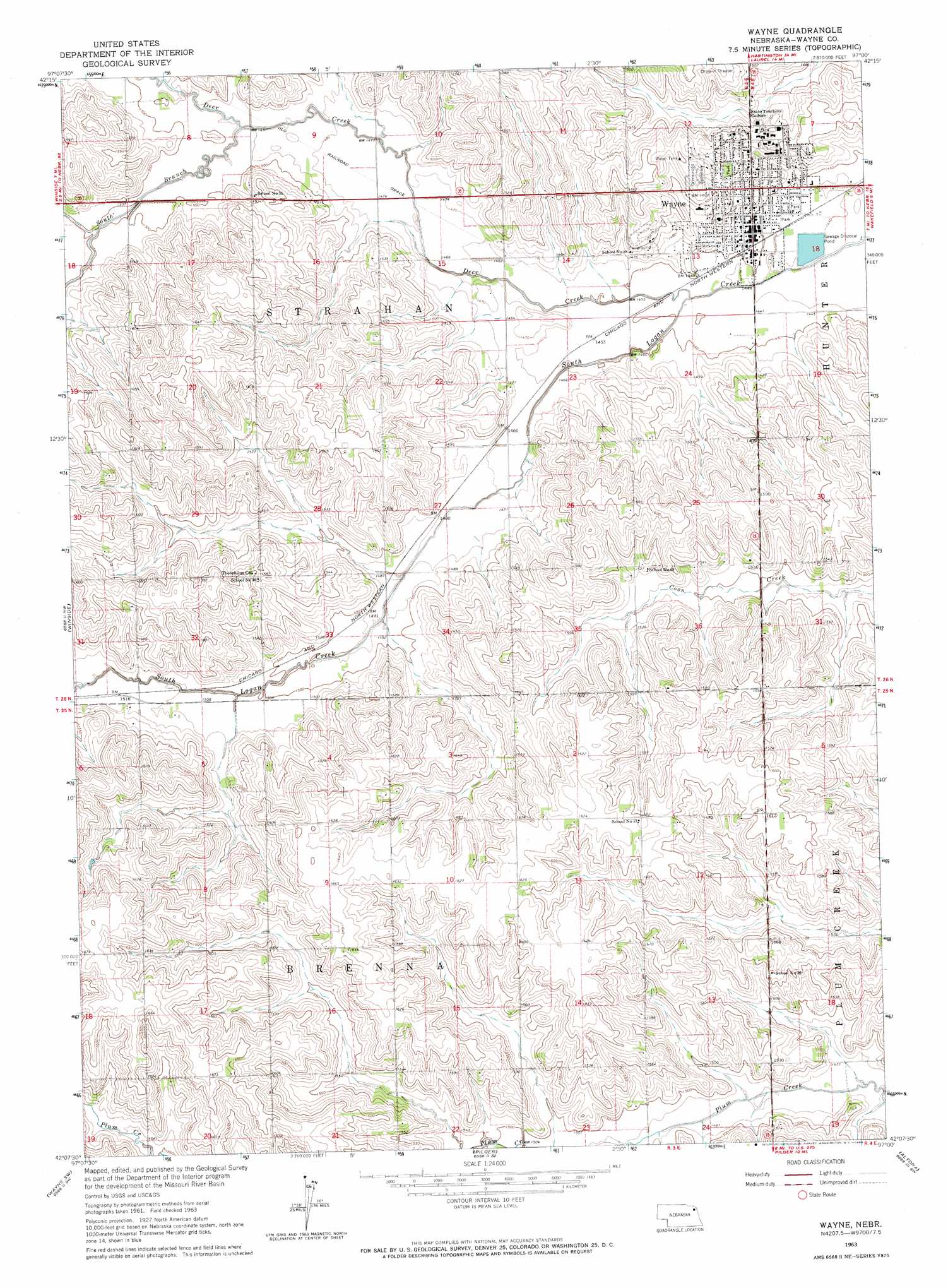
Wayne Topo Map Nebraska
To zoom in, hover over the map of Wayne
USGS Topo Quad 42097b1 - 1:24,000 scale
| Topo Map Name: | Wayne |
| USGS Topo Quad ID: | 42097b1 |
| Print Size: | ca. 21 1/4" wide x 27" high |
| Southeast Coordinates: | 42.125° N latitude / 97° W longitude |
| Map Center Coordinates: | 42.1875° N latitude / 97.0625° W longitude |
| U.S. State: | NE |
| Filename: | O42097B1.jpg |
| Download Map JPG Image: | Wayne topo map 1:24,000 scale |
| Map Type: | Topographic |
| Topo Series: | 7.5´ |
| Map Scale: | 1:24,000 |
| Source of Map Images: | United States Geological Survey (USGS) |
| Alternate Map Versions: |
Wayne NE 1963, updated 1964 Download PDF Buy paper map Wayne NE 2011 Download PDF Buy paper map Wayne NE 2014 Download PDF Buy paper map |
1:24,000 Topo Quads surrounding Wayne
Randolph North |
Belden |
Laurel |
Concord |
Allen |
Randolph South |
Carroll |
Laurel Se |
Wakefield Sw |
Wakefield |
Norfolk Ne |
Winside |
Wayne |
Altona Nw |
Altona Ne |
Hoskins |
Wayne Sw |
Pilger |
Altona |
Altona Se |
Madison Ne |
Stanton |
Stanton Ne |
Wisner |
Beemer |
> Back to 42097a1 at 1:100,000 scale
> Back to 42096a1 at 1:250,000 scale
> Back to U.S. Topo Maps home
Wayne topo map: Gazetteer
Wayne: Parks
Ashley Park elevation 456m 1496′Boy/Girl Scout Park elevation 440m 1443′
Bressler Park elevation 458m 1502′
Cunningham Field elevation 456m 1496′
East Park elevation 441m 1446′
East Park elevation 441m 1446′
Henry Victor Park elevation 442m 1450′
Memorial Stadium elevation 456m 1496′
Nebraska Street Park elevation 446m 1463′
Sunnyview Park elevation 456m 1496′
Swimming Pool and Tennis Court Park elevation 454m 1489′
Viken Park elevation 451m 1479′
Wayne State College Historical Marker elevation 456m 1496′
Willow Bowl elevation 448m 1469′
Wayne: Populated Places
Wayne elevation 443m 1453′Wayne: Post Offices
Wayne Post Office elevation 444m 1456′Wayne: Streams
Deer Creek elevation 438m 1437′South Branch Deer Creek elevation 449m 1473′
Wayne digital topo map on disk
Buy this Wayne topo map showing relief, roads, GPS coordinates and other geographical features, as a high-resolution digital map file on DVD: