Coleridge Topo Map Nebraska
To zoom in, hover over the map of Coleridge
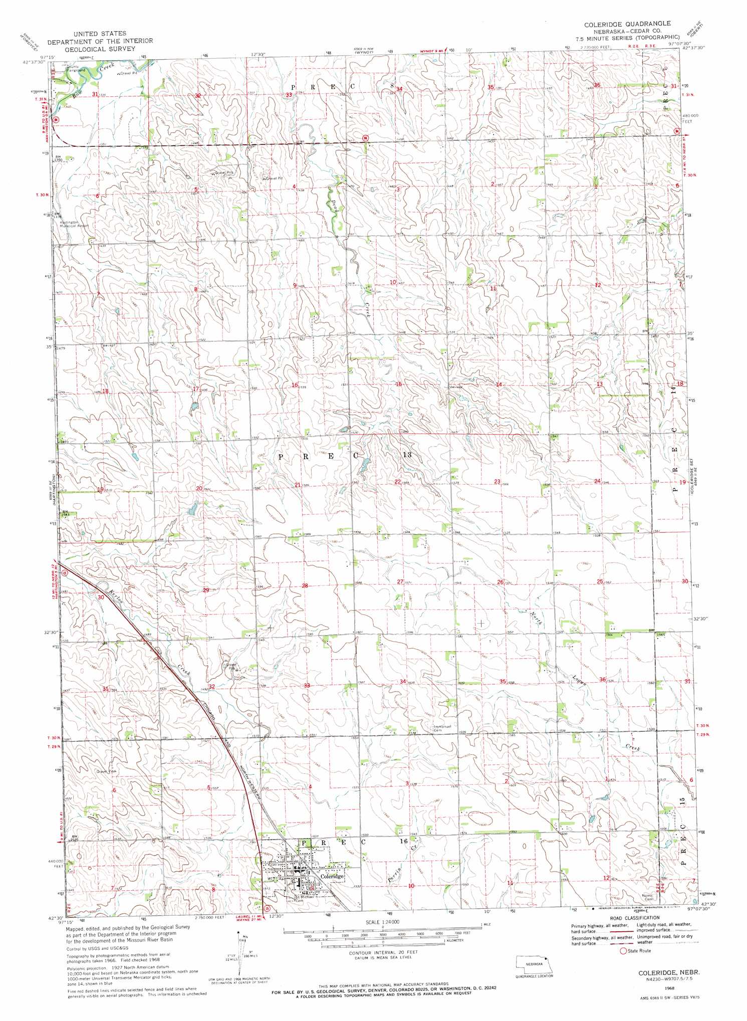
USGS Topo Quad 42097e2 - 1:24,000 scale
| Topo Map Name: | Coleridge |
| USGS Topo Quad ID: | 42097e2 |
| Print Size: | ca. 21 1/4" wide x 27" high |
| Southeast Coordinates: | 42.5° N latitude / 97.125° W longitude |
| Map Center Coordinates: | 42.5625° N latitude / 97.1875° W longitude |
| U.S. State: | NE |
| Filename: | O42097E2.jpg |
| Download Map JPG Image: | Coleridge topo map 1:24,000 scale |
| Map Type: | Topographic |
| Topo Series: | 7.5´ |
| Map Scale: | 1:24,000 |
| Source of Map Images: | United States Geological Survey (USGS) |
| Alternate Map Versions: |
Coleridge NE 1968, updated 1971 Download PDF Buy paper map Coleridge NE 2011 Download PDF Buy paper map Coleridge NE 2014 Download PDF Buy paper map |
1:24,000 Topo Quads surrounding Coleridge
Gavins Point Dam |
Menominee |
Saint Helena |
Meckling |
Vermillon |
Crofton |
Fordyce |
Wynot |
Obert |
Maskell |
Hartington Sw |
Hartington |
Coleridge |
Coleridge Se |
Martinsburg Sw |
Magnet |
Randolph North |
Belden |
Laurel |
Concord |
Randolph Sw |
Randolph South |
Carroll |
Laurel Se |
Wakefield Sw |
> Back to 42097e1 at 1:100,000 scale
> Back to 42096a1 at 1:250,000 scale
> Back to U.S. Topo Maps home
Coleridge topo map: Gazetteer
Coleridge: Parks
Coleridge Village Park elevation 475m 1558′Coleridge: Populated Places
Coleridge elevation 475m 1558′Coleridge: Post Offices
Coleridge Post Office elevation 474m 1555′Coleridge: Streams
Norwegian Bow Creek elevation 408m 1338′Coleridge digital topo map on disk
Buy this Coleridge topo map showing relief, roads, GPS coordinates and other geographical features, as a high-resolution digital map file on DVD: