Yankton Topo Map South Dakota
To zoom in, hover over the map of Yankton
USGS Topo Map 42097e1 - 1:100,000 scale
| Topo Map Name: | Yankton |
| USGS Topo Quad ID: | 42097e1 |
| Print Size: | ca. 39" wide x 24" high |
| Southeast Coordinates: | 42.5° N latitude / 97° W longitude |
| Map Center Coordinates: | 42.75° N latitude / 97.5° W longitude |
| U.S. States: | SD, NE |
| Filename: | 42097e1.jpg |
| Download Map JPG Image: | Yankton topo map 1:100,000 scale |
| Map Type: | Topographic |
| Topo Series: | 30´x60´ |
| Map Scale: | 1:100,000 |
| Source of Map Images: | United States Geological Survey (USGS) |
| Alternate Map Versions: |
Yankton SD 1985, updated 1985 Download PDF Buy paper map Yankton SD 1985, updated 1989 Download PDF Buy paper map |
1:100,000 Topos surrounding Yankton
Lake Andes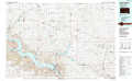 |
Freeman |
Rock Rapids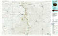 |
Atkinson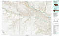 |
Yankton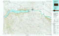 |
Sioux City North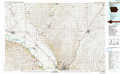 |
O'Neill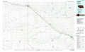 |
Norfolk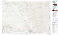 |
Sioux City South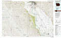 |
> Back to 42096a1 at 1:250,000 scale
> Back to U.S. Topo Maps home
1:24,000 Topo Quads covered by the spatial extent of this 100k map (Yankton)
|
Kingsburg 
|
Tyndall 
|
Tabor 
|
Tabor Ne 
|
Yankton 
|
Mission Hill 
|
Gayville 
|
Gayville Ne 
|
|
Springfield 
|
Santee 
|
Bon Homme Colony 
|
Tabor Se 
|
Gavins Point Dam 
|
Menominee 
|
Saint Helena 
|
Meckling 
|
|
Sparta 
|
Howe Creek 
|
Lindy 
|
Bloomfield Ne 
|
Crofton 
|
Fordyce 
|
Wynot 
|
Obert 
|
|
Center West 
|
Center East 
|
Bloomfield 
|
Bloomfield Se 
|
Hartington Sw 
|
Hartington 
|
Coleridge 
|
Coleridge Se 
|
