Hartington Topo Map Nebraska
To zoom in, hover over the map of Hartington
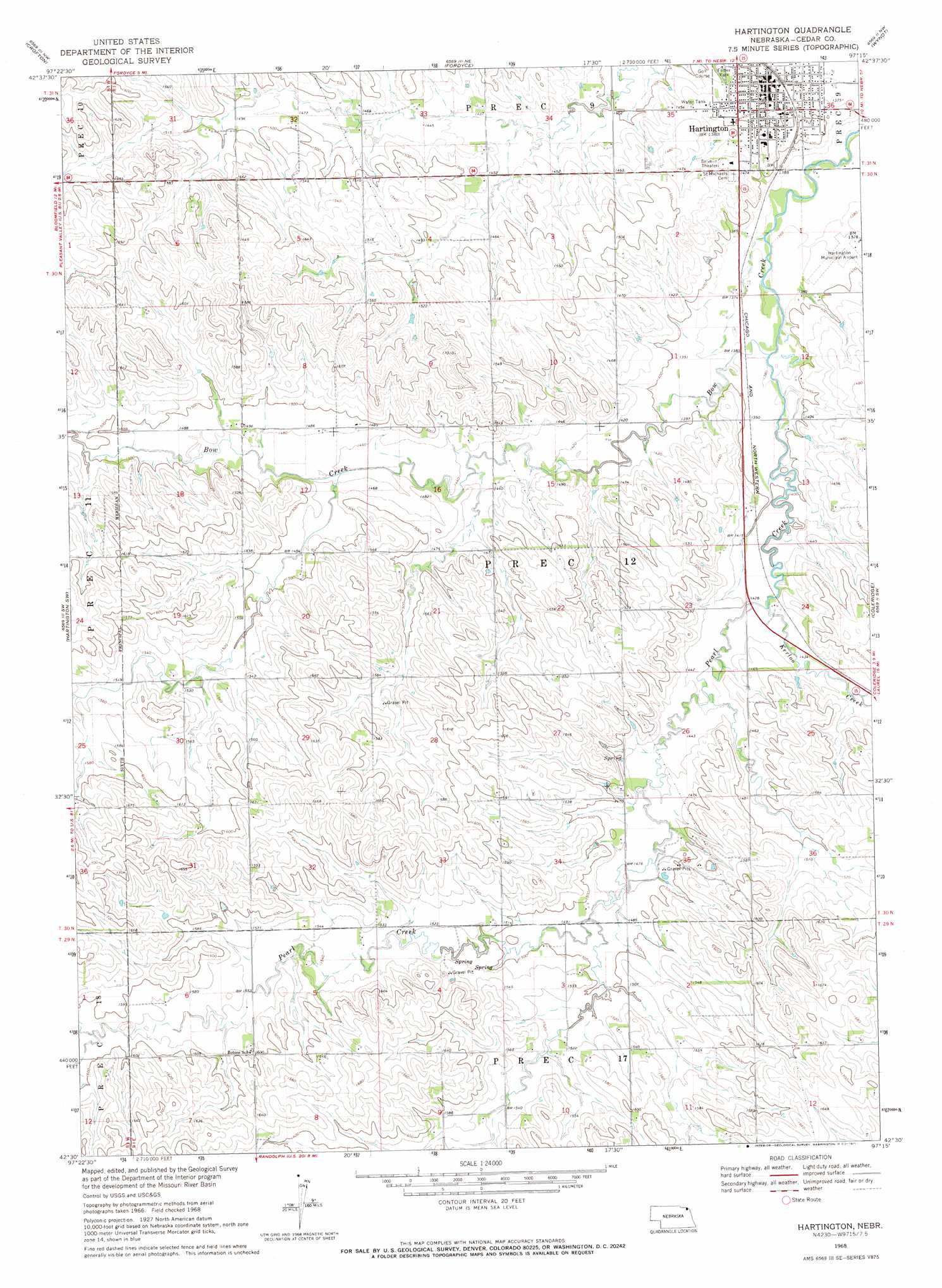
USGS Topo Quad 42097e3 - 1:24,000 scale
| Topo Map Name: | Hartington |
| USGS Topo Quad ID: | 42097e3 |
| Print Size: | ca. 21 1/4" wide x 27" high |
| Southeast Coordinates: | 42.5° N latitude / 97.25° W longitude |
| Map Center Coordinates: | 42.5625° N latitude / 97.3125° W longitude |
| U.S. State: | NE |
| Filename: | O42097E3.jpg |
| Download Map JPG Image: | Hartington topo map 1:24,000 scale |
| Map Type: | Topographic |
| Topo Series: | 7.5´ |
| Map Scale: | 1:24,000 |
| Source of Map Images: | United States Geological Survey (USGS) |
| Alternate Map Versions: |
Hartington NE 1968, updated 1971 Download PDF Buy paper map Hartington NE 2011 Download PDF Buy paper map Hartington NE 2014 Download PDF Buy paper map |
1:24,000 Topo Quads surrounding Hartington
Tabor Se |
Gavins Point Dam |
Menominee |
Saint Helena |
Meckling |
Bloomfield Ne |
Crofton |
Fordyce |
Wynot |
Obert |
Bloomfield Se |
Hartington Sw |
Hartington |
Coleridge |
Coleridge Se |
Wausa |
Magnet |
Randolph North |
Belden |
Laurel |
Osmond |
Randolph Sw |
Randolph South |
Carroll |
Laurel Se |
> Back to 42097e1 at 1:100,000 scale
> Back to 42096a1 at 1:250,000 scale
> Back to U.S. Topo Maps home
Hartington topo map: Gazetteer
Hartington: Airports
Hartington Municipal Airport elevation 420m 1377′Hartington: Parks
Cedar County Historical Marker elevation 423m 1387′Felber Park elevation 434m 1423′
Hartington, Home of Two Nebraska Governors Historical Marker elevation 423m 1387′
Hartington: Populated Places
Hartington elevation 428m 1404′Hartington: Post Offices
Hartington Post Office elevation 426m 1397′Hartington: Streams
Kerloo Creek elevation 433m 1420′Pearl Creek elevation 415m 1361′
Hartington digital topo map on disk
Buy this Hartington topo map showing relief, roads, GPS coordinates and other geographical features, as a high-resolution digital map file on DVD: