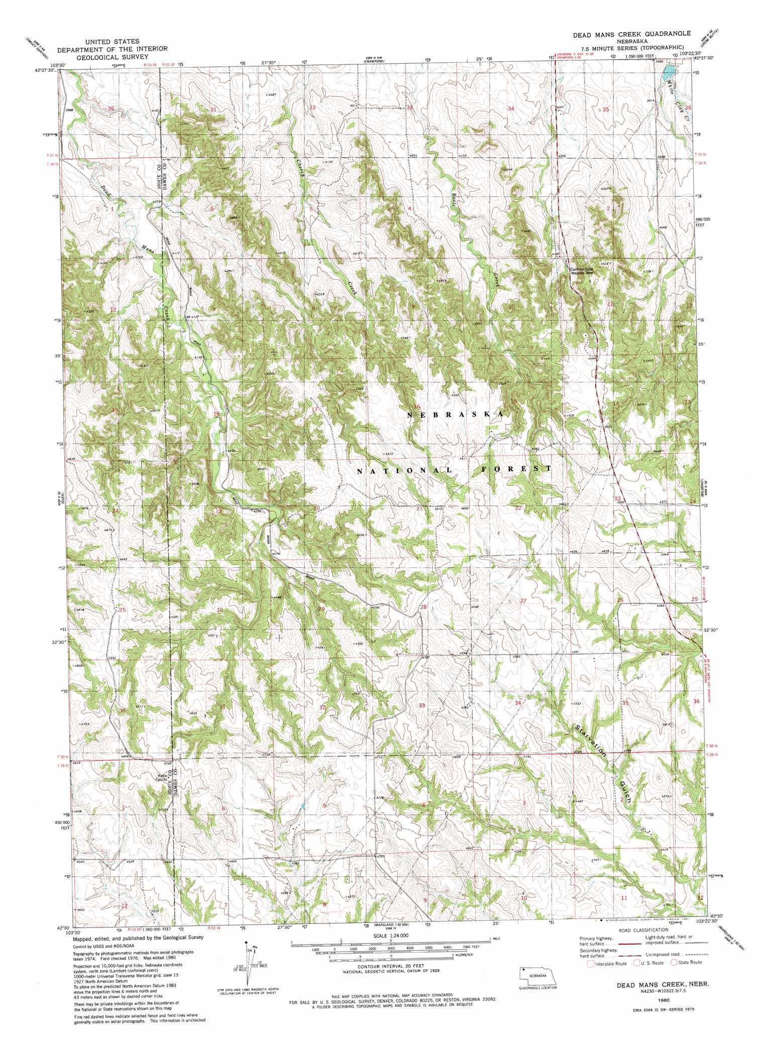
Dead Mans Creek Topo Map Nebraska
To zoom in, hover over the map of Dead Mans Creek
USGS Topo Quad 42103e4 - 1:24,000 scale
| Topo Map Name: | Dead Mans Creek |
| USGS Topo Quad ID: | 42103e4 |
| Print Size: | ca. 21 1/4" wide x 27" high |
| Southeast Coordinates: | 42.5° N latitude / 103.375° W longitude |
| Map Center Coordinates: | 42.5625° N latitude / 103.4375° W longitude |
| U.S. State: | NE |
| Filename: | O42103E4.jpg |
| Download Map JPG Image: | Dead Mans Creek topo map 1:24,000 scale |
| Map Type: | Topographic |
| Topo Series: | 7.5´ |
| Map Scale: | 1:24,000 |
| Source of Map Images: | United States Geological Survey (USGS) |
| Alternate Map Versions: |
Dead Mans Creek NE 1980, updated 1981 Download PDF Buy paper map Dead Mans Creek NE 2011 Download PDF Buy paper map Dead Mans Creek NE 2014 Download PDF Buy paper map |
| FStopo: | US Forest Service topo Dead Mans Creek is available: Download FStopo PDF Download FStopo TIF |
1:24,000 Topo Quads surrounding Dead Mans Creek
Five Points |
Roundtop |
Horn |
Whitney |
Trunk Butte |
Andrews |
Smiley Canyon |
Crawford |
Crow Butte |
Chimney Butte |
Kyle Creek |
Glen |
Dead Mans Creek |
Belmont |
Coffee Mill Butte Sw |
Whistle Creek Nw |
Whistle Creek Ne |
Marsland Nw |
Marsland Ne |
Box Butte Reservoir West |
Whistle Creek Sw |
Whistle Creek Se |
Marsland Sw |
Marsland Se |
Nonpareil |
> Back to 42103e1 at 1:100,000 scale
> Back to 42102a1 at 1:250,000 scale
> Back to U.S. Topo Maps home
Dead Mans Creek topo map: Gazetteer
Dead Mans Creek: Dams
Dodd Dam elevation 1183m 3881′Dead Mans Creek: Parks
Cochran State Wayside Area elevation 1285m 4215′Dead Mans Creek: Reservoirs
Dodd Reservoir elevation 1183m 3881′Dead Mans Creek digital topo map on disk
Buy this Dead Mans Creek topo map showing relief, roads, GPS coordinates and other geographical features, as a high-resolution digital map file on DVD:
Eastern Wyoming & Western South Dakota
Buy digital topo maps: Eastern Wyoming & Western South Dakota