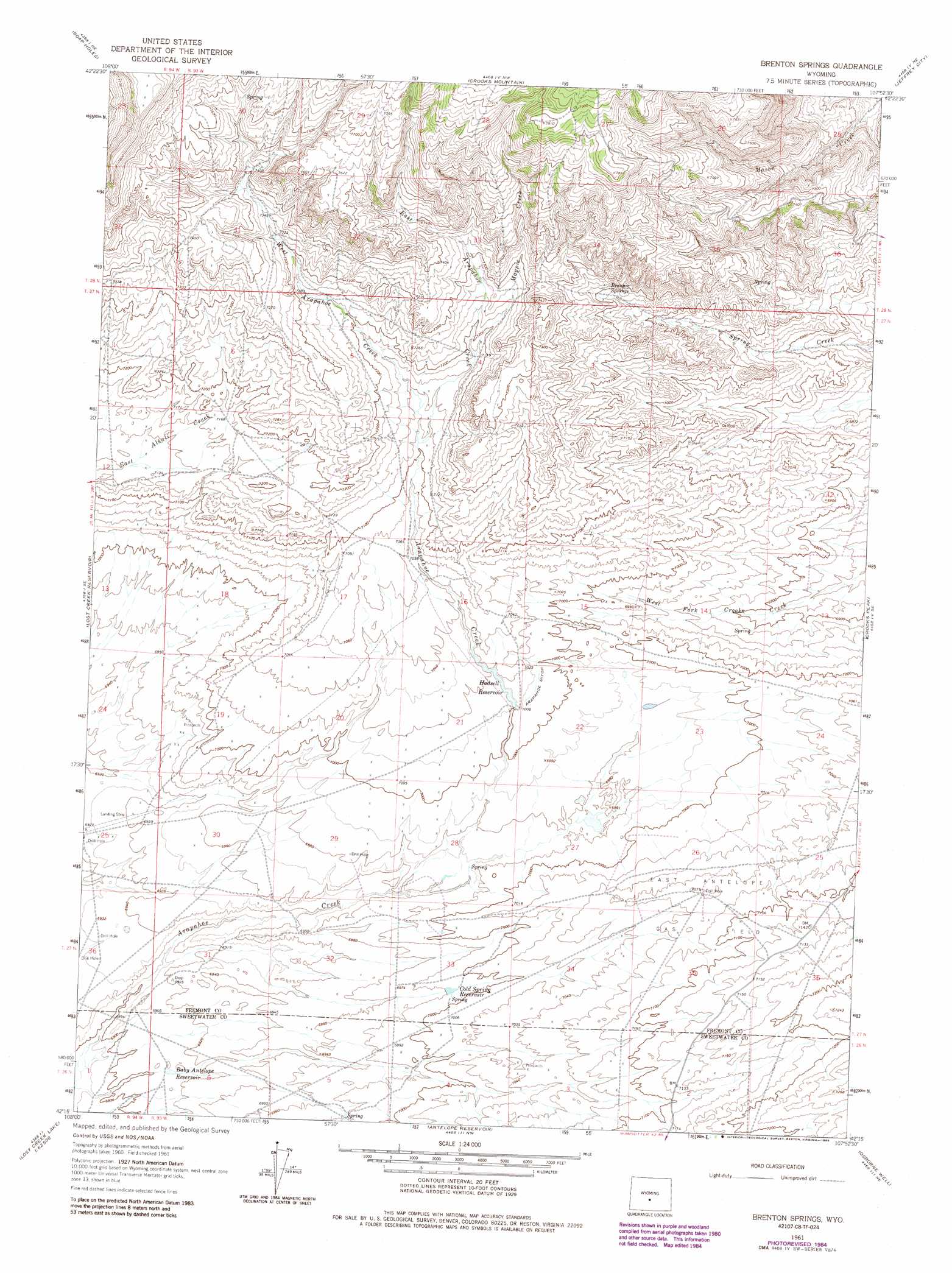
Brenton Springs Topo Map Wyoming
To zoom in, hover over the map of Brenton Springs
USGS Topo Quad 42107c8 - 1:24,000 scale
| Topo Map Name: | Brenton Springs |
| USGS Topo Quad ID: | 42107c8 |
| Print Size: | ca. 21 1/4" wide x 27" high |
| Southeast Coordinates: | 42.25° N latitude / 107.875° W longitude |
| Map Center Coordinates: | 42.3125° N latitude / 107.9375° W longitude |
| U.S. State: | WY |
| Filename: | o42107c8.jpg |
| Download Map JPG Image: | Brenton Springs topo map 1:24,000 scale |
| Map Type: | Topographic |
| Topo Series: | 7.5´ |
| Map Scale: | 1:24,000 |
| Source of Map Images: | United States Geological Survey (USGS) |
| Alternate Map Versions: |
Brenton Springs WY 1961, updated 1966 Download PDF Buy paper map Brenton Springs WY 1961, updated 1985 Download PDF Buy paper map Brenton Springs WY 2012 Download PDF Buy paper map Brenton Springs WY 2015 Download PDF Buy paper map |
1:24,000 Topo Quads surrounding Brenton Springs
Sweetwater Station |
Myers Ranch |
Graham Ranch |
Stampede Meadow |
Black Rock Gap |
Happy Spring |
Soap Holes |
Crooks Mountain |
Jeffrey City |
Split Rock Nw |
Olson Springs |
Lost Creek Reservoir |
Brenton Springs |
Crooks Peak |
Sagebrush Park |
Cyclone Draw |
Osborne Draw |
Antelope Reservoir |
Osborne Well |
Hadsell Spring |
Lost Creek Lake |
Eagles Nest Draw |
Battle Spring |
Sooner Reservoir |
Chicken Spring |
> Back to 42107a1 at 1:100,000 scale
> Back to 42106a1 at 1:250,000 scale
> Back to U.S. Topo Maps home
Brenton Springs topo map: Gazetteer
Brenton Springs: Canals
Arapahoe Ditch elevation 2139m 7017′Brenton Springs: Mines
B and H Group Mine elevation 2118m 6948′Sheep Mountain Operations Mine elevation 2151m 7057′
Wycal Mine elevation 2205m 7234′
Brenton Springs: Oilfields
East Antelope Gas Field elevation 2158m 7080′Brenton Springs: Reservoirs
Baby Antelope Reservoir elevation 2107m 6912′Cold Spring Reservoir elevation 2130m 6988′
Hadsell Reservoir elevation 2145m 7037′
Brenton Springs: Springs
Brenton Springs elevation 2200m 7217′Brenton Springs: Streams
East Arapahoe Creek elevation 2169m 7116′Magpie Creek elevation 2188m 7178′
West Arapahoe Creek elevation 2169m 7116′
Brenton Springs digital topo map on disk
Buy this Brenton Springs topo map showing relief, roads, GPS coordinates and other geographical features, as a high-resolution digital map file on DVD:
Eastern Wyoming & Western South Dakota
Buy digital topo maps: Eastern Wyoming & Western South Dakota