Crooks Mountain Topo Map Wyoming
To zoom in, hover over the map of Crooks Mountain
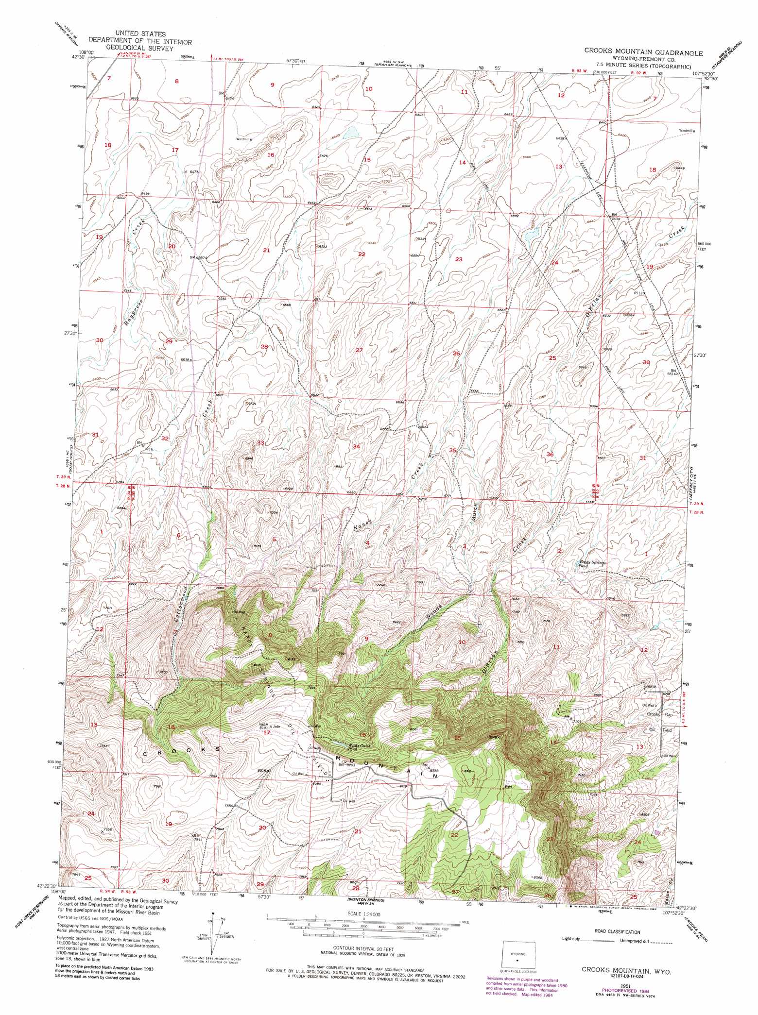
USGS Topo Quad 42107d8 - 1:24,000 scale
| Topo Map Name: | Crooks Mountain |
| USGS Topo Quad ID: | 42107d8 |
| Print Size: | ca. 21 1/4" wide x 27" high |
| Southeast Coordinates: | 42.375° N latitude / 107.875° W longitude |
| Map Center Coordinates: | 42.4375° N latitude / 107.9375° W longitude |
| U.S. State: | WY |
| Filename: | o42107d8.jpg |
| Download Map JPG Image: | Crooks Mountain topo map 1:24,000 scale |
| Map Type: | Topographic |
| Topo Series: | 7.5´ |
| Map Scale: | 1:24,000 |
| Source of Map Images: | United States Geological Survey (USGS) |
| Alternate Map Versions: |
Crooks Mountain WY 1951, updated 1953 Download PDF Buy paper map Crooks Mountain WY 1951, updated 1963 Download PDF Buy paper map Crooks Mountain WY 1951, updated 1973 Download PDF Buy paper map Crooks Mountain WY 1951, updated 1985 Download PDF Buy paper map Crooks Mountain WY 2012 Download PDF Buy paper map Crooks Mountain WY 2015 Download PDF Buy paper map |
1:24,000 Topo Quads surrounding Crooks Mountain
Dishpan Butte |
Elkhorn Springs |
Tin Cup Mountain |
Muskrat Basin |
Coyote Springs |
Sweetwater Station |
Myers Ranch |
Graham Ranch |
Stampede Meadow |
Black Rock Gap |
Happy Spring |
Soap Holes |
Crooks Mountain |
Jeffrey City |
Split Rock Nw |
Olson Springs |
Lost Creek Reservoir |
Brenton Springs |
Crooks Peak |
Sagebrush Park |
Cyclone Draw |
Osborne Draw |
Antelope Reservoir |
Osborne Well |
Hadsell Spring |
> Back to 42107a1 at 1:100,000 scale
> Back to 42106a1 at 1:250,000 scale
> Back to U.S. Topo Maps home
Crooks Mountain topo map: Gazetteer
Crooks Mountain: Lakes
Boggy Springs Pond elevation 2050m 6725′Woods Gulch Pond elevation 2433m 7982′
Crooks Mountain: Oilfields
Happy Springs Oil Field elevation 2463m 8080′Crooks Mountain: Streams
Cottonwood Creek elevation 1957m 6420′Haypress Creek elevation 1964m 6443′
Nancy Creek elevation 1951m 6400′
Crooks Mountain: Summits
Crooks Mountain elevation 2533m 8310′Crooks Mountain: Valleys
Woods Gulch elevation 2023m 6637′Crooks Mountain digital topo map on disk
Buy this Crooks Mountain topo map showing relief, roads, GPS coordinates and other geographical features, as a high-resolution digital map file on DVD:
Eastern Wyoming & Western South Dakota
Buy digital topo maps: Eastern Wyoming & Western South Dakota