Myers Ranch Topo Map Wyoming
To zoom in, hover over the map of Myers Ranch
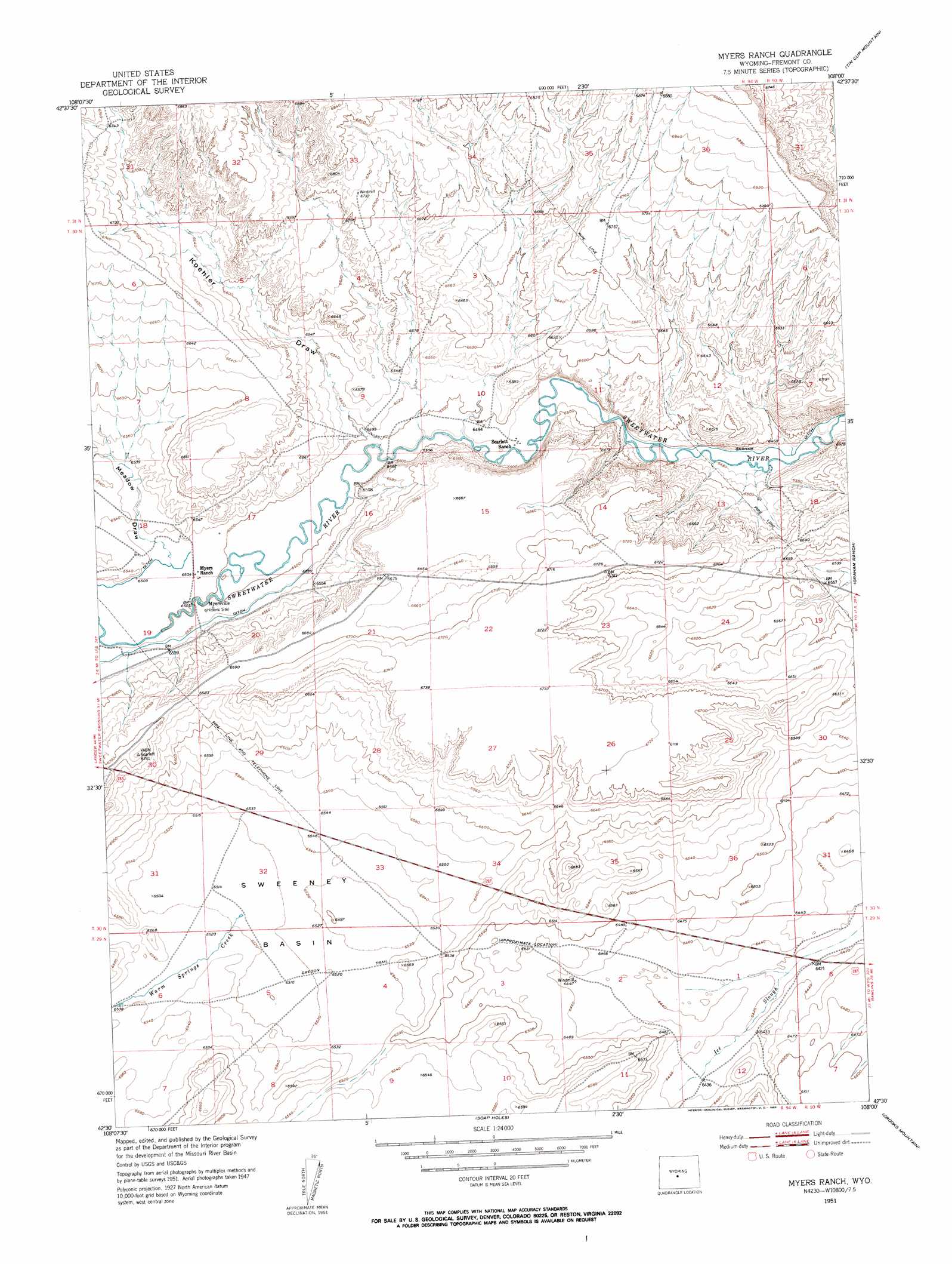
USGS Topo Quad 42108e1 - 1:24,000 scale
| Topo Map Name: | Myers Ranch |
| USGS Topo Quad ID: | 42108e1 |
| Print Size: | ca. 21 1/4" wide x 27" high |
| Southeast Coordinates: | 42.5° N latitude / 108° W longitude |
| Map Center Coordinates: | 42.5625° N latitude / 108.0625° W longitude |
| U.S. State: | WY |
| Filename: | o42108e1.jpg |
| Download Map JPG Image: | Myers Ranch topo map 1:24,000 scale |
| Map Type: | Topographic |
| Topo Series: | 7.5´ |
| Map Scale: | 1:24,000 |
| Source of Map Images: | United States Geological Survey (USGS) |
| Alternate Map Versions: |
Myers Ranch WY 1951, updated 1953 Download PDF Buy paper map Myers Ranch WY 2012 Download PDF Buy paper map Myers Ranch WY 2015 Download PDF Buy paper map |
1:24,000 Topo Quads surrounding Myers Ranch
Bringolf Ranch |
Sand Draw |
Blue Gulch |
Rongis Reservoir |
Rongis Reservoir Se |
Yellowstone Ranch |
Dishpan Butte |
Elkhorn Springs |
Tin Cup Mountain |
Muskrat Basin |
Red Canyon |
Sweetwater Station |
Myers Ranch |
Graham Ranch |
Stampede Meadow |
Barras Springs |
Happy Spring |
Soap Holes |
Crooks Mountain |
Jeffrey City |
Sulphur Bar Spring |
Olson Springs |
Lost Creek Reservoir |
Brenton Springs |
Crooks Peak |
> Back to 42108e1 at 1:100,000 scale
> Back to 42108a1 at 1:250,000 scale
> Back to U.S. Topo Maps home
Myers Ranch topo map: Gazetteer
Myers Ranch: Basins
Sweeney Basin elevation 1989m 6525′Myers Ranch: Canals
Graham Ditch elevation 1968m 6456′Myers Ranch: Populated Places
Myersville (historical) elevation 1985m 6512′Myers Ranch: Streams
Warm Springs Creek elevation 1988m 6522′Myers Ranch: Valleys
Government Meadows Draw elevation 1986m 6515′Koehler Draw elevation 1983m 6505′
Myers Ranch digital topo map on disk
Buy this Myers Ranch topo map showing relief, roads, GPS coordinates and other geographical features, as a high-resolution digital map file on DVD: