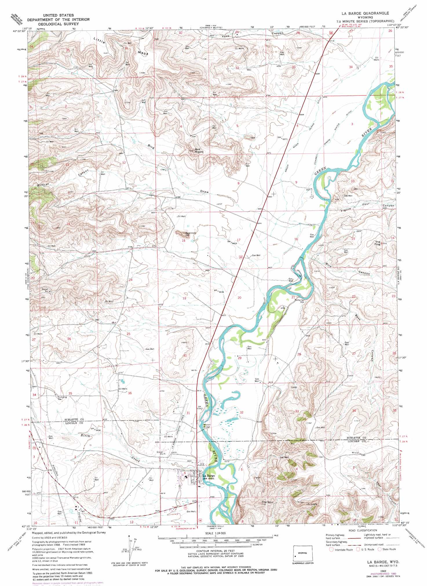
La Barge Topo Map Wyoming
To zoom in, hover over the map of La Barge
USGS Topo Quad 42110c2 - 1:24,000 scale
| Topo Map Name: | La Barge |
| USGS Topo Quad ID: | 42110c2 |
| Print Size: | ca. 21 1/4" wide x 27" high |
| Southeast Coordinates: | 42.25° N latitude / 110.125° W longitude |
| Map Center Coordinates: | 42.3125° N latitude / 110.1875° W longitude |
| U.S. State: | WY |
| Filename: | o42110c2.jpg |
| Download Map JPG Image: | La Barge topo map 1:24,000 scale |
| Map Type: | Topographic |
| Topo Series: | 7.5´ |
| Map Scale: | 1:24,000 |
| Source of Map Images: | United States Geological Survey (USGS) |
| Alternate Map Versions: |
La Barge WY 1969, updated 1973 Download PDF Buy paper map La Barge WY 1969, updated 1979 Download PDF Buy paper map La Barge WY 1969, updated 1980 Download PDF Buy paper map La Barge WY 2012 Download PDF Buy paper map La Barge WY 2015 Download PDF Buy paper map |
1:24,000 Topo Quads surrounding La Barge
Springman Creek |
Deer Hill |
Big Piney West |
Big Piney East |
Ross Butte |
Pine Grove Ridge |
Cretaceous Mountain |
Chimney Butte |
Milleson Draw |
Sugar Loaf Nw |
Lake Mountain |
The Hogsback |
La Barge |
La Barge Se |
Oasis Well |
Fort Hill |
Red Gap |
Names Hill |
Anderson Canyon |
Monument Butte |
Fontenelle Gap |
The Palisades |
Fontenelle Reservoir Sw |
Fontenelle Reservoir Se |
Blue Forest |
> Back to 42110a1 at 1:100,000 scale
> Back to 42110a1 at 1:250,000 scale
> Back to U.S. Topo Maps home
La Barge topo map: Gazetteer
La Barge: Bridges
Whelan Bridge elevation 2003m 6571′La Barge: Mines
Government Mine elevation 2008m 6587′La Barge: Populated Places
La Barge elevation 2009m 6591′La Barge: Streams
Birch Creek elevation 2005m 6578′La Barge: Summits
Bird Nipple elevation 2220m 7283′Little Mesa elevation 2333m 7654′
Red Hill elevation 2111m 6925′
The Frog elevation 2141m 7024′
The Spur elevation 2180m 7152′
La Barge: Valleys
Bess Canyon elevation 2026m 6646′Bird Canyon elevation 2018m 6620′
Bird Draw elevation 2015m 6610′
Figure Four Canyon elevation 2019m 6624′
Wildcat Canyon elevation 2072m 6797′
Yose Canyon elevation 2041m 6696′
La Barge digital topo map on disk
Buy this La Barge topo map showing relief, roads, GPS coordinates and other geographical features, as a high-resolution digital map file on DVD: