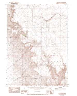
Hoppin Springs Topo Map Oregon
To zoom in, hover over the map of Hoppin Springs
USGS Topo Quad 42117a5 - 1:24,000 scale
| Topo Map Name: | Hoppin Springs |
| USGS Topo Quad ID: | 42117a5 |
| Print Size: | ca. 21 1/4" wide x 27" high |
| Southeast Coordinates: | 42° N latitude / 117.5° W longitude |
| Map Center Coordinates: | 42.0625° N latitude / 117.5625° W longitude |
| U.S. State: | OR |
| Filename: | o42117a5.jpg |
| Download Map JPG Image: | Hoppin Springs topo map 1:24,000 scale |
| Map Type: | Topographic |
| Topo Series: | 7.5´ |
| Map Scale: | 1:24,000 |
| Source of Map Images: | United States Geological Survey (USGS) |
| Alternate Map Versions: |
Hoppin Springs OR 1982, updated 1983 Download PDF Buy paper map Hoppin Springs OR 2011 Download PDF Buy paper map Hoppin Springs OR 2014 Download PDF Buy paper map |
1:24,000 Topo Quads surrounding Hoppin Springs
> Back to 42117a1 at 1:100,000 scale
> Back to 42116a1 at 1:250,000 scale
> Back to U.S. Topo Maps home
Hoppin Springs topo map: Gazetteer
Hoppin Springs: Basins
Juans Forty elevation 1946m 6384′The Basin elevation 1977m 6486′
Hoppin Springs: Reservoirs
Larribeau Reservoir elevation 1999m 6558′Hoppin Springs: Springs
Andy Five Spring elevation 1693m 5554′Chato Spring elevation 1926m 6318′
Edge Spring elevation 1951m 6400′
Hoppin Springs elevation 1980m 6496′
Shearing Corral Spring elevation 1898m 6227′
The Waterfall elevation 1649m 5410′
Wild Rose Spring elevation 1691m 5547′
Hoppin Springs: Streams
Rock Creek elevation 1548m 5078′Hoppin Springs: Valleys
Lowry Canyon elevation 1529m 5016′Hoppin Springs digital topo map on disk
Buy this Hoppin Springs topo map showing relief, roads, GPS coordinates and other geographical features, as a high-resolution digital map file on DVD:


