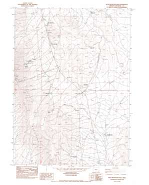
Blue Mountain Pass Topo Map Oregon
To zoom in, hover over the map of Blue Mountain Pass
USGS Topo Quad 42117c7 - 1:24,000 scale
| Topo Map Name: | Blue Mountain Pass |
| USGS Topo Quad ID: | 42117c7 |
| Print Size: | ca. 21 1/4" wide x 27" high |
| Southeast Coordinates: | 42.25° N latitude / 117.75° W longitude |
| Map Center Coordinates: | 42.3125° N latitude / 117.8125° W longitude |
| U.S. State: | OR |
| Filename: | o42117c7.jpg |
| Download Map JPG Image: | Blue Mountain Pass topo map 1:24,000 scale |
| Map Type: | Topographic |
| Topo Series: | 7.5´ |
| Map Scale: | 1:24,000 |
| Source of Map Images: | United States Geological Survey (USGS) |
| Alternate Map Versions: |
Blue Mountain Pass OR 1982, updated 1983 Download PDF Buy paper map Blue Mountain Pass OR 2011 Download PDF Buy paper map Blue Mountain Pass OR 2014 Download PDF Buy paper map |
1:24,000 Topo Quads surrounding Blue Mountain Pass
> Back to 42117a1 at 1:100,000 scale
> Back to 42116a1 at 1:250,000 scale
> Back to U.S. Topo Maps home
Blue Mountain Pass topo map: Gazetteer
Blue Mountain Pass: Gaps
Blue Mountain Pass elevation 1611m 5285′Blue Mountain Pass: Reservoirs
Basque Flat Reservoir elevation 1439m 4721′Blue Mountain Pit Reservoir elevation 1672m 5485′
Blue Mountain Reservoir Number Five elevation 1479m 4852′
Blue Mountain Reservoir Number One elevation 1513m 4963′
Blue Mountain Reservoir Number Two elevation 1464m 4803′
Crossroad Reservoir elevation 1557m 5108′
Gallagher Reservoir elevation 1521m 4990′
Gild Reservoir elevation 1718m 5636′
Lava Ridge Reservoir elevation 1547m 5075′
Lone Star Reservoir elevation 1500m 4921′
Long Draw Reservoir elevation 1597m 5239′
Blue Mountain Pass: Springs
Burnout Spring elevation 1798m 5898′Summit Spring elevation 1778m 5833′
Wash Rock Spring elevation 1656m 5433′
Blue Mountain Pass: Streams
Horse Corral Creek elevation 1480m 4855′Blue Mountain Pass: Summits
The Cap elevation 1662m 5452′The Table elevation 1994m 6541′
Blue Mountain Pass digital topo map on disk
Buy this Blue Mountain Pass topo map showing relief, roads, GPS coordinates and other geographical features, as a high-resolution digital map file on DVD:


